
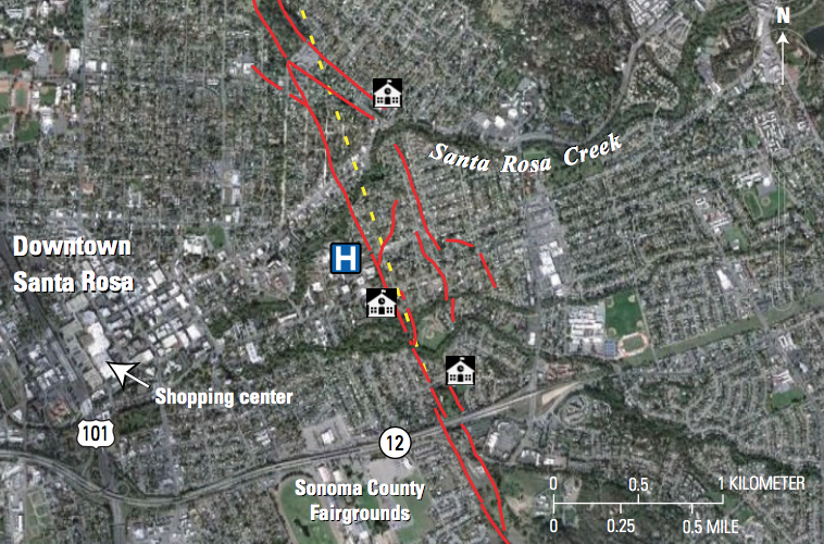
Trace of the Rodgers Creek Fault Through Santa Rosa
Detailed Description
Google Earth satellite image of central Santa Rosa (dated October 25, 2009) showing the surface trace of the Rodgers Creek Fault in red lines. The yellow dashed line shows the previously inferred location of the fault across the Santa Rosa Creek floodplain prior to laser-based mapping. The building symbols mark the locations of schools close to the fault; the H represents a hospital complex.
Sources/Usage
Public Domain.
Santa Rosa's Past and Future Earthquakes (FS-2019-3035)
USGS Fact Sheet