
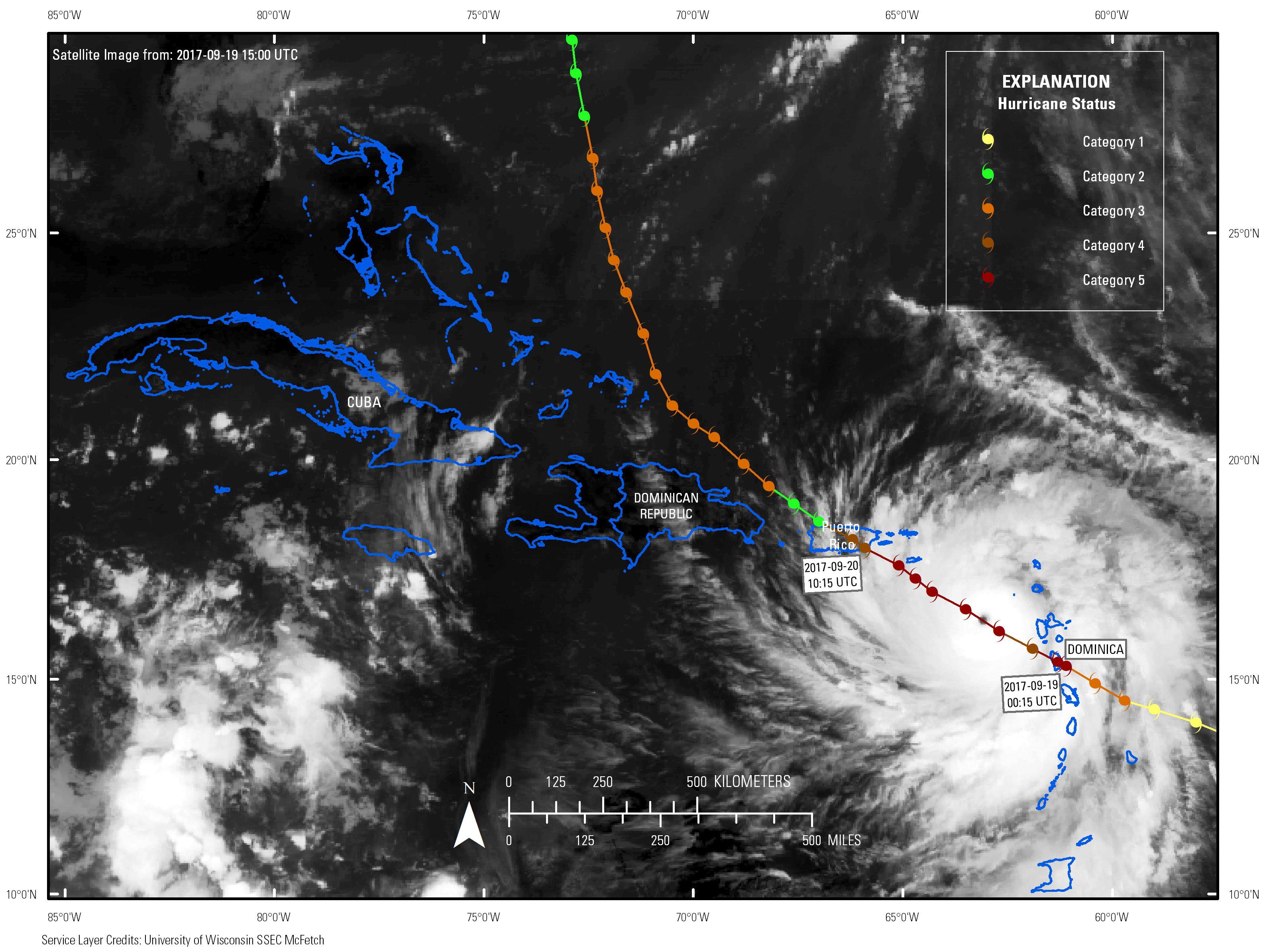
Track of Hurricane Maria

Detailed Description
Map shows the track of Hurricane Maria (2017) across the Caribbean with colors indicating category on the Saffir-Simpson Hurricane Wind Scale. Data provided by NOAA. Base image is intellectual property of NOAA and is used herein under license. Copyright Esri and its creator.
Sources/Usage
Public Domain.
Hurricane track data provided by NOAA for Maria (2017). Base image is from the Geostationary Operational Environmental Satellites (GOES-13) spacecraft and was accessed through Multi-format Client-agnostic File Extraction Through Contextual HTTP (MCFECTH) that is maintained by The Satellite Data Services group at the University of Wisconsin-Madison Space Science and Engineering Center (SSEC) and is used herein under license. Copyright Esri and its licensors. All rights reserved.