
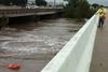
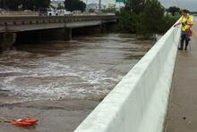
USGS Responds to Near Record Flooding in Central Texas

Detailed Description
USGS scientist Mark Warzecha makes a streamflow measurement with Acoustic Doppler Current Profiler downstream of a USGS streamgage station on the Blanco River at Interstate 35. The streamgage is not currently accessible, so a measurement is being made at the safest downstream location.
Sources/Usage
Public Domain.