
USGS tests drone-based ground-penetrating radar

Detailed Description
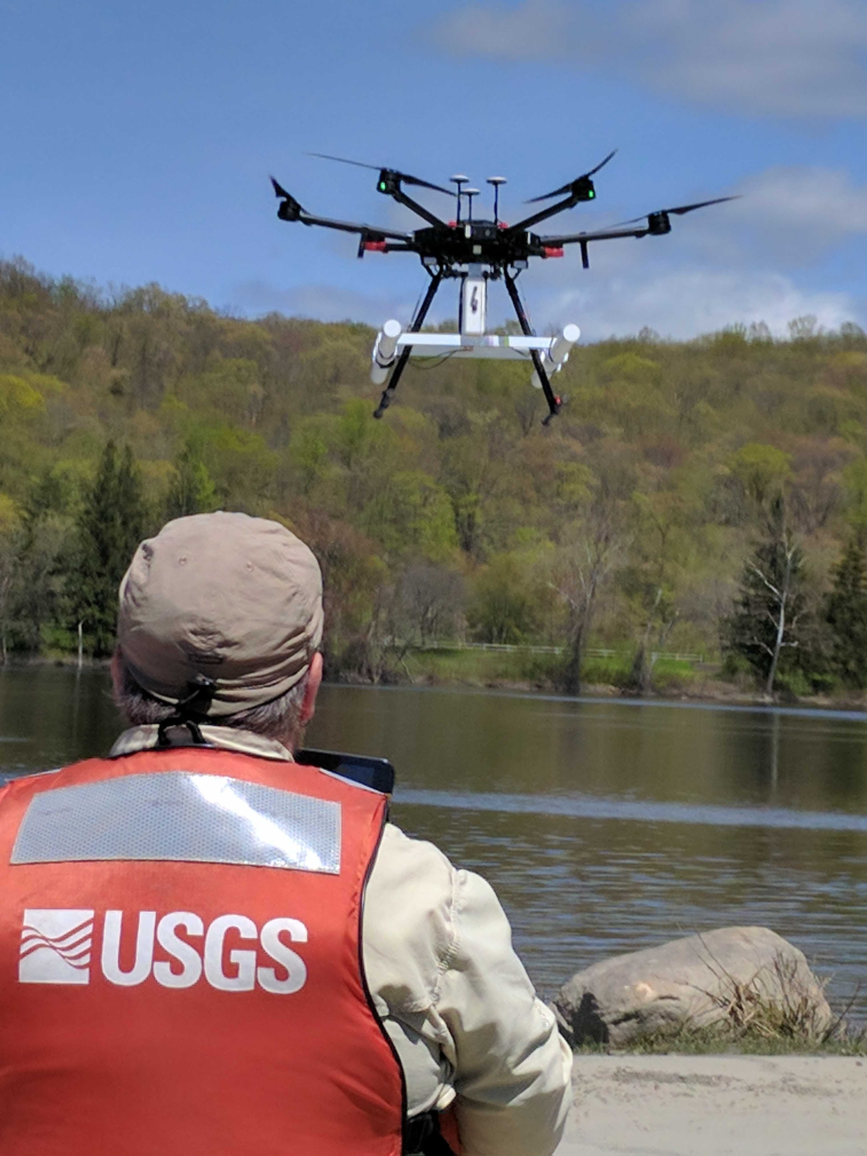
USGS hydrographers collect tens of thousands of streamflow measurements every year. In-water work by personnel is one of the most dangerous aspects of USGS hydrologic studies, especially during high-flow conditions. In May 2019, USGS continued testing of a light-weight, self-contained ground-penetrating radar (GPR) system that can be mounted on a small drone. We are testing use of the GPR to map river bathymetry (profiles of water depth along the river bottom), measurements often made by personnel in the water or on boats. We are also testing use of the GPR to map the shallow subsurface geology below the stream. Combined with the water velocity measurements collected with other remote tools, we are testing use of the GPR data to calculate the river discharge. The data also can be used to help us better understand movement of water between the ground and the stream, which is important for understanding groundwater/surface-water interactions that can affect water quality and availability.
In this photo, a USGS scientist flies the GPR system (the white object mounted below the drone) over the Connecticut River on a multirotor drone undergoing testing for the Department of Interior.
Sources/Usage
Public Domain.