
Well Vulnerability map for the Delaware River
By New Jersey Water Science Center
May 2022 (approx.)
Detailed Description
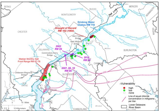
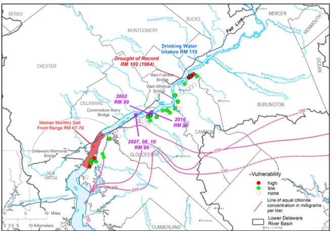
Map of the lower Delaware River indicating the current Salt Front and the drought of 1963 Salt Front related to wells vulnerable to salt intrusion
Sources/Usage
Public Domain.