
WellFootprint Map for Groundwater-Flow Model, Lansdale, Pennsylvania
Detailed Description
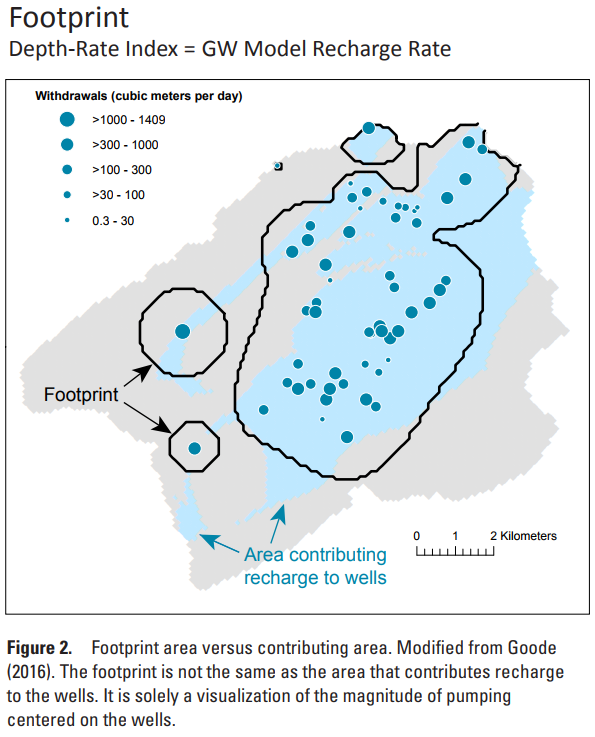
Figure showing a WellFootprint Map for groundwater withdrawals used for simulation of groundwater flow at the North Penn 7 Superfund Site in southeastern Pennsylvania. This is fig. 2 from USGS Open-File Report 2017-1137. The black WellFootprint contours visualize the magnitude of the groundwater withdrawals, relative to the recharge rate used for the groundwater-flow model. The blue shading shows the area contributing recharge to those wells in the steady-state model simulation.
Sources/Usage
Public Domain.