
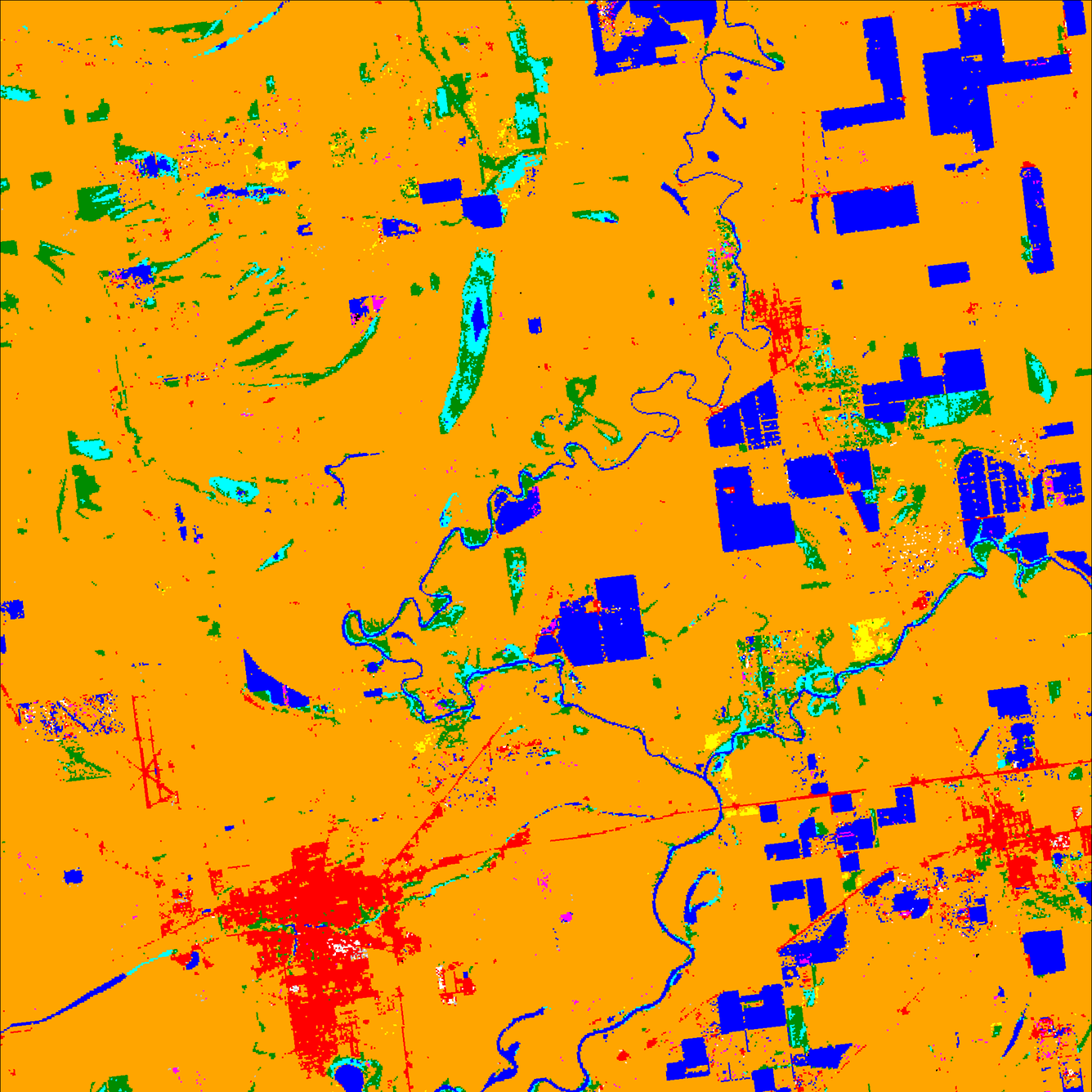
West-central Mississippi land cover map derived from 2013 Landsat imag
By Mendenhall Research Fellowship Program
2013 (approx.)
Detailed Description
This color-coded land cover map, showing cropland, water bodies, urban areas, and other types of land cover, is based on a 2013 Landsat satellite image. Satellite-image-derived land cover maps are essential tools for studying land cover and land use change over time on local, regional, and global scales. They enable land change scientists to determine not just what types of change are occurring, but how fast they are taking place and what factors might be driving them.
Sources/Usage
Public Domain.