
Wilmington blind thrust, Los Angeles, CA
Detailed Description
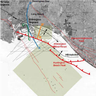
Location map for the study site for external grant G17AP00008. The two green boxes represent the areas of 3D seismic surveys used in this study. The grey lines denote select DOE Terralog, USGS (E1-01-SC), and USGS (A-1-00-SC) 2D seismic surveys. Base image from Bing Maps.
Sources/Usage
Public Domain.