
Coastal Change Likelihood Assessment


Detailed Description
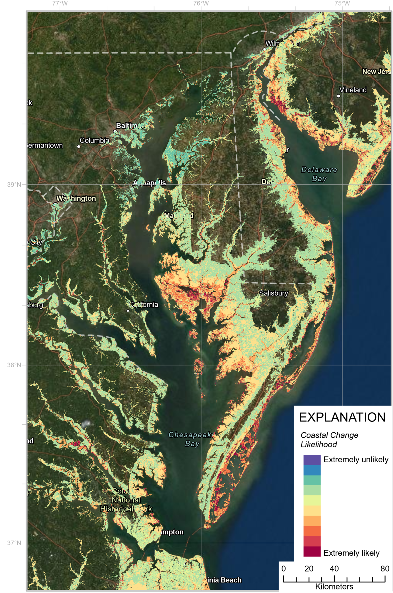
The U.S. Geological Survey, in partnership with the National Park Service through the Natural Resource Preservation Program, developed the Coastal Change Likelihood (CCL) assessment to determine the future likelihood of coastal change along U.S. coastlines in the next decade. The Northeast United States, from Maine to Virginia, was selected for a proof-of-concept pilot study.
The assessment utilizes datasets that describe the coastal landscape, or fabric, and six common coastal hazards—erosion, storm frequency, relative sea level rise, tidal flooding, storm overwash probability, and wave power. A supervised machine learning framework is used to synthesize the fabric and hazard data to estimate the likelihood of coastal change in the coming decade.
Sources/Usage
Public Domain.
Related

Coastal Change Likelihood
Related