
Repeat photography of the Glen Canyon Dam site on the Colorado River in Grand Canyon, before and after its construction


Detailed Description
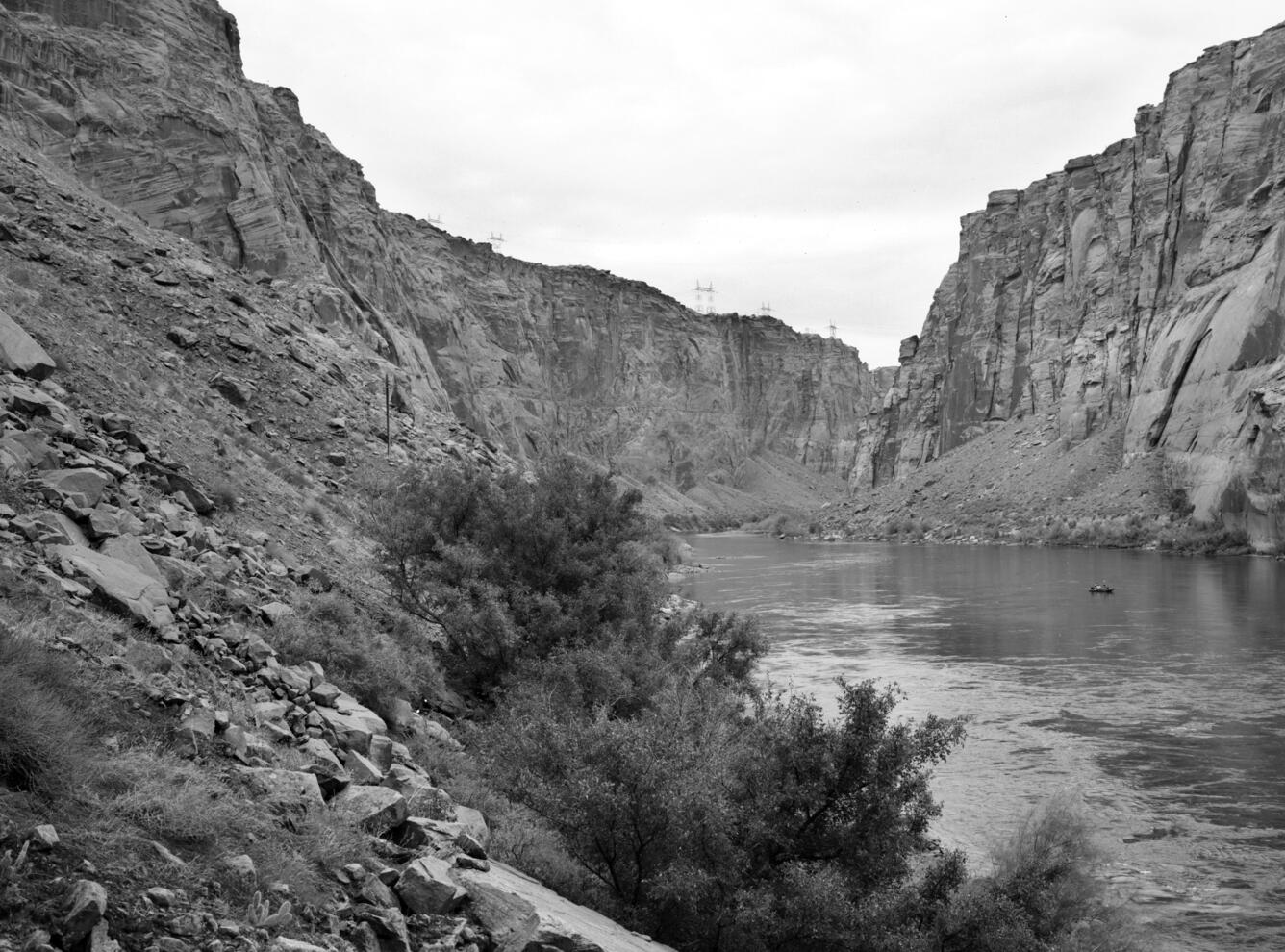
Repeat photography of the Glen Canyon Dam site on the Colorado River in Grand Canyon, before and after its construction. The original historic images were taken on December 23, 1889 by Franklin Nims, during the Stanton Expedition at River Mile -14.7. The images were later "matched" by USGS. The views are taken from river left looking upstream at the dam site, and downstream, just below the dam. Stake (camera point) s2638 in the SBSC’s Southwest Repeat Photography Collection. Dates and descriptions of each image are below.
Excerpt of the Stanton Survey History by Robert H. Webb, USGS, public domain (from the now unavailable webpage on the subject):
In May 1889, railroad engineer Robert Brewster Stanton, in collaboration with real estate investor Frank M. Brown, began a survey of the Green and Colorado River corridors. Their goal was to construct a railroad line from Grand Junction, Colorado to San Diego, California, one that would wind at river-level through several of the Colorado River’s canyons. While that expedition ended in disaster in July after three men—one of them Brown—drowned in Grand Canyon, Stanton successfully completed the survey that winter (1889-1890). The expedition quickly discovered that conducting the survey by instrument was far too time-consuming for their allotted time, so the men turned to line-of-site photographs taken on newfangled flexible roll film (rather than the cumbersome glass plates used by their predecessors). Although the railroad project never got past the planning stages, the photographs would prove to be invaluable as the basis for repeat photography a century later. From 1989 to 1995, the USGS re-photographed nearly all of the images that the expedition’s photographers—Franklin A. Nims and, after Nims was injured and left the expedition, Stanton himself—took in both Grand and Cataract Canyons. The photographs reveal changes in desert and riparian vegetation, rapids, and beaches, as a result of both natural and human-caused processes. Many of the Grand Canyon images were published in the book “Grand Canyon, A Century of Change,” by Robert Webb, and a selection of the Cataract Canyon images appeared in “Cataract Canyon: A Human and Environmental History of the Rivers in Canyonlands,” by Robert Webb, Jayne Belnap, and John Weisheit. In 2010, the USGS re-matched many of the images, both in Grand Canyon and Cataract Canyon.
December 23, 1889: Historic images taken on December 23, 1889 of the Colorado River, River Mile Mile -14.7, near the site where Glen Canyon Dam would later be built. Photographs were taken on river left looking upstream and downstream. For Stanton’s crew, the objective on the morning of December 23 was not just to survey a railroad route but to reach Lee’s Ferry in time for Christmas. They knew that Warren Johnson lived at Lee’s Ferry and expected a feast, a departure from their spartan river fare. They had camped the previous night only a short distance above the current site of Glen Canyon Dam. At 8:30 am, Stanton stopped in a right-hand bend -14.7 miles upstream of Lee’s Ferry. While others surveyed the route, Nims captured this view under cloudy skies. While the Brown-Stanton expedition would eventually switch from an instrument survey to a purely photographic survey of the canyons of the Colorado River in order to save time, at this point, they were still conducting an instrument survey. Three members of the expedition, with plane table and stadia rod, are visible in the center foreground. Shrubs, likely Mormon tea and saltbrush, grow upon the slope in the foreground, while the river’s edge is barren. Photo credits: Franklin A. Nims, original courtesy of The National Archives, #57-RS-235 and #57-RS-236, public domain.
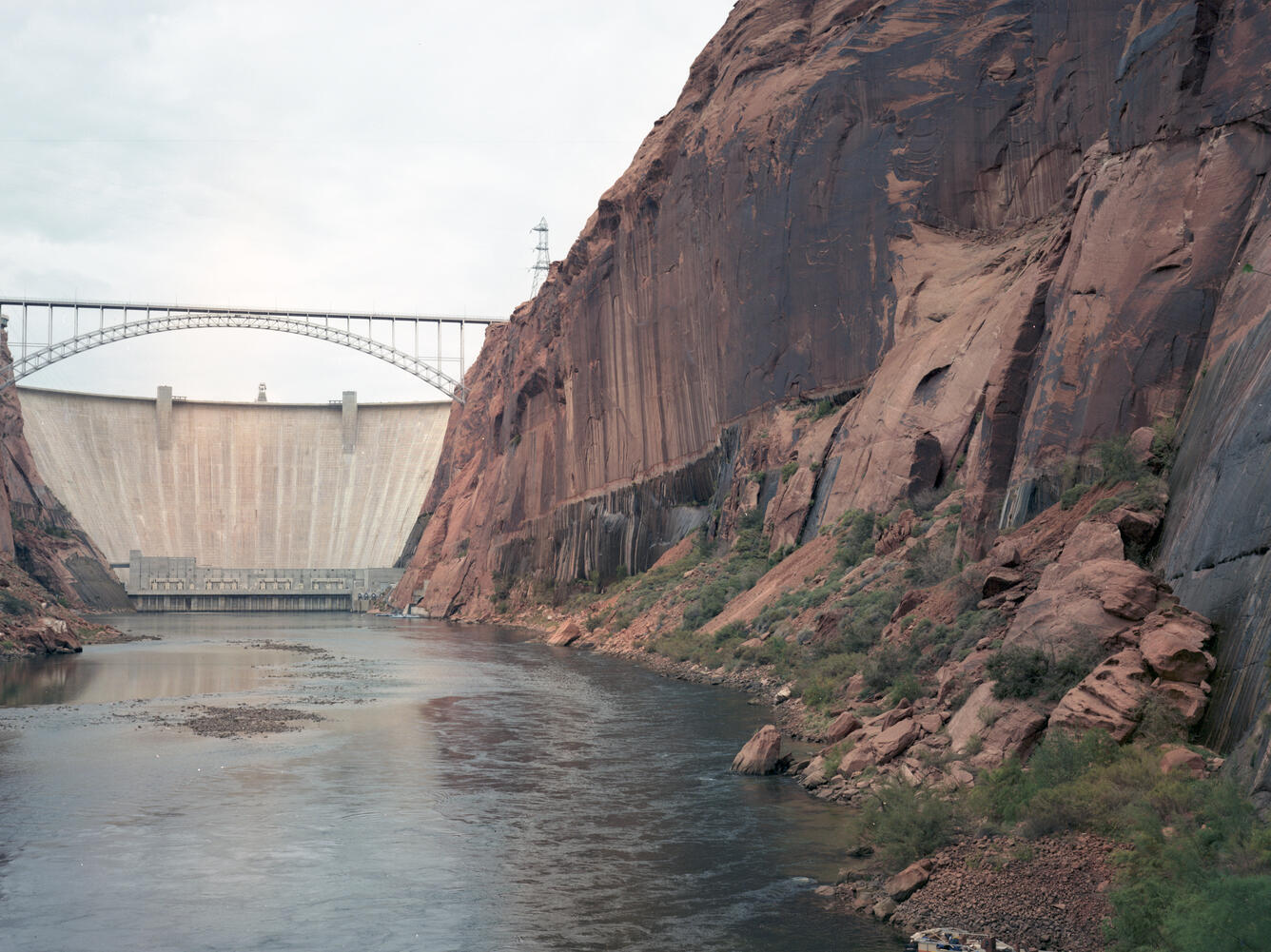
October 29, 1992: USGS repeat photographs near Glen Canyon Dam taken on October 29, 1992, as a match to the 1889 Franklin Nims image of the site before the dam was built, at Colorado River mile -14.7, during the Stanton Expedition. The views are taken from river left looking upstream at the dam and downstream from the dam. In October 1956, the blasting began on the walls of Navajo Sandstone at this once obscure spot. In 1963, Glen Canyon Dam was completed and Lake Powell began to fill. At this point, about one-half mile downstream, a new horizontal stripe on the wall was created by seepage from the reservoir. The small sand bars that lined the banks of the Colorado River in 1889 have eroded away, although a large sand bar is present directly across the river from the camera station. A century later, the presence of Glen Canyon Dam, which is just upstream, affects this view and all others downstream that show the river corridor. Large power poles dominate the skyline, a small power line crosses in the midground, and riparian vegetation, mostly netleaf hackberry and non-native tamarisk, has become established along the river corridor now protected from large floods. The shrubs growing along the slopes include Mormon tea, sand sagebrush, prickly pear cactus, and non-native Russian thistle. A small area of biological soil crust is apparent at lower left. Photo credits: Robert H. Webb, USGS.
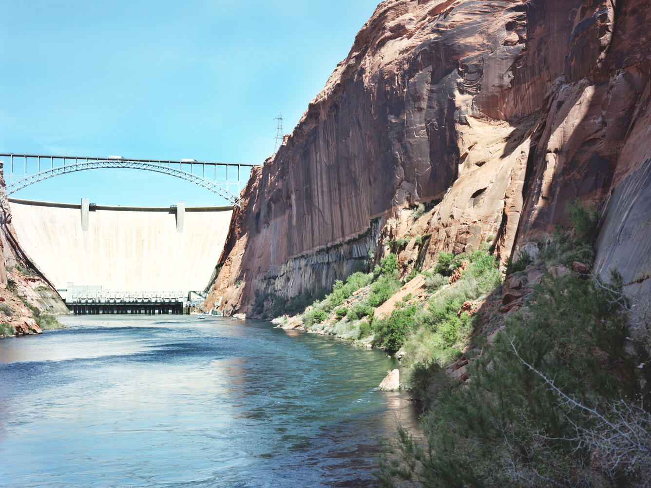
April 20, 2011: USGS repeat photographs near Glen Canyon Dam taken on April 20, 2011, as a match to the 1992 USGS and 1889 Nims/Stanton images. The views are taken from river left looking upstream at the dam and downstream from the dam. The vegetation growing along the shoreline has increased. Many of the individual plants persist, and a new netleaf hackberry is visible in the lower right corner of the image. The netleaf hackberry have increased in both stature and number of individuals in the ensuing two decades, and the tamarisk visible along the opposite bank has increased as well. Many of the Mormon tea persist, while some of the four-wing saltbush and sand sagebrush have died, as has prickly pear cactus. The biological soil crust is still present albeit subdued, and the large boulder in the center foreground has rotated. Photo credits: Robert H. Webb, USGS.
Sources/Usage
Public Domain.
Related

The Southwest Repeat Photography Collection (previously 'Desert Laboratory Repeat Photography Collection')
Related