



Rangeland managers need information on the current vegetation condition and how the landscape has changed through time. To address this need, scientists from the USGS and Bureau of Land Management (BLM) developed the Rangeland Condition Monitoring Assessment and Projection (RCMAP) project. These data classify western U.S.
RCMAP Long-term and Near-real time Rangeland Vegetation Monitoring
Detailed Description
This video is a recording of a previous webinar entitled “RCMAP Long-term and Near-real time Rangeland Vegetation Monitoring”. This webinar was recorded on September 22, 2026.
The United States Geological Survey (USGS) Earth Resources Observation and Science (EROS) Center maintains one of the largest civilian collection of images of the Earth’s land surface. At EROS we study land change and produce land change data products used by researchers, resource managers, and policy makers across the nation and around the world. The EROS User Services team provides assistance and outreach to help users in the data community access and work with data distributed from EROS. As part of the outreach effort, the EROS User Services team provides the EROS User Experience webinar series, where we talk to staff at EROS to learn more about the data, tools, and services provided by the USGS EROS. This webinar on RCMAP with USGS Ecologist Matthew Rigge was part of that series.
During this webinar users learned about the Rangeland Condition Monitoring Assessment and Projection (RCMAP) data and how to access the products. They also heard about case studies on how the data can support decision making.
Rangeland managers need information about current vegetation conditions and how landscapes have changed over time. To address this need, scientists from the USGS and Bureau of Land Management (BLM) developed RCMAP.
RCMAP provides annual maps of fractional cover for Western U.S. rangelands and the sagebrush biome of Canada, expressed as a percentage from 0-100 for ten components: the cover of annual herbaceous, bare ground, herbaceous, litter, non-sagebrush shrub, perennial herbaceous, sagebrush, shrub, and tree, as well as shrub height. Maps are produced using Landsat imagery for each year in a time-series stretching from 1985-current.
This long-term record helps users understand how vegetation responds to drought, invasive species, land management decisions, and disturbance. RCMAP time-series data can also be used to evaluate the effects of weather variability, vegetation treatments and changes in management practices.
RCMAP also produces a suite of weekly temporal resolution exotic annual grass (EAG) and herbaceous cover products that support near-real-time empowering fire and grazing management decisions. The RCMAP-EAG products map the extent of EAG invasion helping managers evaluate treatment success and protect core, uninvaded habitats.
We closed the webinar with a question-and-answer session for anything related to RCMAP data, or the tools used to access, process, and download the data.
Additional information and links related to this webinar:
- RCMAP (USGS): https://www.usgs.gov/centers/eros/science/rangeland-condition-monitoring-assessment-and-projection-rcmap
- RCMAP (MRLC): https://www.mrlc.gov/data/project/rcmap
- RCMAP Viewer: https://www.mrlc.gov/rangeland-viewer/
- RCMAP OGC Services: https://www.mrlc.gov/data-services-page
- RCMAP Video: https://www.usgs.gov/media/videos/visualizing-rangeland-change-rcmap-data
- Join the MRLC listserv to receive emails about future data releases.
- EROS User Services: https://www.usgs.gov/centers/eros/science/eros-user-services
- Previous recordings from this webinar series can be found on EROS User Experience Webinars webpage.
- Follow the USGS EROS on Social Media:
To join the EROS User Group and sign up to be notified of future webinars in this series, please visit: https://www.usgs.gov/centers/eros/science/eros-user-services.
Details
00:55:49
Sources/Usage
Public Domain.
Related
RCMAP (MRLC): https://www.mrlc.gov/data/project/rcmap
RCMAP Viewer: https://www.mrlc.gov/rangeland-viewer/
RCMAP OGC Services: https://www.mrlc.gov/data-services-page
RCMAP Video: https://www.usgs.gov/media/videos/visualizing-rangeland-change-rcmap-data
EROS User Services
Your trusted resource for USGS EROS data and tools. As the primary contact point for the USGS Earth Resources Observation and Science (EROS) center, we help thousands of users each year access and understand our vast archive of remotely sensed imagery and science products.

Rangeland Condition Monitoring, Assessment, and Projection (RCMAP)
Rangelands cover more than half of the western United States and are important for biodiversity, livestock grazing, recreation, and ecosystem services. Monitoring the condition and trends of rangelands over time is essential for sustainable land management. The Rangeland Condition Monitoring, Assessment, and Projection (RCMAP) project provides annual, 30 m resolution fractional component data to...
Visualizing Rangeland Change with RCMAP Data
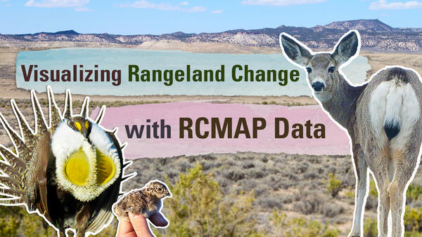
Rangeland managers need information on the current vegetation condition and how the landscape has changed through time. To address this need, scientists from the USGS and Bureau of Land Management (BLM) developed the Rangeland Condition Monitoring Assessment and Projection (RCMAP) project. These data classify western U.S.
Related
RCMAP (MRLC): https://www.mrlc.gov/data/project/rcmap
RCMAP Viewer: https://www.mrlc.gov/rangeland-viewer/
RCMAP OGC Services: https://www.mrlc.gov/data-services-page
RCMAP Video: https://www.usgs.gov/media/videos/visualizing-rangeland-change-rcmap-data
EROS User Services
Your trusted resource for USGS EROS data and tools. As the primary contact point for the USGS Earth Resources Observation and Science (EROS) center, we help thousands of users each year access and understand our vast archive of remotely sensed imagery and science products.
Rangeland Condition Monitoring, Assessment, and Projection (RCMAP)
Rangelands cover more than half of the western United States and are important for biodiversity, livestock grazing, recreation, and ecosystem services. Monitoring the condition and trends of rangelands over time is essential for sustainable land management. The Rangeland Condition Monitoring, Assessment, and Projection (RCMAP) project provides annual, 30 m resolution fractional component data to...
Visualizing Rangeland Change with RCMAP Data
Rangeland managers need information on the current vegetation condition and how the landscape has changed through time. To address this need, scientists from the USGS and Bureau of Land Management (BLM) developed the Rangeland Condition Monitoring Assessment and Projection (RCMAP) project. These data classify western U.S.
Rangeland managers need information on the current vegetation condition and how the landscape has changed through time. To address this need, scientists from the USGS and Bureau of Land Management (BLM) developed the Rangeland Condition Monitoring Assessment and Projection (RCMAP) project. These data classify western U.S.