An official website of the United States government
Here's how you know
Official websites use .gov
A .gov website belongs to an official government organization in the United States.
Secure .gov websites use HTTPS
A lock () or https:// means you’ve safely connected to the .gov website. Share sensitive information only on official, secure websites.
USGS EROS User Experience Webinars highlight the data, tools, and applications developed and used at the USGS Earth Resources Observation and Science (EROS) Center.
Led by EROS User Services staff, these webinars connect you directly with the experts behind the science. The recordings of each webinar are added to this page, so check back often to see what's new!
This is the thumbnail image for a video titled "Landsat Special Requests: Expanding Acquisition Capabilities".
This webinar introduced participants to the purpose, value, and workflow of Landsat Special Requests. We began with a brief review of Landsat’s Data Acquisition Plan, which directs the acquisitions of nearly 750 scenes each day for Landsat 8 and Landsat 9, and explains why most acquisitions focus on daytime land surfaces. After establishing this foundation, we explored how Special Requests allow scientists to obtain observations that fall outside of the standard acquisition plan.
Using real-world examples including nighttime urban heat measurements and near polar ice extent imaging, we demonstrated how Special Requests expand research possibilities across a wide range of scientific applications.
Participants learned:
how to access request forms, and complete and submit them correctly (including a walkthrough),
about the approval process,
how to retrieve acquired data through the USGS EarthExplorer data portal.
We also discussed typical timelines, limitations, and common reasons for approval or denial to help users set realistic expectations.
By the end of the session, participants should have a clear, practical understanding of when and how to submit effective Landsat Special Requests and how these acquisitions can significantly enhance scientific investigations.
This is the thumbnail image for a video titled "Introducing ASTER Version 4: What's New in Data Access, Products, Formats, and How to Unlock the ASTER Cloud Archive"
The ASTER instrument aboard NASA’s Terra satellite has collected over 4.7 million observations since its launch in 2000. ASTER data helps advance research and applications for volcano monitoring, mineral and geologic mapping, topography, and land cover change. NASA’s Land Processes Distributed Active Archive Center (LP DAAC) at the USGS EROS Center processes ASTER observations into 11 standard products that are archived within the Earthdata Cloud environment.
Updated atmospheric correction algorithms and ancillary input data sources
Level-2 products delivered as Cloud-Optimized GeoTIFF (COG), enabling efficient access and analysis in cloud-based, high-performance computing environments
ASTER is a cooperative effort between NASA, Japan's Ministry of Economy, Trade and Industry (METI), and Japan Space Systems.
This webinar covered product enhancements, new formats, changes in data access, and innovative ways to process and analyze ASTER data. Live demonstrations on accessing data in NASA Earthdata Seach, opening and working with the data in QGIS, and a walkthrough of the “Exploring ASTER L1T Radiance” Python script were provided.
The Multi-Resolution Land Characteristics (MRLC) Consortium offers great tools for accessing and analyzing land cover data from the National Land Cover Database (NLCD). During this webinar you will learn about two key MRLC tools:
These tools support visualization, analysis, and data downloads. Demonstrations of the MRLC Viewer and EVA tool will be provided, showcasing how to use the tools to explore Annual NLCD products, visualize land cover and land cover change, request custom downloads, and how to generate county-level land cover change statistics between selected years.
The powerful Application for Extracting and Exploring Analysis Ready Samples (AppEEARS) provides access to more than 100 geospatial datasets from multiple agencies, including several NASA Distributed Active Archive Centers (DAACs), the USGS EROS Center, and the National Park Service (NPS).
AppEEARS allows users an efficient way to access and transform geospatial data and explore results prior to download by:
Extracting data for point locations or areas of interest for specific variables and time ranges, reducing download volumes.
Using services which clip and mosaic the data for you, as well as reformatting and reprojecting data outputs.
Exploring the data with built-in visualizations prior to downloading.
Utilizing the AppEEARS API.
This webinar provides a background on AppEEARS, several demonstrations of the application, and a question-and-answer session at the end.
When Landsat Collection 2 data became available in 2020, access opened up in the cloud—bringing Landsat to users where they work and unlocking faster, more efficient analysis at scale. Landsat data are in uncompressed Cloud Optimized GeoTIFF (COG) format and are available from the Amazon Web Services (AWS) Simple Storage Services (S3).
Accessing Landsat data in the cloud allows users to:
Retrieve and process specific areas of interest (AOIs) more efficiently without manually searching for data or downloading entire scenes.
Eliminate time-consuming data transfers and storage, allowing users to focus on analysis and leveraging open-source tools.
Visualize and retrieve large-scale Landsat data directly in a cloud environment.
This webinar focuses on accessing and processing Landsat products in the cloud, assisting users on improving their existing workflows by using common programming tools available in the commercial cloud. Demonstrations of some tutorial scripts are also included.
The genesis of the National Land Cover Database (NLCD) began in the early 1990s, when a group of Federal agencies with a common need for Landsat data established the Multi-Resolution Land Characteristics (MRLC) Consortium.
Advances in cloud computing, improved sensor technologies, and AI-based algorithm development allowed the USGS in 2024 to release a new collection of next generation land cover data. The resulting Annual NLCD includes:
An ensemble of deep-learning-based algorithms used to map, monitor, and synthesize the complexities of land use, cover, and condition change through time.
Annual change information from 1985 through 2023 for the conterminous United States.
This webinar provides information on the history of NLCD, details on the new Annual NLCD dataset, plans for future datasets, and the impacts and influence NLCD data have had on science applications, land managers, and decision-makers.
The USGS EarthExplorer (EE) application provides online search, browse display, metadata export, data download, and processing support for the USGS EROS center's data holdings.
Topics covered in the webinar include:
How to register for an EROS Registration System (ERS) account.
How to perform a basic search for Landsat and National Agriculture Imagery Program (NAIP) imagery.
The Earth surface Mineral dust source InvesTigation (EMIT) imaging spectrometer aboard the International Space Station, measures the spectrum of light ranging from the visible to shortwave infrared (VSWIR). The data identify the distinct spectral signatures or fingerprints of surface materials present.
The EMIT mission has embraced open science, making the entire science data system open source, enabling intercomparison and transportability between systems.
EMIT data are available from NASA’s Land Processes Distributed Active Archive Center (LP DAAC) at the USGS EROS.
EMIT data can be applied across many scientific domains to map things like mineral types, vegetation species and health, snow grain size, water quality, dust, and greenhouse gases.
In this webinar you will learn about EMIT data products, how to access the data, and resources available from the LP DAAC for working with the data.
Simplifying Geospatial Data Workflows with NASA's AppEEARS
This video is a recording of a previous webinar entitled: “Simplifying Geospatial Data Workflows with NASA's AppEEARS”. This webinar was recorded on July 17, 2025.
This video is a recording of a previous webinar entitled: “Simplifying Geospatial Data Workflows with NASA's AppEEARS”. This webinar was recorded on July 17, 2025.
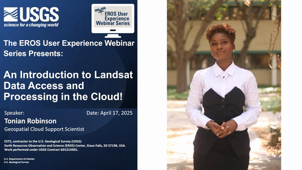
An Introduction to Landsat Data Access and Processing in the Cloud
This video is a recording of a previous webinar entitled: “An Introduction to Landsat Data Access and Processing in the Cloud!.” This webinar was recorded on April 17, 2025.
This video is a recording of a previous webinar entitled: “An Introduction to Landsat Data Access and Processing in the Cloud!.” This webinar was recorded on April 17, 2025.
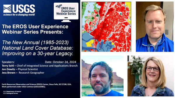
The New Annual (1985-2023) National Land Cover Database: Improving on a 30-Year Legacy
This video is a recording of a previous webinar entitled: “The New Annual (1985-2023) National Land Cover Database: Improving on a 30-year Legacy.” This webinar was recorded on October 24, 2024 at the USGS EROS.
This video is a recording of a previous webinar entitled: “The New Annual (1985-2023) National Land Cover Database: Improving on a 30-year Legacy.” This webinar was recorded on October 24, 2024 at the USGS EROS.
The United States Geological Survey (USGS) Earth Resources Observation and Science (EROS) Center maintains one of the largest civilian collection of images of the Earth’s land surface. At EROS, we study land change and produce land change data products used by researchers, resource managers, and policymakers across the nation and around the world.
The United States Geological Survey (USGS) Earth Resources Observation and Science (EROS) Center maintains one of the largest civilian collection of images of the Earth’s land surface. At EROS, we study land change and produce land change data products used by researchers, resource managers, and policymakers across the nation and around the world.
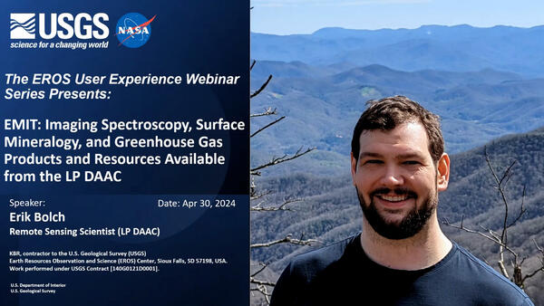
EMIT: Imaging Spectroscopy, Surface Mineralogy, and Greenhouse Gas Products and Resources Available from the LP DAAC
This is a recording of a previous webinar entitled: “EMIT: Imaging Spectroscopy, Surface Mineralogy, and Greenhouse Gas Products and Resources Available from the LP DAAC”. This webinar was recorded on May 30, 2024.
This is a recording of a previous webinar entitled: “EMIT: Imaging Spectroscopy, Surface Mineralogy, and Greenhouse Gas Products and Resources Available from the LP DAAC”. This webinar was recorded on May 30, 2024.
Landsat: Products & Services from the USGS - Webinar, September 2023
The USGS Earth Resources Observation and Science (EROS) Center maintains the largest civilian collection of images of the Earth’s land surface. At EROS we study land change and produce land change data products used by researchers, resource managers, and policymakers across the nation and around the world.
The USGS Earth Resources Observation and Science (EROS) Center maintains the largest civilian collection of images of the Earth’s land surface. At EROS we study land change and produce land change data products used by researchers, resource managers, and policymakers across the nation and around the world.
Bulk Download Web Application (BDWA) - Webinar, April 2023
The USGS Earth Resources Observation and Science (EROS) Center maintains the largest civilian collection of images of the Earth’s land surface. At EROS we study land change and produce land change data products used by researchers, resource managers, and policy makers across the nation and around the world.
The USGS Earth Resources Observation and Science (EROS) Center maintains the largest civilian collection of images of the Earth’s land surface. At EROS we study land change and produce land change data products used by researchers, resource managers, and policy makers across the nation and around the world.
Simplifying Geospatial Data Workflows with NASA's AppEEARS
This video is a recording of a previous webinar entitled: “Simplifying Geospatial Data Workflows with NASA's AppEEARS”. This webinar was recorded on July 17, 2025.
This video is a recording of a previous webinar entitled: “Simplifying Geospatial Data Workflows with NASA's AppEEARS”. This webinar was recorded on July 17, 2025.
An Introduction to Landsat Data Access and Processing in the Cloud
This video is a recording of a previous webinar entitled: “An Introduction to Landsat Data Access and Processing in the Cloud!.” This webinar was recorded on April 17, 2025.
This video is a recording of a previous webinar entitled: “An Introduction to Landsat Data Access and Processing in the Cloud!.” This webinar was recorded on April 17, 2025.
The New Annual (1985-2023) National Land Cover Database: Improving on a 30-Year Legacy
This video is a recording of a previous webinar entitled: “The New Annual (1985-2023) National Land Cover Database: Improving on a 30-year Legacy.” This webinar was recorded on October 24, 2024 at the USGS EROS.
This video is a recording of a previous webinar entitled: “The New Annual (1985-2023) National Land Cover Database: Improving on a 30-year Legacy.” This webinar was recorded on October 24, 2024 at the USGS EROS.
The United States Geological Survey (USGS) Earth Resources Observation and Science (EROS) Center maintains one of the largest civilian collection of images of the Earth’s land surface. At EROS, we study land change and produce land change data products used by researchers, resource managers, and policymakers across the nation and around the world.
The United States Geological Survey (USGS) Earth Resources Observation and Science (EROS) Center maintains one of the largest civilian collection of images of the Earth’s land surface. At EROS, we study land change and produce land change data products used by researchers, resource managers, and policymakers across the nation and around the world.
EMIT: Imaging Spectroscopy, Surface Mineralogy, and Greenhouse Gas Products and Resources Available from the LP DAAC
This is a recording of a previous webinar entitled: “EMIT: Imaging Spectroscopy, Surface Mineralogy, and Greenhouse Gas Products and Resources Available from the LP DAAC”. This webinar was recorded on May 30, 2024.
This is a recording of a previous webinar entitled: “EMIT: Imaging Spectroscopy, Surface Mineralogy, and Greenhouse Gas Products and Resources Available from the LP DAAC”. This webinar was recorded on May 30, 2024.
Landsat: Products & Services from the USGS - Webinar, September 2023
The USGS Earth Resources Observation and Science (EROS) Center maintains the largest civilian collection of images of the Earth’s land surface. At EROS we study land change and produce land change data products used by researchers, resource managers, and policymakers across the nation and around the world.
The USGS Earth Resources Observation and Science (EROS) Center maintains the largest civilian collection of images of the Earth’s land surface. At EROS we study land change and produce land change data products used by researchers, resource managers, and policymakers across the nation and around the world.
Bulk Download Web Application (BDWA) - Webinar, April 2023
The USGS Earth Resources Observation and Science (EROS) Center maintains the largest civilian collection of images of the Earth’s land surface. At EROS we study land change and produce land change data products used by researchers, resource managers, and policy makers across the nation and around the world.
The USGS Earth Resources Observation and Science (EROS) Center maintains the largest civilian collection of images of the Earth’s land surface. At EROS we study land change and produce land change data products used by researchers, resource managers, and policy makers across the nation and around the world.


 National Land Cover Database: Improving on a 30-Year Legacy")


 - Webinar, April 2023")