For the first time, national-scale maps of carbon stored in wetland soil across all interior and coastal settings were created from harmonized public datasets
These datasets represent a revised national scale estimate of wetland soil carbon stock assessments by improving representation of soil organic carbon densities.
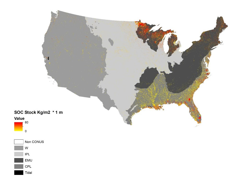
Carbon storage in wetland soils can have physical influences on water flow, water retention, and biogeochemical cycles and thus are critical to water models that guide decisions that affect downstream users. The amount of carbon stored in wetland soils is calculated from the soil’s carbon concentration (by weight) and its bulk density (a measure of its compactness). However, wetland soils are difficult to quantify and map due to varying sampling protocols and the discontinuous and variable nature of wetlands and water on the landscape. Despite conterminous United States (CONUS) wetland losses of 53 percent since European settlement, wetlands are still about 5 percent of CONUS land surface, with carbon-rich soils that represent nearly 15 percent of CONUS soil carbon storage to 1 meter depth.
Scientists created three-dimensional maps of soil carbon stored across the conterminous United States in inland and tidal wetlands of the U.S. Geological Survey’s National Land Cover Database and National Oceanic and Atmospheric Administration’s Coastal Change Analysis Program. The resulting maps identify 1) wetland soil carbon storage at high resolution, and 2) issues of spatial bias among approaches used for different public datasets, and 3) strategic approaches to improve assessment of vulnerability of wetland carbon storage. This approach provides more accurate estimates of carbon storage for national- and regional-scale computer models and can be applied to other wetland soil datasets, by region, or updated as new data becomes available.