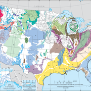
Central Valley is virtually one large, sediment-filled valley in California between the Coast Ranges and the Sierra Nevada. The aquifer system is divided into three subregions on the basis of surface-water basins.

A huge volume of sediments of deep marine, shallow marine, deltaic, and continental origin fill Central Valley. Most of the freshwater, however, is contained in the upper part of the sediments consisting of post-Eocene continental rocks and deposits, with thicknesses ranging from 1,000 to 3,000 feet. The continental sediments consist mostly of basin-fill or lake deposits of sand and gravel interbedded and mixed with clay and silt. Depending on location, deposits of fine-grained materials-mostly clay and silt-compose as much as 50 percent of the thickness of the valley-fill sediments. Although a number of stratigraphic units have been identified (Tuscan, Tehama, Tulare, and San Joaquin formations), their spatial character and extent is poorly known. For the Central Valley Hydrologic Model, continental deposits were divided into 10 vertical layers and characterized using sediment textures (percent coarse-grained sediments).
The data files listed below are supplemental to Groundwater Availability of the Central Valley aquifer, California (USGS Professional Paper 1766). The report includes a description of methods used to derive the data.
Click on the links below to download files for this aquifer. For information about the available file types, see Aquifer data: Explanation of spatial data formats.
Borehole Data:
- Percentage coarse-grain deposits Metadata (36KB XML) Excel table (4.5MB ZIP) Text file (2.7MB ZIP)
Extent of Central Valley Aquifer: Metadata (19KB XML) Shapefile (271KB ZIP)
Hydrologic Model Layer Surfaces: Metadata (31KB XML) Shapefile (all layers) (2.8MB ZIP) Text file (1MB ZIP)
- Layer 1 (top) Raster (1.7MB ZIP) ASCII grid (340KB ZIP)
- Layer 2 (top) Raster (1.4MB ZIP) ASCII grid (295KB ZIP)
- Layer 3 (top) Raster (1.2MB ZIP) ASCII grid (295KB ZIP)
- Layer 4 (top) Raster (1.2MB ZIP) ASCII grid (299KB ZIP)
- Layer 5 (top) Raster (1.2MB ZIP) ASCII grid (299KB ZIP)
- Layer 6 (top) Raster (1.2MB ZIP) ASCII grid (300KB ZIP)
- Layer 7 (top) Raster (1.2MB ZIP) ASCII grid (304KB ZIP)
- Layer 8 (top) Raster (1.2MB ZIP) ASCII grid (309KB ZIP)
- Layer 9 (top) Raster (1.2MB ZIP) ASCII grid (310KB ZIP)
- Layer 10 (top) Raster (1.2MB ZIP) ASCII grid (309KB ZIP)
- Layer 10 (bottom) Raster (1.2MB ZIP) ASCII grid (307KB ZIP)
Below are other webpages associated with this aquifer.
Principal Aquifers of the United States
Regional Groundwater Availability Studies
Below are publications associated with this aquifer.
Groundwater availability of the Central Valley Aquifer, California Groundwater availability of the Central Valley Aquifer, California
Ground Water Atlas of the United States Ground Water Atlas of the United States
Principal aquifers [of the United States] Principal aquifers [of the United States]
Central Valley is virtually one large, sediment-filled valley in California between the Coast Ranges and the Sierra Nevada. The aquifer system is divided into three subregions on the basis of surface-water basins.

A huge volume of sediments of deep marine, shallow marine, deltaic, and continental origin fill Central Valley. Most of the freshwater, however, is contained in the upper part of the sediments consisting of post-Eocene continental rocks and deposits, with thicknesses ranging from 1,000 to 3,000 feet. The continental sediments consist mostly of basin-fill or lake deposits of sand and gravel interbedded and mixed with clay and silt. Depending on location, deposits of fine-grained materials-mostly clay and silt-compose as much as 50 percent of the thickness of the valley-fill sediments. Although a number of stratigraphic units have been identified (Tuscan, Tehama, Tulare, and San Joaquin formations), their spatial character and extent is poorly known. For the Central Valley Hydrologic Model, continental deposits were divided into 10 vertical layers and characterized using sediment textures (percent coarse-grained sediments).
The data files listed below are supplemental to Groundwater Availability of the Central Valley aquifer, California (USGS Professional Paper 1766). The report includes a description of methods used to derive the data.
Click on the links below to download files for this aquifer. For information about the available file types, see Aquifer data: Explanation of spatial data formats.
Borehole Data:
- Percentage coarse-grain deposits Metadata (36KB XML) Excel table (4.5MB ZIP) Text file (2.7MB ZIP)
Extent of Central Valley Aquifer: Metadata (19KB XML) Shapefile (271KB ZIP)
Hydrologic Model Layer Surfaces: Metadata (31KB XML) Shapefile (all layers) (2.8MB ZIP) Text file (1MB ZIP)
- Layer 1 (top) Raster (1.7MB ZIP) ASCII grid (340KB ZIP)
- Layer 2 (top) Raster (1.4MB ZIP) ASCII grid (295KB ZIP)
- Layer 3 (top) Raster (1.2MB ZIP) ASCII grid (295KB ZIP)
- Layer 4 (top) Raster (1.2MB ZIP) ASCII grid (299KB ZIP)
- Layer 5 (top) Raster (1.2MB ZIP) ASCII grid (299KB ZIP)
- Layer 6 (top) Raster (1.2MB ZIP) ASCII grid (300KB ZIP)
- Layer 7 (top) Raster (1.2MB ZIP) ASCII grid (304KB ZIP)
- Layer 8 (top) Raster (1.2MB ZIP) ASCII grid (309KB ZIP)
- Layer 9 (top) Raster (1.2MB ZIP) ASCII grid (310KB ZIP)
- Layer 10 (top) Raster (1.2MB ZIP) ASCII grid (309KB ZIP)
- Layer 10 (bottom) Raster (1.2MB ZIP) ASCII grid (307KB ZIP)
Below are other webpages associated with this aquifer.
Principal Aquifers of the United States
Regional Groundwater Availability Studies
Below are publications associated with this aquifer.


