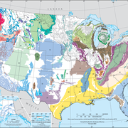
The rocks and deposits of the Great Basin carbonate and alluvial aquifer system (GBCAAS) are grouped into hydrogeologic units that are inferred to have reasonably distinct hydrologic properties due to their physical characteristics.

The hydrogeologic units for the Great Basin carbonate and alluvial aquifer system (GBCAAS) study area include (1) a noncarbonate confining unit representing low-permeability Precambrian siliciclastic formations, (2) a lower carbonate aquifer unit representing high-permeability Cambrian through Devonian limestone and dolomite, (3) an upper siliciclastic confining unit representing low-permeability Mississippian shale, (4) an upper carbonate aquifer unit representing high-permeability Pennsylvanian and Permian carbonate rocks, (5) a thrusted noncarbonate confining unit representing low-permeability siliciclastic rocks incorporated in regional thrust faults, (6) a thrusted lower carbonate aquifer unit representing high-permeability limestone and dolomite incorporated in regional thrust faults, (7) a volcanic unit representing outcrop areas of volcanic rocks, (8) a lower basin-fill aquifer unit representing the lower one-third of the Cenozoic basin fill, and (9) an upper basin-fill aquifer unit representing the upper two-thirds of the Cenozoic basin fill.
The data files listed below are supplemental to Conceptual model of the Great Basin carbonate and alluvial aquifer system (USGS Scientific Investigations Report 2010-5193). This report includes a description of methods used to derive the data.
Click on the links below to download files for this aquifer. For information about the available file types, see Aquifer data: Explanation of spatial data formats.
Hydrogeologic Unit Extents:
- Basin and Range carbonate rock Metadata (22 KB) Shapefile (131 KB)
Hydrologic Unit Surfaces: Metadata (30 KB)
- Non-Carbonate Confining Unit (top) Raster (297 KB) ASCII grid (220 KB)
- Lower Carbonate Aquifer Unit (top) Raster (294 KB) ASCII grid (217 KB)
- Upper Siliciclastic Confining Unit (top) Raster (292 KB) ASCII grid (217 KB)
- Upper Carbonate Aquifer Unit (top) Raster (291 KB) ASCII grid (216 KB)
- Thrusted Non-Carbonate Confining Unit and Thrusted Lower Carbonate Aquifer Unit (top) Raster (288 KB) ASCII grid (214 KB)
- Volcanic Unit (top) Raster (285 KB) ASCII grid (213 KB)
- Lower Basin-Fill Aquifer Unit (top) Raster (274 KB) ASCII grid (208 KB)
- Upper Basin-Fill Aquifer Unit (top) Raster (233 KB) ASCII grid (180 KB)
Below are other webpages associated with this aquifer.
Principal Aquifers of the United States
Regional Groundwater Availability Studies
Below are publications associated with this aquifer.
Conceptual model of the Great Basin carbonate and alluvial aquifer system Conceptual model of the Great Basin carbonate and alluvial aquifer system
Ground Water Atlas of the United States Ground Water Atlas of the United States
Principal aquifers [of the United States] Principal aquifers [of the United States]
The rocks and deposits of the Great Basin carbonate and alluvial aquifer system (GBCAAS) are grouped into hydrogeologic units that are inferred to have reasonably distinct hydrologic properties due to their physical characteristics.

The hydrogeologic units for the Great Basin carbonate and alluvial aquifer system (GBCAAS) study area include (1) a noncarbonate confining unit representing low-permeability Precambrian siliciclastic formations, (2) a lower carbonate aquifer unit representing high-permeability Cambrian through Devonian limestone and dolomite, (3) an upper siliciclastic confining unit representing low-permeability Mississippian shale, (4) an upper carbonate aquifer unit representing high-permeability Pennsylvanian and Permian carbonate rocks, (5) a thrusted noncarbonate confining unit representing low-permeability siliciclastic rocks incorporated in regional thrust faults, (6) a thrusted lower carbonate aquifer unit representing high-permeability limestone and dolomite incorporated in regional thrust faults, (7) a volcanic unit representing outcrop areas of volcanic rocks, (8) a lower basin-fill aquifer unit representing the lower one-third of the Cenozoic basin fill, and (9) an upper basin-fill aquifer unit representing the upper two-thirds of the Cenozoic basin fill.
The data files listed below are supplemental to Conceptual model of the Great Basin carbonate and alluvial aquifer system (USGS Scientific Investigations Report 2010-5193). This report includes a description of methods used to derive the data.
Click on the links below to download files for this aquifer. For information about the available file types, see Aquifer data: Explanation of spatial data formats.
Hydrogeologic Unit Extents:
- Basin and Range carbonate rock Metadata (22 KB) Shapefile (131 KB)
Hydrologic Unit Surfaces: Metadata (30 KB)
- Non-Carbonate Confining Unit (top) Raster (297 KB) ASCII grid (220 KB)
- Lower Carbonate Aquifer Unit (top) Raster (294 KB) ASCII grid (217 KB)
- Upper Siliciclastic Confining Unit (top) Raster (292 KB) ASCII grid (217 KB)
- Upper Carbonate Aquifer Unit (top) Raster (291 KB) ASCII grid (216 KB)
- Thrusted Non-Carbonate Confining Unit and Thrusted Lower Carbonate Aquifer Unit (top) Raster (288 KB) ASCII grid (214 KB)
- Volcanic Unit (top) Raster (285 KB) ASCII grid (213 KB)
- Lower Basin-Fill Aquifer Unit (top) Raster (274 KB) ASCII grid (208 KB)
- Upper Basin-Fill Aquifer Unit (top) Raster (233 KB) ASCII grid (180 KB)
Below are other webpages associated with this aquifer.
Principal Aquifers of the United States
Regional Groundwater Availability Studies
Below are publications associated with this aquifer.


