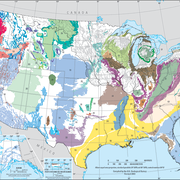
The Mississippi Embayment aquifer system is more than 5,000 feet thick in a wide area of south-central Louisana and southwestern Mississippi.

Hydrogeologic units of the Mississippi embayment aquifer system include the Mississippi River Valley alluvial aquifer, Vicksburg-Jackson confining unit, the upper Claiborne aquifer, the middle Claiborne confining unit, the middle Claiborne aquifer, the lower Claiborne confining unit, the lower Claiborne aquifer, the middle Wilcox aquifer, the lower Wilcox aquifer, and the Midway confining unit.
The data files listed below are supplemental to Digital surfaces and thicknesses of selected hydrogeologic units within the Mississippi Embayment Regional Aquifer Study (MERAS) (USGS Scientific Investigations Report 2008-5089). The report includes a description of methods used to derive the data.
Click on the links below to download files for this aquifer. For information about the available file types, see Aquifer data: Explanation of spatial data formats.
Hydrogeologic Unit Extents:
- Vicksburg-Jackson Group Metadata (12 KB) Shapefile (97 KB)
- Upper Claiborne aquifer Metadata (12 KB) Shapefile (118 KB)
- Middle Claiborne confining unit Metadata (12 KB) Shapefile (105 KB)
- Middle Claiborne aquifer Metadata (12 KB) Shapefile (109 KB)
- Lower Claiborne confining unit Metadata (12 KB) Shapefile (91 KB)
- Lower Claiborne aquifer Metadata (12 KB) Shapefile (87 KB)
- Middle Wilcox aquifer Metadata (12 KB) Shapefile (95 KB)
- Lower Wilcox aquifer Metadata (12 KB) Shapefile (71 KB)
- Midway confining unit Metadata (12 KB) Shapefile (98 KB)
Hydrologic Unit Surfaces:
- Vicksburg-Jackson Group (top) Metadata (12 KB) Raster (96 KB) ASCII grid (80 KB)
- Upper Claiborne aquifer (top) Metadata (12 KB) Raster (200 KB) ASCII grid (170 KB)
- Middle Claiborne confining unit (top) Metadata (12 KB) Raster (241 KB) ASCII grid (200 KB)
- Middle Claiborne aquifer (top) Metadata (12 KB) Raster (300 KB) ASCII grid (256 KB)
- Lower Claiborne confining unit (top) Metadata (12 KB) Raster (240 KB) ASCII grid (203 KB)
- Lower Claiborne aquifer (top) Metadata (12 KB) Raster (249 KB) ASCII grid (210 KB)
- Middle Wilcox aquifer (top) Metadata (12 KB) Raster (362 KB) ASCII grid (305 KB)
- Lower Wilcox aquifer (top) Metadata (12 KB) Raster (151 KB) ASCII grid (125 KB)
- Midway confining unit (top) Metadata (12 KB) Raster (371 KB) ASCII grid (317 KB)
Below are other webpages associated with this aquifer.
Principal Aquifers of the United States
Regional Groundwater Availability Studies
Below are publications associated with this aquifer.
Digital surfaces and thicknesses of selected hydrogeologic units within the Mississippi Embayment Regional Aquifer Study (MERAS) Digital surfaces and thicknesses of selected hydrogeologic units within the Mississippi Embayment Regional Aquifer Study (MERAS)
Ground Water Atlas of the United States Ground Water Atlas of the United States
Principal aquifers [of the United States] Principal aquifers [of the United States]
The Mississippi Embayment aquifer system is more than 5,000 feet thick in a wide area of south-central Louisana and southwestern Mississippi.

Hydrogeologic units of the Mississippi embayment aquifer system include the Mississippi River Valley alluvial aquifer, Vicksburg-Jackson confining unit, the upper Claiborne aquifer, the middle Claiborne confining unit, the middle Claiborne aquifer, the lower Claiborne confining unit, the lower Claiborne aquifer, the middle Wilcox aquifer, the lower Wilcox aquifer, and the Midway confining unit.
The data files listed below are supplemental to Digital surfaces and thicknesses of selected hydrogeologic units within the Mississippi Embayment Regional Aquifer Study (MERAS) (USGS Scientific Investigations Report 2008-5089). The report includes a description of methods used to derive the data.
Click on the links below to download files for this aquifer. For information about the available file types, see Aquifer data: Explanation of spatial data formats.
Hydrogeologic Unit Extents:
- Vicksburg-Jackson Group Metadata (12 KB) Shapefile (97 KB)
- Upper Claiborne aquifer Metadata (12 KB) Shapefile (118 KB)
- Middle Claiborne confining unit Metadata (12 KB) Shapefile (105 KB)
- Middle Claiborne aquifer Metadata (12 KB) Shapefile (109 KB)
- Lower Claiborne confining unit Metadata (12 KB) Shapefile (91 KB)
- Lower Claiborne aquifer Metadata (12 KB) Shapefile (87 KB)
- Middle Wilcox aquifer Metadata (12 KB) Shapefile (95 KB)
- Lower Wilcox aquifer Metadata (12 KB) Shapefile (71 KB)
- Midway confining unit Metadata (12 KB) Shapefile (98 KB)
Hydrologic Unit Surfaces:
- Vicksburg-Jackson Group (top) Metadata (12 KB) Raster (96 KB) ASCII grid (80 KB)
- Upper Claiborne aquifer (top) Metadata (12 KB) Raster (200 KB) ASCII grid (170 KB)
- Middle Claiborne confining unit (top) Metadata (12 KB) Raster (241 KB) ASCII grid (200 KB)
- Middle Claiborne aquifer (top) Metadata (12 KB) Raster (300 KB) ASCII grid (256 KB)
- Lower Claiborne confining unit (top) Metadata (12 KB) Raster (240 KB) ASCII grid (203 KB)
- Lower Claiborne aquifer (top) Metadata (12 KB) Raster (249 KB) ASCII grid (210 KB)
- Middle Wilcox aquifer (top) Metadata (12 KB) Raster (362 KB) ASCII grid (305 KB)
- Lower Wilcox aquifer (top) Metadata (12 KB) Raster (151 KB) ASCII grid (125 KB)
- Midway confining unit (top) Metadata (12 KB) Raster (371 KB) ASCII grid (317 KB)
Below are other webpages associated with this aquifer.
Principal Aquifers of the United States
Regional Groundwater Availability Studies
Below are publications associated with this aquifer.


