
USGS Geologic Mapping Project Supports Critical Mineral Exploration, Enhances Public Safety in the Southeast
Deep beneath the southeastern U.S. lies a hidden world of critical minerals and potential earthquake risks. A U.S. Geological Survey geologic mapping project is dedicated to uncovering these secrets, with the goal of enriching the nation’s geological understanding and improving public safety.
The project aims to create detailed geologic maps of the Atlantic Seaboard Fall Line, a geologic boundary from New Jersey to Georgia. This area features rapids in streams and rivers, with higher land to the northwest. The Fall Line marks a 10-mile-wide area between the hard metamorphic rock of the Piedmont to the west and the softer sedimentary rock of the Coastal Plain to the east.
These new geologic maps will fill in knowledge gaps in many places in the southeastern U.S. that have not been mapped in detail before.
“New technologies and mapping techniques allow us to create more accurate maps of what lies underground, providing crucial geologic information, such as where important minerals could be or where earthquake risks are greater,” said Mark Carter, a USGS research geologist and project lead with the USGS Florence Bascom Geoscience Center.
A key focus of this mapping project is to inform State Geological Surveys, private industry, and key decision-makers where critical minerals vital to the economy and national security might be located.
As demand for rare earth elements and other critical minerals grows for use in technology, energy, and defense sectors, this project can provide vital data that helps the U.S. secure domestic sources of critical minerals, thus reducing the nation’s dependence on foreign sources.
“Critical minerals are needed for almost every part of modern life,” Carter explained. “Projects like this one can make the U.S. more self-reliant by helping us find where these resources are.”
Critical minerals like titanium are found in sandy deposits along the coastal plain, originating from weathered rocks in and around the Appalachians and washed downstream. While experts know the current locations of many of these sandy deposits, their original sources in Piedmont and Blue Ridge bedrock upstream are still unknown. Discovering the origin of these minerals is important because there may be large amounts of valuable resources yet to be uncovered, added Carter.
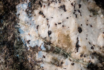
Titanium is one of 50 critical minerals essential to the U.S. economy and national security. More than 95% of titanium used in the U.S. during 2024 was imported from other countries, so finding domestic sources of titanium is important for the U.S. to be self-sufficient. Titanium’s high strength-to-weight ratio is crucial for components in airplanes, spacecraft, military armor, and medical implants. Most titanium ore is processed into titanium dioxide, a pigment used in various products like paints, plastics, toothpaste and sunscreen.
In addition to its potential in locating critical minerals, this project fills a critical public safety need by assessing areas for earthquake hazards.
Many older geologic maps of the southeastern U.S. do not provide the detail needed to identify possible geological hazards, including rare but severe earthquakes that endanger lives and infrastructure. Updated maps can improve geological understanding and knowledge on earthquake risks, helping local governments and emergency services better prepare for and mitigate the impacts of earthquakes. This improved understanding helps local and state governments maximize the effectiveness of building codes, emergency plans, and public awareness programs.
“At the heart of this mapping endeavor is a commitment to public safety,” said Carter. “The project will provide local agencies and policymakers with the knowledge needed to implement effective hazard mitigation strategies, which can help save lives, protect communities and reduce economic losses in the event of a future earthquake.”
At present, the research for the project is focused on the Fall Line in southeast Virginia, northeastern North Carolina, and central Georgia. Much of the work in Georgia is focused on Federal lands, including the Oconee National Forests and both the Piedmont and Bond Swamp National Wildlife Refuges.
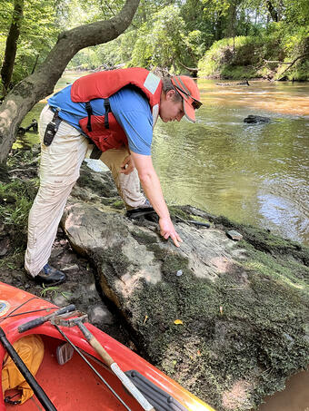
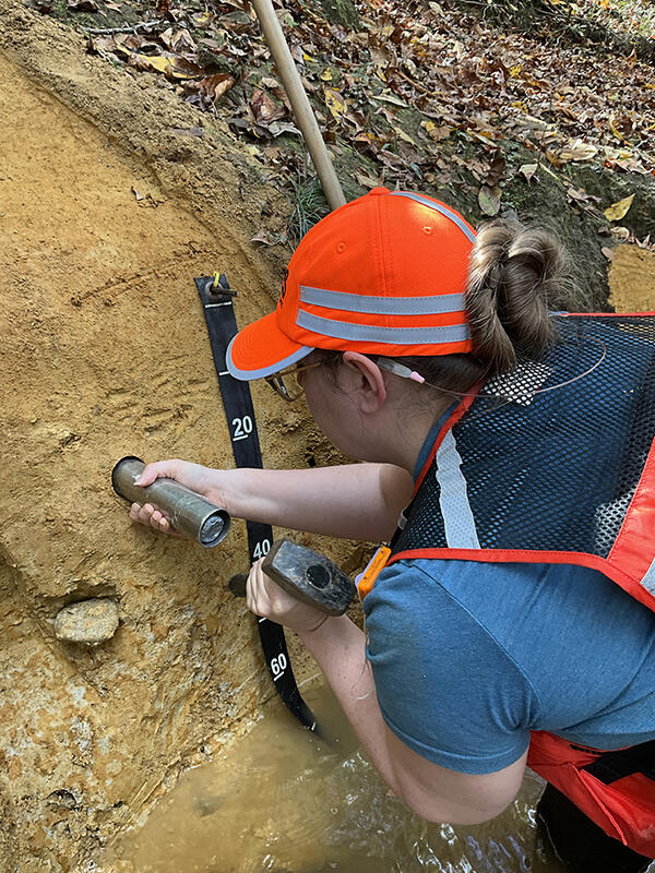
During fieldwork, geologists traverse varied terrains to study rocks outcrops, topographic features, and soils while collecting samples for laboratory analysis. A key aspect of geologic mapping is laboratory work to determine the age of rocks and sediments. At USGS labs, various techniques are employed to achieve this, such as uranium-lead dating for zircon minerals, pollen analysis to determine sediment age, cosmogenic nuclide dating to measure sunlight exposure, and optically stimulated luminescence dating to find out when sands were last exposed to sunlight, which tells experts when the sands were buried.
This field and laboratory work also helps other parts of the USGS like the Earth Mapping Resources Initiative (Earth MRI), which collects geophysical, geologic, geochemical, and topographic data across all regions of the U.S. to enhance scientific understanding of the nation's geology and mineral resources. Earth MRI airborne surveys aid geologic mapping by measuring rock characteristics that are not visible to the naked eye but can be matched to geologic features that span large regions, even in remote, rugged areas or areas covered by vegetation or water. This project and similar efforts by USGS and State geological survey partners provide essential ground-truth information to interpret the geophysical data and infer the bedrock geology and features such as faults that are concealed beneath younger soils and sediment.
To learn more about this USGS National Cooperative Geologic Mapping Program project, visit: Geology of the eastern Piedmont and upper Coastal Plain along the Fall Zone, Virginia to Georgia | U.S. Geological Survey