Desert communities throughout the Southwest are putting water availability at the top of their municipal agendas.
In the 1800s, cowboys, ranchers, and miners quarreled over water in the American Southwest, over where to find it and who could use it. Today, people in the region are faced with even greater concerns. Rapid population growth combined with the impact of longer droughts may present a greater demand for water resources in the future.
However, one area stands out from the rest: the upper Santa Cruz Basin in Arizona has shown a remarkable capacity to store water. The Santa Cruz River area was the site of the first European settlements in the region because of its water availability and lush environment.
What causes the higher water availability in this area?
During the rainy season in southern Arizona, water seeps into the ground and is stored in big, underground bathtubs called aquifers. Groundwater in aquifers can be brought to the surface by natural springs or wells. The aquifers that provide much of the groundwater to the city of Nogales and the surrounding communities are collectively called “the microbasins.” The microbasins are narrow, and scientists originally thought they were shallow—100–150 feet below the surface—because solid bedrock is close to the surface and water cannot pass through it easily.
Could water be leaking beneath the shallow aquifers, making more water available?
Keith Nelson, a hydrologist at the Arizona Department of Water Resources (ADWR) in Phoenix, worked to find the answer. He used a water simulation program and entered data that included the possibility of aquifers deeper than 150 feet beneath the surface. The model produced results closer to the actual conditions.
“Although that was reassuring,” said Nelson, “I was reluctant to consider the findings more than preliminary until I could get field data on whether the rocks in the area would actually let water through to lower levels.”
Nelson then collaborated with geologist William Page of the U.S. Geological Survey (USGS). After Nelson had explained his dilemma, Page shared results of his studies in the area. Page has worked in the region for many years and collects data about geologic formations and faults to determine how they affect surface water and groundwater flow.
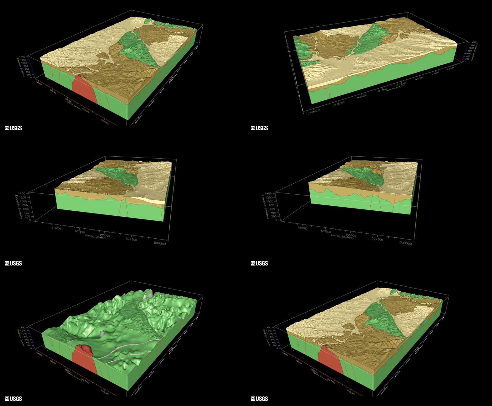
A three-dimensional (3D) geologic model developed by the USGS was one of several techniques used to understand how water flows in the Santa Cruz Basin. The model helped define the geometry and thickness of the basin aquifer system and enabled the viewing of subsurface data interactively in 3D space. This gives scientists the ability to slice through and rotate the modeled geology into various orientations, thereby better understanding the internal complexities of the basin. These types of interactive models are cutting-edge in the scientific community.
Data from Page’s collective geologic studies revealed many areas of fractured sediments throughout the Santa Cruz Basin and numerous deep aquifers, some reaching 2,500 feet below the surface. Where sediments are fractured, channels form, allowing water to flow at deeper levels. The sediments let water through easily and are also porous and store even more water.
Studies based on data from both the USGS and the ADWR provide insight into how the regional hydrologic system works. Their efforts are enthusiastically received by residents, the City of Nogales, and other regional water users and managers.
“[Page’s] work confirmed our unexpected results that there are deep aquifers beneath the shallow ones in the microbasins,” Nelson commented. “The ADWR will use the results of the new USGS studies to create more effective water management strategies.”
For more information, contact Kevin Gallagher, USGS Associate Director for Core Science Systems, at kgallagher@usgs.gov.
Read more stories about USGS science in action.


