An official website of the United States government
Here's how you know
Official websites use .gov
A .gov website belongs to an official government organization in the United States.
Secure .gov websites use HTTPS
A lock () or https:// means you’ve safely connected to the .gov website. Share sensitive information only on official, secure websites.
It’s not uncommon for young scientists doing remote sensing research these days to use what they call the “full Landsat record” in their studies—a time frame they often characterize as 1984 to present.
But Landsat’s history of Earth observations goes back further than that—to 1972, the launch of the first Landsat mission called the Earth Resources Technology Satellite (ERTS-1), and a groundbreaking sensor called the Multispectral Scanner (MSS) that gave birth to the modern remote sensing era.
Given all that, why then are so few researchers making use of those first 12 years in their work today? And more importantly, if issues with MSS data are keeping those studies from happening, can and will that data be corrected to make the Landsat record more complete?
The answer to the first question is multi-faceted. As for the latter? Well, many Landsat scientists and engineers still believe the answer is “yes.”
Here’s why MSS is so challenging to use in combination with the later Landsat record. MSS’ mere four bands hardly compare to Landsat 8’s nine spectral and two thermal bands. MSS resolution, at 60 meters, is coarser than the latest Landsat sensors. And because of its discrepancies spatially, geometrically, and radiometrically, MSS data are just challenging enough to work with that many scientists simply move past them when it comes to studying environmental characteristics and change across the decades.
They shouldn’t, says Tom Loveland, the retired chief scientist at the Earth Resources Observation and Science (EROS) Center and long-time proponent of MSS.
“If we’re going to study change over time, we can’t ignore the first dozen years of the program,” Loveland said. “The information content (from MSS) is still important.”
Warren Cohen with the USDA Forest Service talks about the value of Landsat's long history of observations in monitoring and assessing forests.
It was always been important to Warren Cohen in his research work with the U.S. Forest Service. Cohen, a former member of the Landsat Science Team who has lobbied extensively for improvements to the MSS data, made considerable use of that data to track forest disturbances over time, including how those forests recovered and the succession that followed disturbance events.
At a time when the interests of timber harvesting in old forests were butting up against the Endangered Species Act, Cohen and his work with Landsat and MSS data helped fuel the U.S. Forest Service’s eventual reliance on remote sensing and, in time, a program it developed called the Landscape Change Monitoring System.
While it certainly would have been beneficial to have had Landsat data in the 1940s, ‘50s, and ‘60s, gaining access to that MSS data in the 1970s was important nonetheless, Cohen said, because it came at a time when the world’s population was exploding by 23 percent—a mushrooming human footprint that ended up causing major changes across Earth’s landscapes.
“And sure, you know, MSS was and is hard to use,” Cohen said. Without question, marrying up MSS data with later Landsat sensors like the Thematic Mapper (TM), Enhanced Thematic Mapper-Plus (ETM+), and the Operational Land Imager (OLI) is challenging, he said, though he quickly added, “it’s the only thing we have for back then, so it’s really worth doing.”
So how then can MSS data be made more compatible and thus more usable in the entire Landsat record? That’s a challenge the USGS, the calibration experts at EROS, and others have been wrestling with for years, though it appears now that perhaps they are finally making some headway.
Geometric Aligning of MSS Looks Promising
Among the three key areas of improvement cited most often—the geometry of MSS data, cloud masking, and atmospheric correction—the one that seems most promising at this point is the geometric alignment, said Chris Engebretson, the Landsat Data Processing Systems Manager at EROS.
The calibration team at EROS is working on improving the registration process for aligning the MSS pixels with those from later sensors. One way to do that is through more ground control points, which would provide more consistent alignment, Engebretson said.
“If I’m looking at a particular pixel, a particular field, I want to be able to drop a line through that pixel and go all the way back to 1972,” he said. “In order for that to work, all the data have to be properly aligned. There’s always been challenges with doing corrections of MSS data.”
Using more ground control points is just part of the solution, he added. “Even then, we can make it better,” Engebretson said. “That geometric accuracy is obviously one of the big things we need to look at if we want to really open up the MSS archive.”
Identifying and fixing the cloud issues in MSS data, and correcting for aerosols, water vapor, and other constituents in the atmosphere, are also keys to improving that archive, though those efforts require the kind of attention that has often been directed to the myriad of other responsibilities the USGS EROS calibration team has, Engebretson said.
“Which has always been the problem with MSS,” he added. “How do you rack and stack the MSS work with everything else that’s on our plate when it’s a really big plate?”
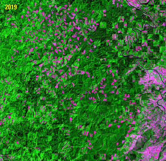
This animation depicts logging-related changes to a forested area in Oregon. The first image was captured by the Multispectral Scanner (MSS) onboard the first Landsat satellite.
The Landsat Science Team (LST) understands that, said Christopher Crawford, the USGS Landsat Project Scientist and USGS agency co-chair of the LST. Still, the team attempted to move the ball on MSS again at its semi-annual meeting in Phoenix, AZ, this past February. On the cloud masking issue, Cohen and his colleagues developed a cloud-masking algorithm six years ago that has shown promise in producing results on the presence or absence of clouds, which in turn can be used in assessing the quality of images used in analysis.
The problem with MSS data on clouds is, if a pixel is very bright, it’s difficult to differentiate whether that brightness is caused by clouds, snow, or sand, Engebretson said. Later Landsat sensors had shortwave infrared (SWIR) bands that helped with that differentiation, as well as thermal bands that can detect the cold temperatures that accompany clouds.
The algorithm developed by Cohen’s colleague Justin Braaten—called the MSS clear-view mask, or MSScvm—relies on a series of spectral tests on a single band of brightness and normalized band differences to identify cloud, cloud shadow, and clear-view pixels. It also incorporates a Digital Elevation Model and cloud projection to better separate cloud shadow from topographic shading and water.
It may not be perfect, Loveland said. But it’s a conversation the LST needs to continue with Cohen and his colleagues because of the promise it does offer.
“Because you’re going further and further back in time, the ancillary information you need to characterize what’s in the atmosphere and correct the imagery is also of lower quality and less availability,” Loveland said. “All of the steps taken to improve MSS won’t be as high a quality as we can do now. But the science team understands that. It’s acceptable. We can adjust our standards, but we need access to that record so the science objectives can be addressed.”
Atmospheric Correction Poses Most Challenges
Atmospheric correction is perhaps the most difficult nut to crack. Crawford said one option would be to look at modeling the atmosphere’s path radiance, which relies on radiative transfer. Since MSS data have fewer bands to make inferences about what’s in the atmosphere, Engebretson has said that the calibration staff at EROS has pulled in external atmospheric data in the past for things like aerosols, water vapor, and ozone that even newer Landsat sensors don’t see. For MSS, they would need to go back into the 1970s and look for contemporaneous atmospheric data from NOAA missions and other sources to help in the work of atmospheric correction, Engebretson said.
“It exists,” he said of NOAA’s and other data. “But to a larger degree, a lot of that data have the same problems that we have with MSS data. It’s lower quality. It may not be available across the entire time range.”
Even so, there really hasn’t been a concerted effort to go back, look at what those datasets are, see what issues they have, and then actually try to generate an atmospheric correction algorithm, Engebretson said. There needs to be such an algorithm developed, he added, but again, it’s a question of time, staff, and priorities.
With two atmospheric scientists on the LST, there is certainly a knowledge base there that could act on the issue, Crawford said. But they would have to volunteer to do the work, he said. Or, the other option would be having a mechanism in place to fund an investigator to do that work.
“We know what we need to do,” Crawford said. “The concept is there, but we’ve got to figure out a way to operationalize it.”
As it is, MSS data are processed into Landsat Collections. Making them more compatible with data from later Landsat sensors for future Collections really refers to improved geometry in the Level-1 products, and the best possible Level-2 atmospherically corrected products, Crawford said.
MSS Data Important Contributor to Time Series
The bottom line is, by succeeding with geometric accuracy, cloud masking, and atmospheric correction, Cohen and the others are convinced that MSS will become even more valuable and useful in time series studies. Cohen, for one, believes that with the success NASA has shown in harmonizing Landsat data with the Europe’s similar Copernicus Sentinel-2 imagery, MSS, too, can be harmonized with the rest of the Landsat archive.
It may have less detail than Landsat’s later sensors, he said. It may have less quality. But scientists doing time series work, he added, can live with that knowing it’s the only available dataset from the first 12 years of Landsat.
“I’ve done time series with MSS,” Cohen said. “It’s there. It works for us. It’s quite useful. If you want long-term information going back through the full extent of Landsat’s history, you can determine that, yes, it is worth processing. We need it. We don’t want to lose it. I don’t think there’s any question about how important and how valuable MSS is.”
The primary task of the 2018-2023 Landsat Science Team is to provide scientific and technical evaluations to the USGS and NASA on issues critical to the success of the Landsat program, and to ensure that data from future missions such as Landsat 9 and beyond are successfully integrated into the overall Landsat record.
The primary task of the 2018-2023 Landsat Science Team is to provide scientific and technical evaluations to the USGS and NASA on issues critical to the success of the Landsat program, and to ensure that data from future missions such as Landsat 9 and beyond are successfully integrated into the overall Landsat record.
Landsat 1-5 Multispectral Scanner (MSS) Collection 1 Level-1 data are now available to download from the USGS Landsat archive. The addition of these data into the collection inventory structure that was first implemented in 2016 ensures a consistent archive of known data quality to support time-series analyses.
May 16, 2018 - Landsat MSS Collection 1 Data Now Available
Landsat 1-5 Multispectral Scanner (MSS) Collection 1 Level-1 data are now available to download from the USGS Landsat archive. The addition of these data into the collection inventory structure that was first implemented in 2016 ensures a consistent archive of known data quality to support time-series analyses.
Multispectral Scanner (MSS) Level-1, collected at 80-meter, multispectral data from Landsats 1 - 5. Data was processed to 60-meter pixel size. (1972-2013). NOTE: Landsat Collection 1 data and products are no longer available to download from the USGS as of December 30, 2022. Landsat Collection 2 remains available. Please access the Landsat Collection 2 webpage below for information about...
USGS EROS Archive - Landsat Archives - Landsat 1-5 Multispectral Scanner (MSS) Level-1 Data Products
Multispectral Scanner (MSS) Level-1, collected at 80-meter, multispectral data from Landsats 1 - 5. Data was processed to 60-meter pixel size. (1972-2013). NOTE: Landsat Collection 1 data and products are no longer available to download from the USGS as of December 30, 2022. Landsat Collection 2 remains available. Please access the Landsat Collection 2 webpage below for information about...
The EarthExplorer (EE) user interface is an online search, discovery, and ordering tool developed by the United States Geological Survey (USGS). EE supports the searching of satellite, aircraft, and other remote sensing inventories through interactive and textual-based query capabilities.
The primary task of the 2018-2023 Landsat Science Team is to provide scientific and technical evaluations to the USGS and NASA on issues critical to the success of the Landsat program, and to ensure that data from future missions such as Landsat 9 and beyond are successfully integrated into the overall Landsat record.
The primary task of the 2018-2023 Landsat Science Team is to provide scientific and technical evaluations to the USGS and NASA on issues critical to the success of the Landsat program, and to ensure that data from future missions such as Landsat 9 and beyond are successfully integrated into the overall Landsat record.
Landsat 1-5 Multispectral Scanner (MSS) Collection 1 Level-1 data are now available to download from the USGS Landsat archive. The addition of these data into the collection inventory structure that was first implemented in 2016 ensures a consistent archive of known data quality to support time-series analyses.
May 16, 2018 - Landsat MSS Collection 1 Data Now Available
Landsat 1-5 Multispectral Scanner (MSS) Collection 1 Level-1 data are now available to download from the USGS Landsat archive. The addition of these data into the collection inventory structure that was first implemented in 2016 ensures a consistent archive of known data quality to support time-series analyses.
Multispectral Scanner (MSS) Level-1, collected at 80-meter, multispectral data from Landsats 1 - 5. Data was processed to 60-meter pixel size. (1972-2013). NOTE: Landsat Collection 1 data and products are no longer available to download from the USGS as of December 30, 2022. Landsat Collection 2 remains available. Please access the Landsat Collection 2 webpage below for information about...
USGS EROS Archive - Landsat Archives - Landsat 1-5 Multispectral Scanner (MSS) Level-1 Data Products
Multispectral Scanner (MSS) Level-1, collected at 80-meter, multispectral data from Landsats 1 - 5. Data was processed to 60-meter pixel size. (1972-2013). NOTE: Landsat Collection 1 data and products are no longer available to download from the USGS as of December 30, 2022. Landsat Collection 2 remains available. Please access the Landsat Collection 2 webpage below for information about...
The EarthExplorer (EE) user interface is an online search, discovery, and ordering tool developed by the United States Geological Survey (USGS). EE supports the searching of satellite, aircraft, and other remote sensing inventories through interactive and textual-based query capabilities.