The National Map Corps is requesting volunteer assistance to verify Post Office information in Illinois
The National Map Corps (TNMCorps) is an online crowdsourcing mapping project with citizen volunteers editing structures in all 50 States, Puerto Rico, and the U.S. Virgin Islands. As part of The National Map, structures include schools, hospitals, post offices, police stations, cemeteries, and other important public buildings. By updating and verifying structures data, volunteers are making significant contributions to USGS National Structures Database, The National Map, and ultimately U.S. Topo Maps!
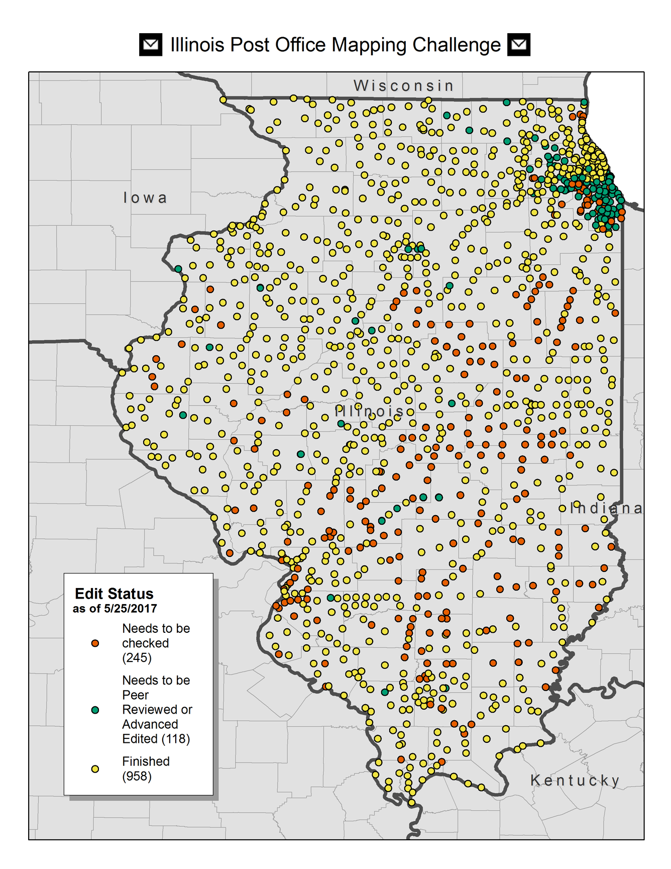
Mapping Challenges are launched periodically as a way to focus volunteers on areas that need editing. A current Challenge is focused on Post Offices in Illinois in advance of US Topo map updates. TNMCorps is attempting to verify all Post Office points by the end of July.
Volunteers who contribute in the Challenge area can be recognized (if desired) on TNMCorps Challenge page and also tweeted on The National Map Twitter account. Anyone with an interest and internet connections can contribute to mapping the Nation!