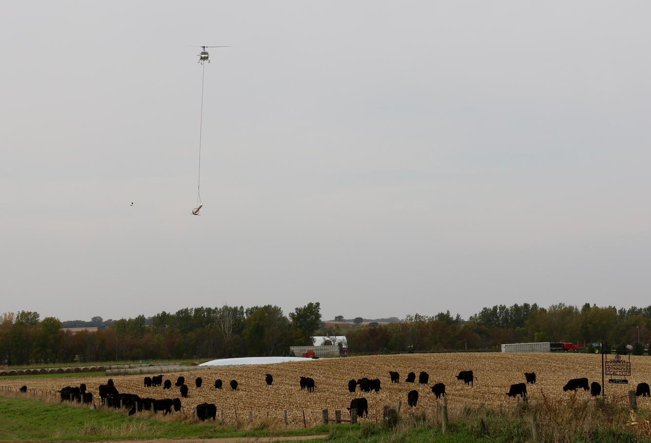
Starting on May 2 and lasting for about two days, a helicopter towing a large, cylindrical sensor will make low-level flights over parts of Cedar Rapids as part of a groundwater survey.

The flights will collect and record underground geologic measurements to help the U.S. Geological Survey better determine groundwater resources in the Cedar River Aquifer. The helicopter, operated by CGG Canada Services under contract to the City of Cedar Rapids, will fly about 200 feet above the ground at almost 70 miles per hour. A remote sensing device will be tethered 100 feet below the helicopter and will measure the physical properties down to about 150 feet underground.
“This advanced technology allows us to efficiently look into the subsurface of the Cedar River Aquifer without drilling wells,” said USGS scientist Greg Delzer. “The data will allow us to map and model the aquifer system so that the city can effectively manage these critical water supplies long into the future.”
“The model will be an essential planning tool for the City of Cedar Rapids,” said Bruce Jacobs, Cedar Rapids utilities engineering manager. “It will provide the insight needed to evaluate the effects of a prolonged drought and allow us to predict how our aquifer would respond to increased water supply demands.”
WHAT: Media and the public are invited to a highly visual press conference about state-of-the-art, low-level scientific helicopter flights that will scan areas of Cedar Rapids, Iowa, next week. The large instrument used to collect below-surface groundwater information will be available for photographing.
WHO: Staff from the USGS, the City of Cedar Rapids and CGG Canada Services will be available for questions.
WHERE: Northwest Water Treatment Plant, 7807 Ellis Road NW, Cedar Rapids, Iowa (map)
WHEN: Monday, May 1, at 11 a.m.
The helicopter is operated by experienced pilots who are specially trained for low-level flying. CGG works with the Federal Aviation Administration to ensure flights are in accordance with federal regulations and safety standards.
Potential weather-related delays will be posted on the City of Cedar Rapids website.
The resulting subsurface aquifer map will be available from the USGS in 2018. For further information, read about a past USGS remote geophysical study online.