Hyperspectral Surveying: A Tool for Assessing the Mineral Potential of Alaska
Alaska is a major producer of base and precious metals and has a high potential for additional undiscovered mineral resources. However, discovery is hindered by Alaska’s vast size, remoteness and rugged terrain. New methods are needed to overcome these obstacles in order to evaluate Alaska’s geology and mineral resource potential.
Hyperspectral surveying is one method that can be used to rapidly acquire data about the distributions of surficial materials, including different types of bedrock and ground cover. The U.S. Geological Survey Alaska Hyperspectral Project is currently conducting a study to assess the applicability of this method in Alaska and a new USGS Fact Sheet details the strategy.
Preliminary observations from these studies indicate the following:
- Regional-scale mineral classification maps generally show lithologic changes consistent with previous geologic mapping.
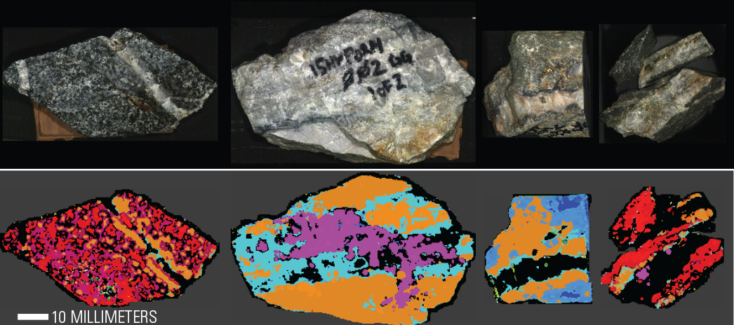
- Mineralogical groupings are consistent at the regional (6 meter) to outcrop scales (30 cm), with greater detail at the hand specimen scale (500 micrometers).
- Differences in wavelength positions for muscovite (different chemistry) can correspond to certain geologic units and general proximity to known porphyry occurrences.
- Preliminary observations in this study support past research, which indicate that hyperspectral data can be used as a tool to identify surface signatures of undiscovered mineral resources.
Hyperspectral surveys provide information about bedrock and cover materials on the Earth’s surface. Data collection is rapid, and can be completed at different spatial scales from broad regional to detailed hand specimens. These surveys provide geologists with information on rock composition that can augment existing geologic mapping. The distributions of mineral classifications in maps also help economic geologists identify potential areas with undiscovered mineral deposits. This project applies an integrated approach that combines spectroscopic measurements with field and laboratory-based geologic investigations.
This product was prepared in collaboration with Alaska Department of Natural Resources Division of Geological and Geophysical Surveys, University of Alaska Fairbanks, and National Park Service.