
July 2007 Eruption—Quarry flow near-view map
February 4, 2011
Media
Sources/Usage: Public Domain. View Media Details
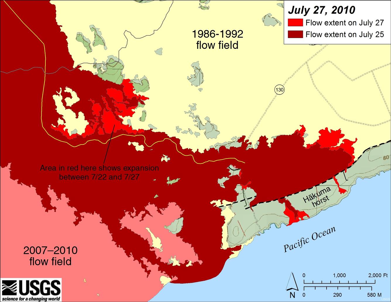
Light red (lower left corner) is the pre-Quarry flow part of the July 2007 eruption flow field. Reddish-brown is the currently-active Quarry flow as of July 25, 2010, while bright red shows the flow field expansion of the Quarry flow mapped by HVO geologists between July 25 and July 27. Lava erupted while Kupaianaha was active from 1986-1992 is shown in light yellow. The currently active flows have been blocked to the south by the north-facing fault scarp that defines the northern edge of the Hakuma horst--a fault block that is raised higher than the surrounding ground. Lava topped a low spot in the horst a few days ago, creating a new ocean entry, and another finger was approaching the ocean when the flows were mapped today.