
Kamoamoa Eruption
March 9, 2011
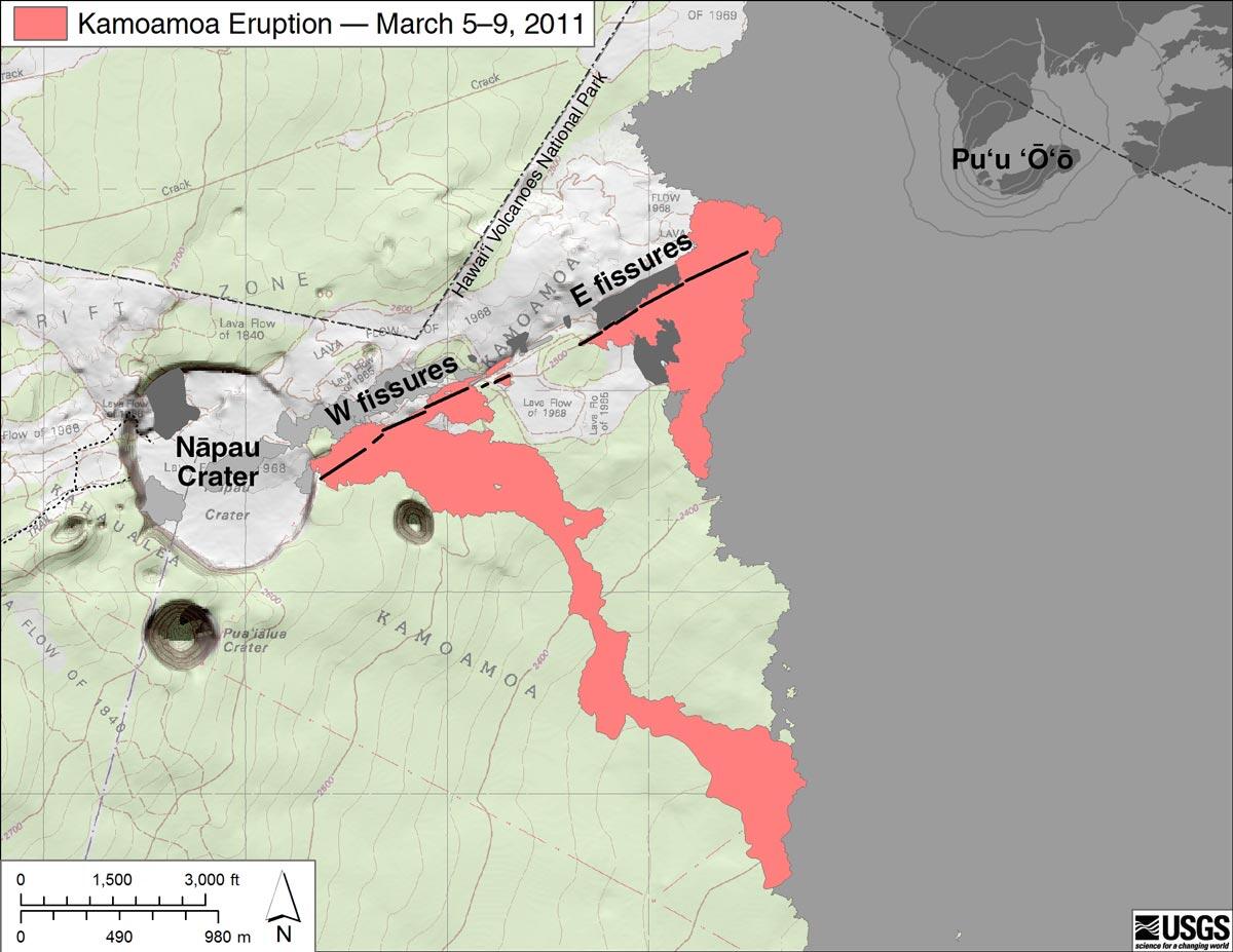
Bright red shows the currently active flow, and light red shows an incomplete mapping of recent, but inactive, flows. Dark gray is the exposed area of flows erupted between 1983 and 1992, while light gray shows the extent of flows erupted from 1992 to 2007. Flows erupted from 2007 to 2011, prior to this eruption, are not present within this map area