Mount Adams, WA as seen from Mount St. Helens (west). Trees are co...
Mount Adams, WA as seen from Mount St. Helens (west). Trees are co...Mount Adams, Washington as seen from Mount St. Helens (west). Trees are covered in frost in the foreground.

Official websites use .gov
A .gov website belongs to an official government organization in the United States.
Secure .gov websites use HTTPS
A lock () or https:// means you’ve safely connected to the .gov website. Share sensitive information only on official, secure websites.
Images related to Cascades Volcano Observatory.

Mount Adams, Washington as seen from Mount St. Helens (west). Trees are covered in frost in the foreground.
Mount Adams, Washington as seen from Mount St. Helens (west). Trees are covered in frost in the foreground.

Loowit Falls flows north out of Mount St. Helens crater. White building in upper right corner is the Loowit gage house, which contains an Acoustic Flow Monitor.
Loowit Falls flows north out of Mount St. Helens crater. White building in upper right corner is the Loowit gage house, which contains an Acoustic Flow Monitor.

South-facing aerial view of Mount St. Helens with Mount Hood (left) and Mount Jefferson (right) on the horizon. June 8, 2005.
South-facing aerial view of Mount St. Helens with Mount Hood (left) and Mount Jefferson (right) on the horizon. June 8, 2005.

Ash collection from east Crater Glacier on Mount St. Helens with a dredge attached to a helicopter cable. Ash is analyzed to help scientists understand eruption characteristics.
Ash collection from east Crater Glacier on Mount St. Helens with a dredge attached to a helicopter cable. Ash is analyzed to help scientists understand eruption characteristics.

Fumaroles steaming within Sherman Crater, Mount Baker, Washington.
Fumaroles steaming within Sherman Crater, Mount Baker, Washington.

The May 18, 1980 eruption of Mount St. Helens began with an enormous landslide that slammed into Spirit Lake, blocking its natural outlet and raising the lake level by 197 feet.
The May 18, 1980 eruption of Mount St. Helens began with an enormous landslide that slammed into Spirit Lake, blocking its natural outlet and raising the lake level by 197 feet.

Aerial view, Mount St. Helens' crater and dome, as seen from the northeast. Note dusting of ash on Mount St. Helens' flank, left near rim.
Aerial view, Mount St. Helens' crater and dome, as seen from the northeast. Note dusting of ash on Mount St. Helens' flank, left near rim.

Aerial view, Mount St. Helens' crater and dome, as seen from the northeast.
Aerial view, Mount St. Helens' crater and dome, as seen from the northeast.

Whaleback structure (center) of dome withn Mount St. Helens' crater. Dome is crumbling to right and glacier is uplifted to the left, view from the north. January 30, 2005.
Whaleback structure (center) of dome withn Mount St. Helens' crater. Dome is crumbling to right and glacier is uplifted to the left, view from the north. January 30, 2005.

Aerial view, Mount St. Helens' crater and dome, as seen from the northwest.
Aerial view, Mount St. Helens' crater and dome, as seen from the northwest.

Lava domes within Mount St. Helens' crater, as seen from the northwest. The 1980-86 dome is in the crater on the left and the new 2004-05 dome is on the right.
Lava domes within Mount St. Helens' crater, as seen from the northwest. The 1980-86 dome is in the crater on the left and the new 2004-05 dome is on the right.

Glacier deformation, east side of Mount St. Helens' dome, as seen from the northeast. Large crevasses within glacier covered with grey ash.
Glacier deformation, east side of Mount St. Helens' dome, as seen from the northeast. Large crevasses within glacier covered with grey ash.

Whaleback structure (center) of dome withn Mount St. Helens' crater as seen from the northwest. January 24, 2005.
Whaleback structure (center) of dome withn Mount St. Helens' crater as seen from the northwest. January 24, 2005.

Crumbled sides of Mount St. Helens' dome, as seen from the northwest. January 24, 2005.
Crumbled sides of Mount St. Helens' dome, as seen from the northwest. January 24, 2005.

Mount St. Helens' crater and dome, as seen from the northeast.
Mount St. Helens' crater and dome, as seen from the northeast.

Vertical view, Mount St. Helens' crater and dome. North is to the bottom and south to the top.
Vertical view, Mount St. Helens' crater and dome. North is to the bottom and south to the top.

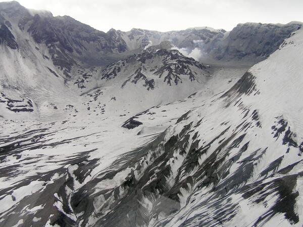
Aerial view, Mount St. Helens' crater and dome, as seen from the northeast. The new dome is just visible in the steam in the back of the crater.
Aerial view, Mount St. Helens' crater and dome, as seen from the northeast. The new dome is just visible in the steam in the back of the crater.

Aerial view, Mount St. Helens' crater and dome, as seen from the northeast.
Aerial view, Mount St. Helens' crater and dome, as seen from the northeast.

Aerial view, Mount St. Helens' crater and dome, as seen from the north-northeast. Ash covering is from event of January 16, 2005.
Aerial view, Mount St. Helens' crater and dome, as seen from the north-northeast. Ash covering is from event of January 16, 2005.

East side of Mount St. Helens' crater and dome, as seen from the north.
East side of Mount St. Helens' crater and dome, as seen from the north.
Mount St. Helens' crater and dome, as seen from the northwest. Ash covering is from event of January 16, 2005.
Mount St. Helens' crater and dome, as seen from the northwest. Ash covering is from event of January 16, 2005.