U.S. flag

An official website of the United States government

November 21, 2022

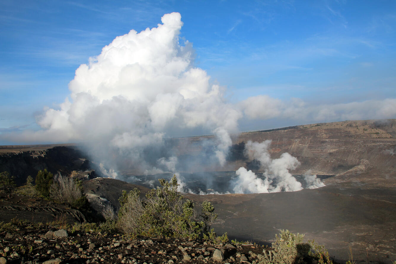
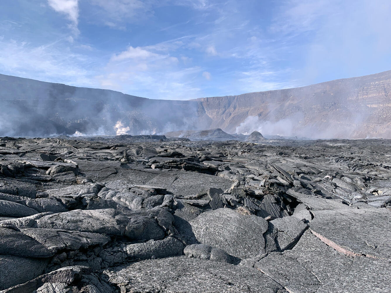
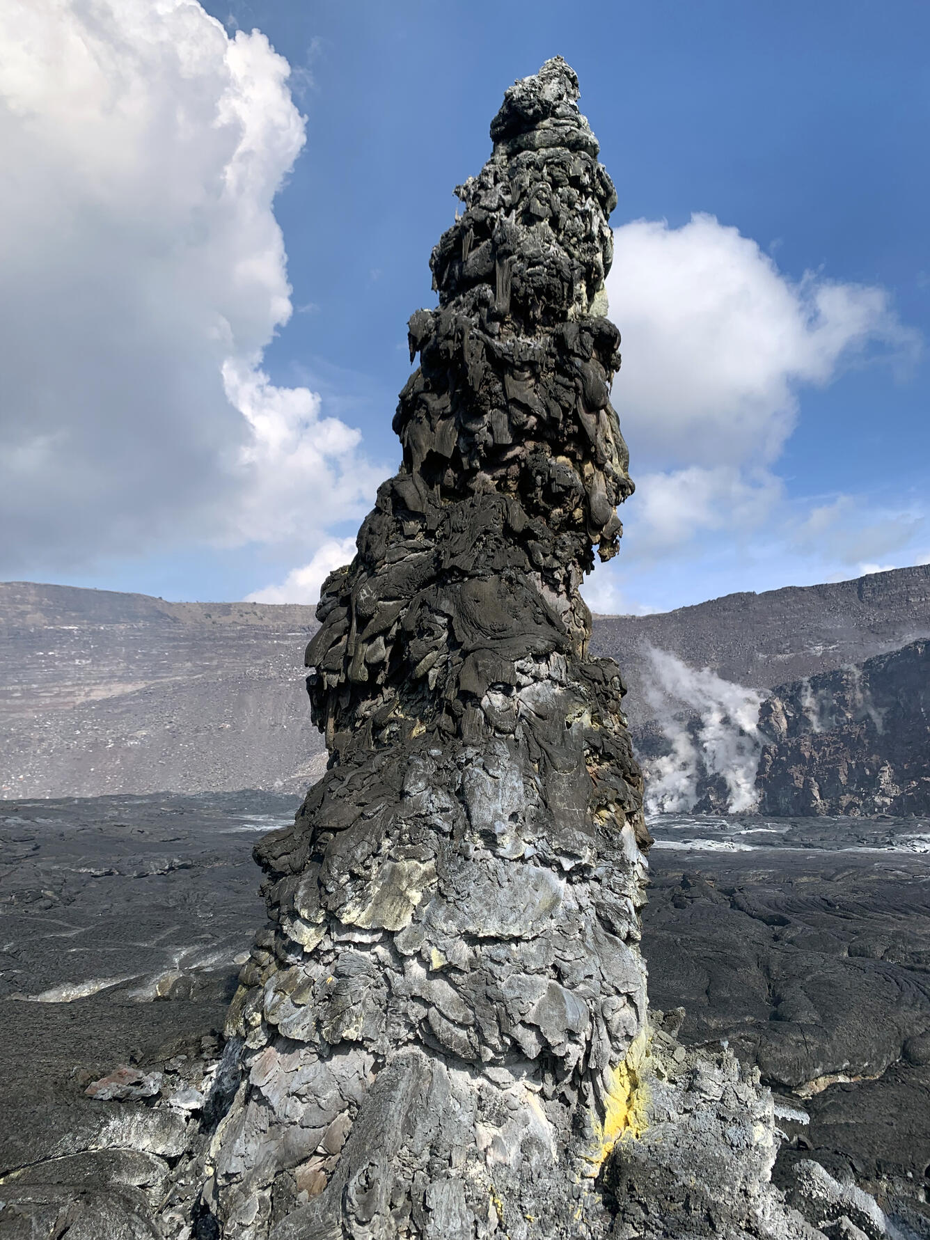
HVO scientists collect detailed data to assess hazards and understand how the eruption is evolving at Kīlauea's summit, all of which are shared with the National Park Service and emergency managers. Access to this hazardous area is by permission from, and in coordination with, Hawai‘i Volcanoes National Park. 

November 17, 2022 — Kīlauea Summit Eruption, Halemaʻumaʻu Observations

The eruption within Halema‘uma‘u, at Kīlauea's summit, began at approximately 3:20 p.m. on September 29, 2021. 

Color photograph of crater erupting
View looking west of Halema‘uma‘u at the summit of Kīlauea volcano the morning of November 17, 2022. This photo is taken from the overlook near Keanakāko‘i Crater, which is publicly accessible. Lava is visible in the center of the photo, to the left of the top of the shrub in the foreground. Volcanic gases are rising from many location across the crater floor, particularly around the margins of Halema‘uma‘u. USGS photo by N. Deligne.
Color photograph of lava lake
A mid-morning view of the southern portion of Halema‘uma‘u, as seen by field crews from the western rim. Activity within Halema‘uma‘u has remained steady over the last week. The active lake surface sits 7 meters (~23 feet) below the surface of the caldera. A small amount of spatter along the eastern margin of the lake was visible (the red glow). The active lake surface is visible from the Keanakākoʻi overlook. USGS photo by L. Gallant.
Color photograph of lava lake
A close-up view of Halema‘uma‘u's active lava lake. The western rim of Kīlauea was visited by field crews who observed variable amounts of spattering along the eastern margin of the lake (seen here at the top of the photograph). The direction of flow is from west to east (bottom to top in this photograph). The size of the plates that move across the surface are related to the speed that lava is fed from the vent (bigger plates move slower, smaller plates move faster). The plates seen here are much larger than those observed in the same place a year ago. This means that the current effusion rate of lava is much smaller than the effusion rate a year ago. USGS photo by L. Gallant.
Color photograph of lava flows
View looking to the west on the crater floor of Halemaʻumaʻu, at the summit of Kīlauea. The foreground is covered by pāhoehoe, and the brown-colored feature in the background is the island that has persisted since the December 2020 eruption within Halema‘uma‘u. USGS photo by D. Downs.
Color photograph of hornito
A hornito located on the eastern side of Halemaʻumaʻu crater floor. The colorful nature of the hornito comes from the various gases that come out of the magma and precipitate on the surrounding rock. Many of these colors are from sulfur that is abundant in Kīlauea magmas. USGS photo by D. Downs.
Color photograph of hornito
This tall, thin hornito on the eastern side of the crater floor of Halemaʻumaʻu is made up of spatter. The spatter made its way through a crack in the thick, solidified lava that forms the base of Halema‘uma‘u crater, at the summit of Kīlauea. The yellow and white patches at the bottom are from sulfur that has come out of the magma precipitating on the lava. USGS photo by D. Downs.

Get Our News

These items are in the RSS feed format (Really Simple Syndication) based on categories such as topics, locations, and more. You can install and RSS reader browser extension, software, or use a third-party service to receive immediate news updates depending on the feed that you have added. If you click the feed links below, they may look strange because they are simply XML code. An RSS reader can easily read this code and push out a notification to you when something new is posted to our site.