U.S. flag

An official website of the United States government

September 1, 2023

On August 25, 2023, HVO staff deployed a new webcam and survey equipment in Kīlauea's summit region. Kīlauea volcano is not erupting but earthquakes and ground deformation indicate that Kīlauea's summit region is becoming increasingly pressurized.

Hawaiian Volcano Observatory scientists deployed monitoring equipment with permission from, and in coordination with, Hawai‘i Volcanoes National Park. Several GPS instruments deployed in Kīlauea south caldera region will measure ground deformation during the ongoing unrest there. A new webcam provides views of Halemaʻumaʻu crater, where recent eruptions have occurred. Halemaʻumaʻu is a significant location to Native Hawaiian communities because it is the home of Pele.

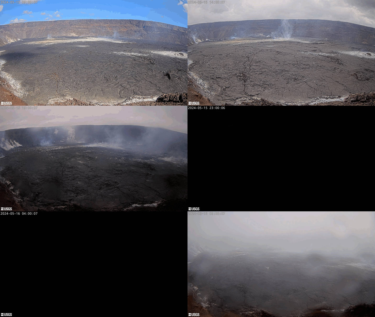
New B2cam views Halemaʻumaʻu crater from the east rim and down-dropped block

View the new B2cam and 24-hour animated GIF here: [B2cam] Halemaʻumaʻu crater from the east rim and down-dropped block | U.S. Geological Survey (usgs.gov)


Color photograph of volcano-monitoring webcam
Last week, HVO staff installed a new webcam—the B2cam—on the down-dropped block within Kīlauea caldera and east rim of Halema‘uma‘u crater. This camera view replaces that of the B1cam, which was moved east during the June 2023 Halema‘uma‘u eruption because it was being exposed to intense heat. The B2cam is located farther south than B1cam was, on a ledge that stands about 100 feet (30 meters) higher. The B2cam provides a low-angle westward view of Halema‘uma‘u crater floor. USGS photo by M. Zoeller.
Remote image Url
Animated GIF showing 24-hours of images
Last 24 Hours - Live view of Halemaʻumaʻu crater [B2cam].  This animated gif is from images collected by a research camera located on the down-dropped block in Kīlauea caldera and east rim of Halemaʻumaʻu crater within Hawaiʻi Volcanoes National Park; the view is to the west.  Disclaimer The webcams are operational 24/7 and faithfully record the dark of night if there are no sources of incandescence or other lights. At times, clouds and rain obscure visibility. The cameras are subject to sporadic breakdown and may not be repaired immediately. Some cameras are observing an area that is off-limits to the general public because of significant volcanic hazards.

Kīlauea GPS survey equipment deployed in south caldera

Scientists temporarily deployed a handful of GPS instruments at established benchmarks; their recorded positions can be compared with those from previous years to discern subtle patterns of ground deformation associated with the ongoing earthquake and ground deformation activity. 


Color photograph of survey instrument
Temporary GPS survey equipment has been deployed in Kīlauea south caldera area for additional measurements during the ongoing heightened unrest there. Scientists temporarily deployed a handful of GPS instruments at established benchmarks; their recorded positions can be compared with those from previous years to discern subtle patterns of ground deformation associated with the ongoing earthquake and ground deformation activity. These data augment the permanent, continuously recording GPS instruments in HVO's monitoring network. USGS photo by A. Ellis.
Color photograph of survey instrument
Scientists temporarily deployed a handful of temporary GPS instruments at established benchmarks in Kīlauea south caldera region to better measure ground deformation during the ongoing unrest there. Steady rates of earthquakes have persisted in this area since August 22. Most earthquakes have occurred at depths of 1–2 miles (2–3 kilometers) below the surface, with no upward migration detected. Summit tiltmeters have tracked slow inflation. USGS photo by A. Ellis.
Color photograph of survey instrument
HVO scientists have been closely monitoring the earthquakes in Kīlauea's summit region over the past weeks. Most earthquakes have occurred at depths of 1–2 miles (2–3 kilometers) below the surface, with no upward migration detected. Along with the slow inflation recorded by summit tiltmeters, these data indicate that Kīlauea's summit is becoming increasingly pressurized. Similar episodes of earthquake and ground deformation activity occurred in November 2020 and August 2021, prior to eruptions in December 2020 and September 2021. To better record this activity, HVO staff deployed temporary GPS survey equipment in south caldera. Their positions will be compared with those from previous years to discern subtle patterns of ground deformation associated with this ongoing activity. USGS photo by A. Ellis.
Color photograph of survey instrument
This photo shows one of several temporary GPS survey stations recently deployed in Kīlauea south caldera region. The instruments will record additional measurements during the ongoing heightened unrest. Patterns of earthquakes and ground deformation indicate that Kīlauea's summit is becoming increasingly pressurized. The activity is currently confined within Kīlauea’s summit region and—if it continues—could escalate to an eruption in the coming days, weeks, or months. The activity could also decrease due to intrusion of magma underground, or other changes, resulting in no eruption. USGS phot by A. Ellis.

Get Our News

These items are in the RSS feed format (Really Simple Syndication) based on categories such as topics, locations, and more. You can install and RSS reader browser extension, software, or use a third-party service to receive immediate news updates depending on the feed that you have added. If you click the feed links below, they may look strange because they are simply XML code. An RSS reader can easily read this code and push out a notification to you when something new is posted to our site.