U.S. flag

An official website of the United States government

August 11, 2025

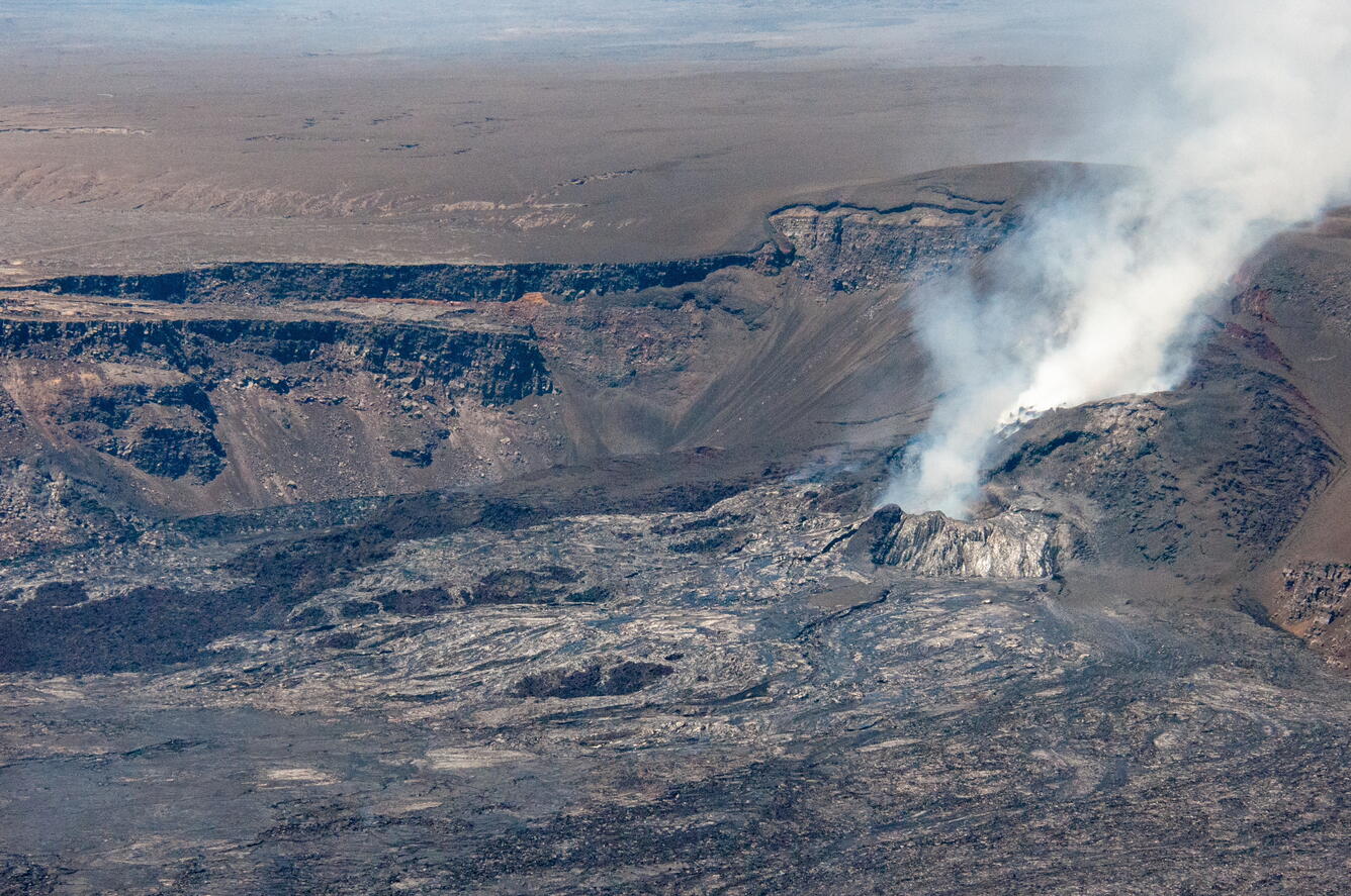
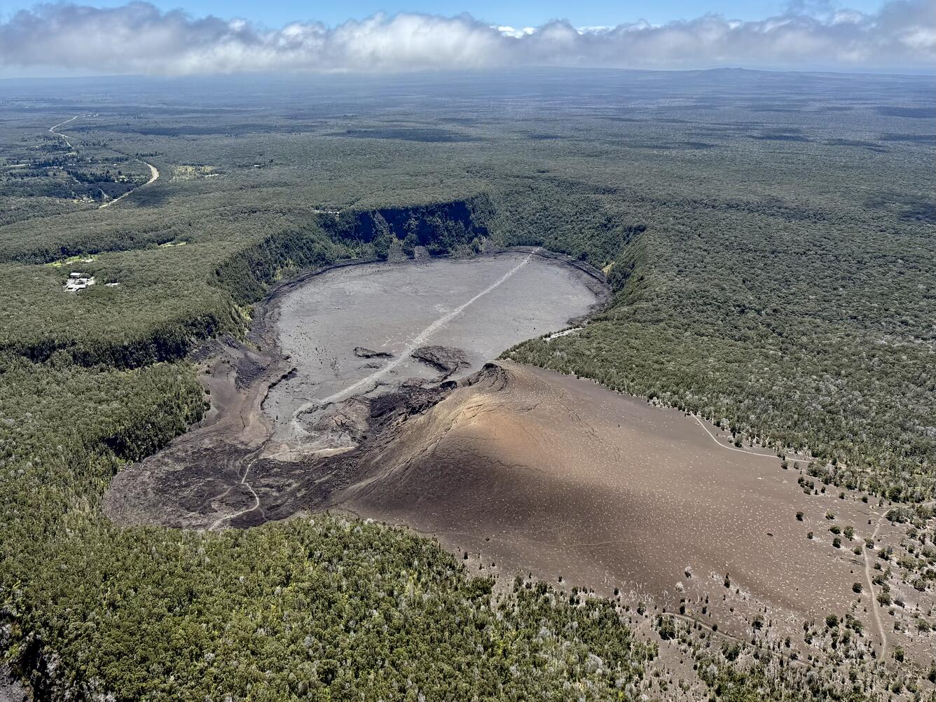
Kīlauea is not erupting. Episode 30 of the ongoing Halemaʻumaʻu eruption took place over about 12 hours on August 6. On August 8, USGS Hawaiian Volcano Observatory geologists conducted a monitoring overflight of the recent eruption area. 


Media
Color photograph of volcanic vent
An aerial image taken during a USGS Hawaiian Volcano Observatory monitoring overflight, following the end of episode 30 on August 6. The image shows two of the eruptive vents (right) located on the western wall of Halema‘uma‘u crater vigorously degassing, as well as recent lava flows covering the crater floor.  A larger tephra cone surrounds the vents (left, right, and above), which has developed since the onset of the December 23, 2024, eruption. The tephra deposit visible above the crater rim has developed from fountaining episodes that have exceeded the rim height.  Extensive cracking (right side of tephra cone) is evident, accompanied by oxidation (red). No molten lava was visible during the overflight on August 8, and the Kīlauea summit eruption remains paused. USGS photo by M. Decker.
Media
Color photograph of crater
An aerial view of Kīlauea Iki and Pu‘u Pua‘i taken during a USGS Hawaiian Volcano Obsrvatory monitoring overflight of Kīlauea summit on August 8. Pu‘u Pua‘i, the large cinder cone in the lower right of the image, was formed by tephra deposits from lava fountains similar to those that have been occurring in the last thirty episodes of the 2024-2025 summit eruption at Kīlauea. During the 1959 Kīlauea Iki eruption, fountains reached heights of 580 meters (1,900 ft), while the ongoing eruption has reached heights of 380 m (1250 ft). The Pu‘u‘ō‘ō vent, which was active from 1983-2018 (far, background), is visible in the distance. USGS photo by M. Decker. 
Media
Color photograph of volcanic landscape and ocean in the distance
This aerial image, taken during a Kīlauea summit overflight on August 8, 2025, looks southwest towards the ocean. In the foreground, two small lava flows that were erupted from Kīlauea in 1982 and 1971 are visible. The darker one on the left is from September 1971, while the shiny grey one on the right is from September 1982. Behind that, the Koa’e fault system, a series of en echelon cracks or normal faults, can be seen running left to right. The dark brown tephra deposits from the ongoing eruption (far right) can be seen on the right side, covering a swath of the landscape downwind. In the distance, the haze you can see is volcanic air pollution (vog) from the degassing plume from the vents in Kīlauea caldera after episode thirty ceased. USGS photo by M. Decker.
Was this page helpful?