
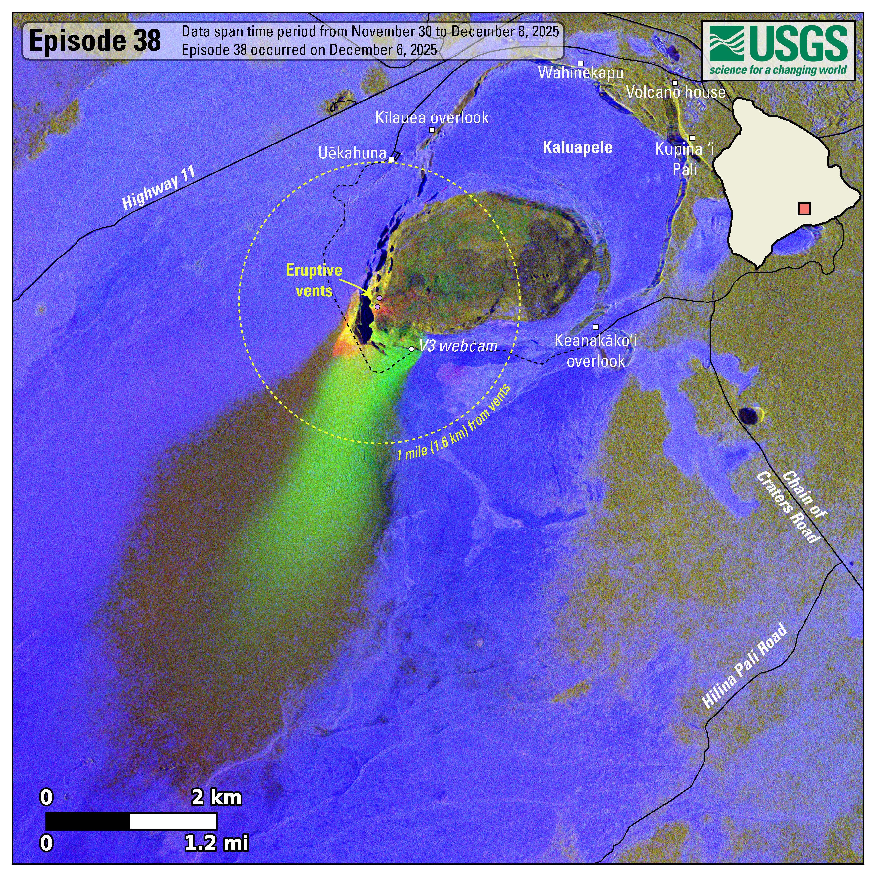
Photo & Video Chronology — December 9, 2025 — Episode 38 deposits at Kīlauea summit
By Hawaiian Volcano Observatory
December 10, 2025
USGS scientists determine the extent of deposits from episode 38 of lava fountaining at Kīlauea summit, which occurred on December 6, 2025.
Media
Sources/Usage: Public Domain. View Media Details
Media
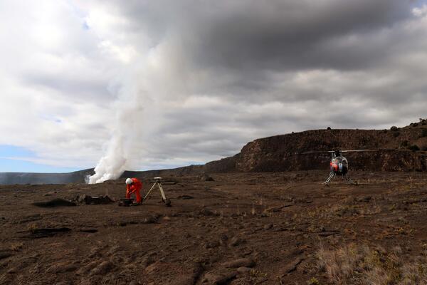
A USGS Hawaiian Volcano Observatory scientist services a GPS station on the floor of Kaluapele (Kīlauea summit caldera). These instruments help measure ground deformation and track pressure changes in the summit magma reservoir. USGS photo by C. Sealing.
Sources/Usage: Public Domain. View Media Details
Media
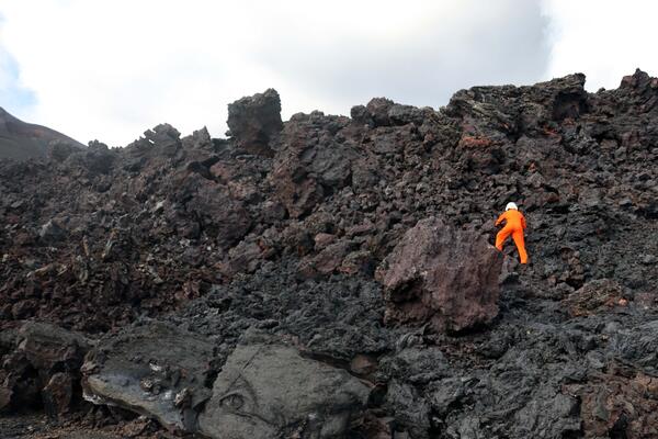
A USGS Hawaiian Volcano Observatory geologist collects clinker from a rubbly spatter-fed lava flow in Halema‘uma‘u crater produced during episode 38 lava fountaining. These lava samples are collected with permission from Hawaiʻi Volcanoes National Park and analyzed in the lab to better understand the magmatic system of Kīlauea. The scientist, who is about 6 feet (2 meters) tall provides a scale for how thick this lava flow is. USGS photo by C. Sealing.
Sources/Usage: Public Domain. View Media Details
Media
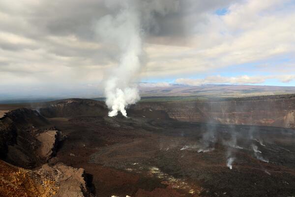
On Tuesday, December 9, USGS-Hawaiian Volcano Observatory geologists conducted a helicopter overflight of Kīlauea summit to survey changes from episode 38 lava fountaining a few days earlier. Scientists collected visual images for photogrammetry, thermal images, and collected lava samples from the caldera floor. They observed widespread deposition of tephra southwest of the vents from episode 38 fountaining, covering more of the closed portions of Crater Rim Drive. In this photo, outgassing plumes rise passively from the north and south vents. USGS photo by C. Sealing.
Sources/Usage: Public Domain. View Media Details
Media
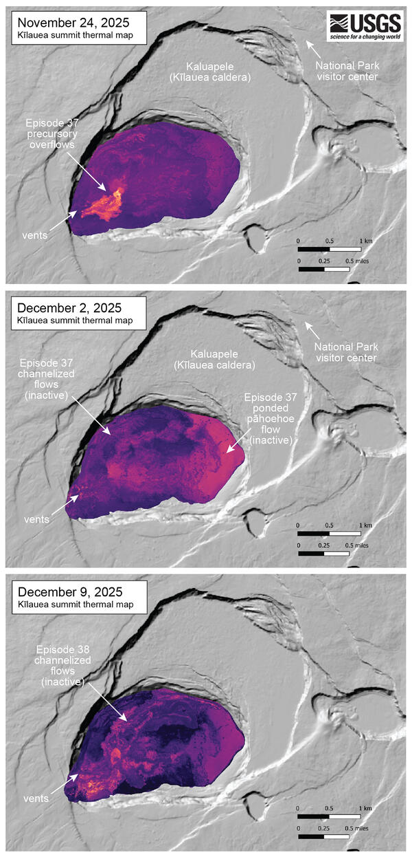
These three thermal maps were made from oblique thermal images collected during helicopter overflights of Kīlauea summit. The collection dates bracket the last two episodes of lava fountaining - episode 37 was on November 25 and episode 38 was on December 6. The November 24 thermal map shows small flows erupted in the precursory phase of episode 37, just before fountains sent flows across the crater floor. The December 2 map shows these eastern flows as a broad region of ponded pāhoehoe that is still warm. The December 9 map shows the thermal signature of channelized flows erupted during episode 38, though these did not reach the eastern tip of the crater floor. USGS map by M. Patrick.
Sources/Usage: Public Domain. View Media Details