



Photo & Video Chronology — Halemaʻumaʻu overflight and maps of new activity, Kīlauea summit
By Hawaiian Volcano Observatory
September 16, 2026
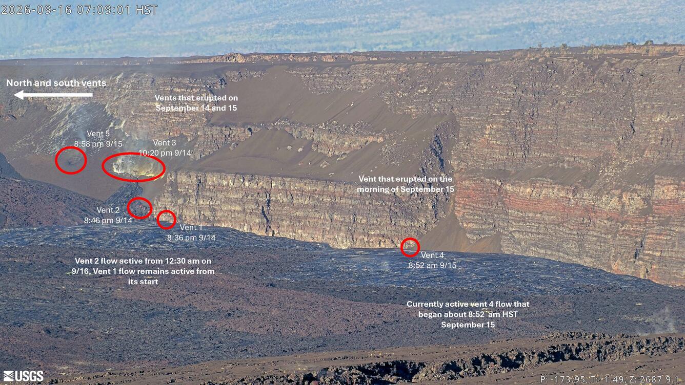
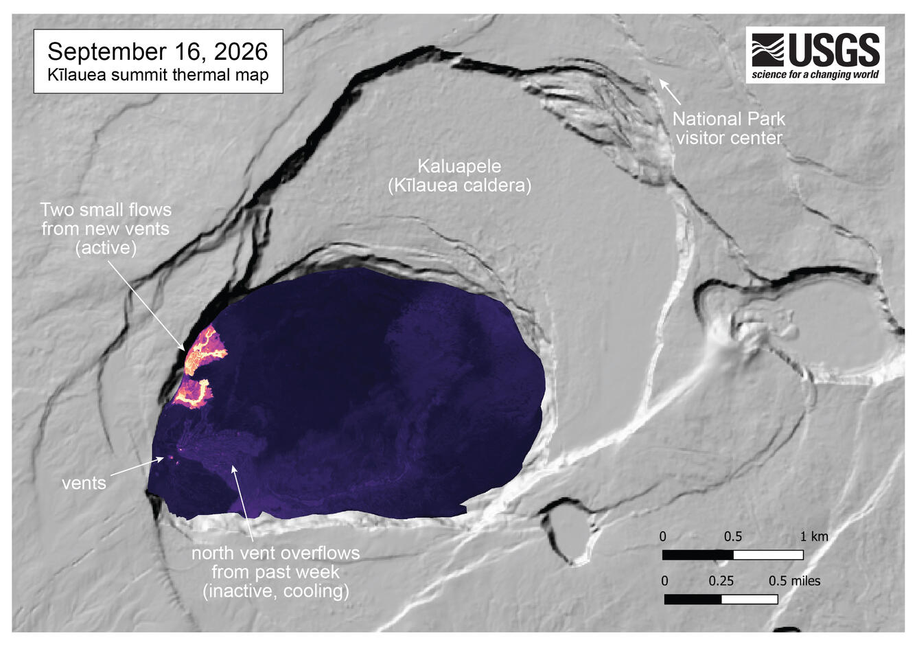
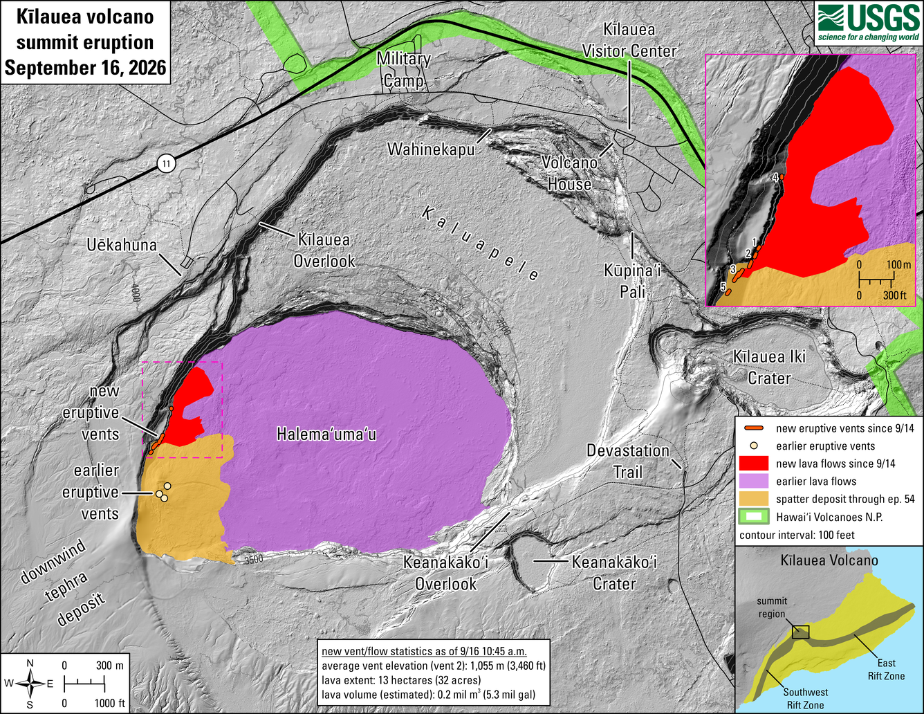
Scientists conducted an overflight of the new fissures that opened up on and near the base of the northwest wall of Halemaʻumaʻu crater on September 14-15. New maps and annotated webcam images provide details on this eruptive activity.
Media
Sources/Usage: Public Domain. View Media Details
Media
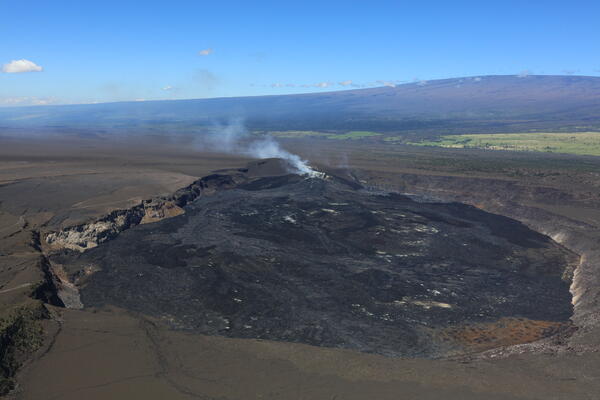
A wide view of Halema‘uma‘u in the summit caldera of Kīlauea in Hawai‘i Volcanoes National Park. The vent complex of ongoing eruption in in center, and lava flows from fissures that started erupting on September 14 appears as silvery areas to the left of the complex. Mauna Loa can be seen in the background. USGS photo by N. Deligne.
Sources/Usage: Public Domain. View Media Details
Media
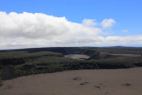
During the USGS Hawaiian Volcano Observatory overflight on September 16, geologists captured this view of Kīlauea Iki (erupted in 1959) in the center, with Maunaulu lava shield (erupted from 1969–1974) on the skyline on the right. USGS photo by N. Deligne.
Sources/Usage: Public Domain. View Media Details
Media
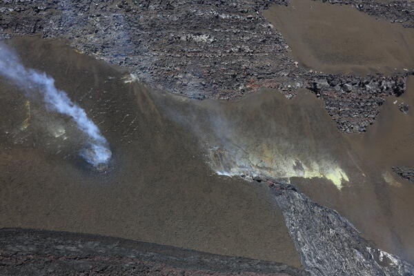
Aerial photo from the east looking west of two currently inactive fissures on the wall of Halema‘uma‘u, located to the north (left out of view) of the main vent complex. The fissure on the left has a circular appearance and initiated shortly before 9 p.m. H.S.T. on September 15. The older fissure on the right, which has cooled lava that flowed out of its northern (right) end, initiated at around 10:20 p.m. HST on September 14. Although both fissures were inactive at the time of a USGS Hawaiian Volcano Observatory helicopter overflight the morning of September 16, 2026, faint incandescence is visible in each fissure. USGS photo by N. Deligne.
Sources/Usage: Public Domain. View Media Details
Media
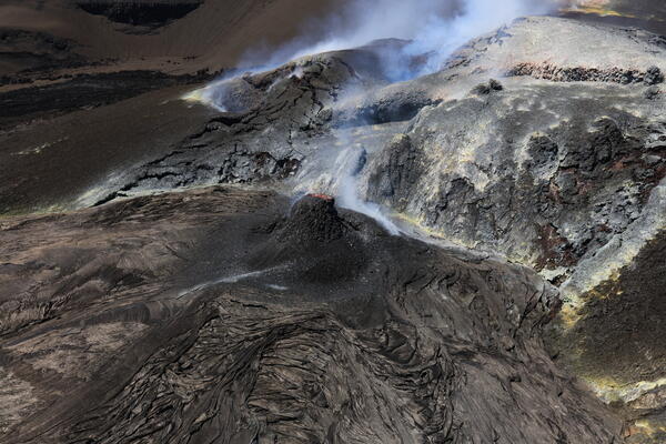
Low-angle aerial view of spatter cone (center of photo) that has built up around north vent since the end of episode 54 lava fountaining on August 25, 2026. The cone is approximately 10 meters (30 feet) high. In this photo, spatter is visible leaving north vent. South vent spatter is visible in the upper portion of the photo on the left side towards the center. USGS photo by N. Deligne.
Sources/Usage: Public Domain. View Media Details
Media
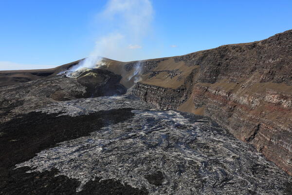
Low-angle aerial view looking southwest of the vent area within Halema‘uma‘u, taken during a USGS Hawaiian Volcano Observatory helicopter overflight on September 16, 2026. The vent complex built up over the course of the eruption that began on December 23, 2024, is visible on the left; the Pu‘u formed by the accumulation of tephra from lava fountaining over that time is behind and above it and is partially obscured by volcanic gas. Red spatter is visible exiting north vent. In the foreground are silvery lava flows that have erupted from fissures formed in the past 2 days (since September 14). One of the active new fissures can be seen at the center of the photo. USGS photo by N. Deligne.
Sources/Usage: Public Domain. View Media Details
Media
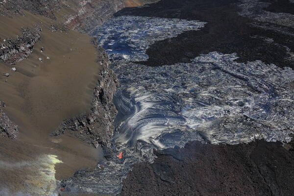
Oblique aerial view to the north of the lava flows (silvery appearance) that have erupted from the new fissures at the summit of Kīlauea volcano within Halema‘uma‘u. This photo was taken on a USGS Hawaiian Volcano Observatory overflight the morning of September 16. The currently active fissure on the crater floor is towards the bottom center of the photo, while a currently inactive fissure has minor incandescence on the bottom left. USGS photo by N. Deligne.
Sources/Usage: Public Domain. View Media Details
Media
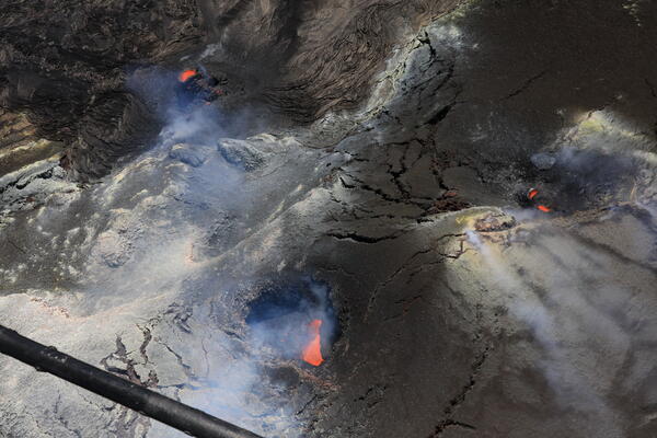
View of north vent (top left), south vent (middle right), and west vent (bottom center) within Halema‘uma‘u at the summit of Kīlauea, taken during a helicopter overflight on September 16, 2026. Helicopter skids are visible in the bottom right. Cooled lava from north vent overviews of the past week are apparent in the upper left portion of the photo with a shiny dark and light brown appearance. During the overflight, spatter was seen from all three vents, most commonly from north vent. USGS photo by N. Deligne.
Sources/Usage: Public Domain. View Media Details
Media
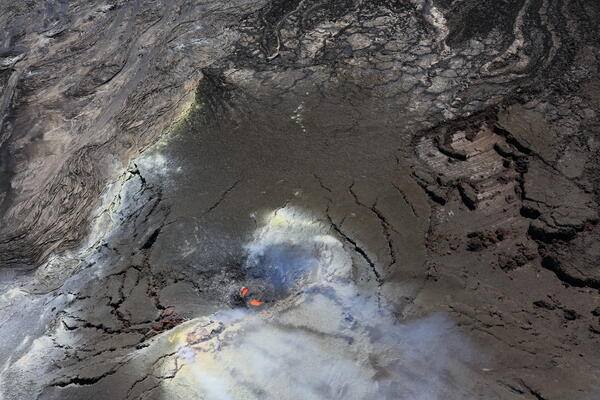
This photo, taken during a USGS Hawaiian Volcano Observatory helicopter overflight on September 16, 2026, shows south vent at the summit of Kīlauea in the bottom center. The caldera floor is towards the top of the photo; the north vent is out of view on the left. There are prominent slickenslides on the right, which are polished striated rock surfaces caused by one rock mass moving across another. In this case, part of the vent area complex slid downhill, exposing underlying rock; the sliding caused the striations. On the left are brown to mauve lava flows erupted from north vent over the last week. USGS photo by N. Deligne.
Sources/Usage: Public Domain. View Media Details
Media
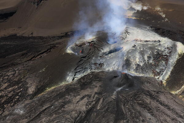
Oblique aerial view looking southwest of south (left) and north (right) vents, taken during a USGS Hawaiian Volcano Observatory helicopter overflight on September 16, 2026. Spattering from north vent has formed a cone that is approximately 10 meters (30 feet) tall. USGS photo by N. Deligne.
Sources/Usage: Public Domain. View Media Details
Media
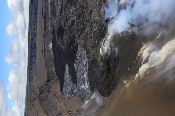
On September 14, new fissures began breaking out along the base of the northwest wall of Halema‘uma‘u crater, north of the episodic lava fountaining vents that have persisted since December 23, 2024, at the summit of Kīlauea. This oblique photo looking north, taken during a USGS Hawaiian Volcano Observatory overflight on September 16 in the morning, prominently shows the lava flows that have erupted from the new fissures. These young lava flows have a silvery appearance. While lava erupts from the new fissures, north, south, and west vent continue to spatter; north vent is visible in the lower half of the photo on the right. USGS photo by N. Deligne.
Sources/Usage: Public Domain. View Media Details
Media
Sources/Usage: Public Domain. View Media Details
Media
Sources/Usage: Public Domain. View Media Details