
Photo & Video Chronology — June 16, 2025 — Mauna Loa GPS Campaign and Kīlauea's Growing Tephra Deposit
By Hawaiian Volcano Observatory
June 16, 2025
HVO staff are conducting the annual Mauna Loa GPS campaign and the ongoing Kīlauea summit eruption that began on December 23, 2024, is currently paused following the high fountaining of episode 25 for 8 hours on June 11, 2025.
Media
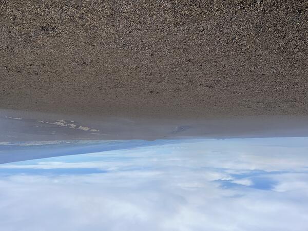
The photo provides a view from near the top of the tephra deposit that accumulated during recent episodes of the ongoing eruption at Kīlauea volcano, looking west towards Kīlauea's upper Southwest Rift Zone. The brown material covering and filling in topographic lows on the landscape erupted since the eruption started on December 23, 2024. The Kamakaiʻa Hills of Kīlauea's middle Southwest Rift Zone are visible on the skyline on the left side. USGS photo by M. Deligne.
Sources/Usage: Public Domain. View Media Details
Media
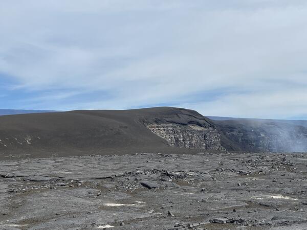
A view of the thick deposit of tephra from the high fountaining of episode 25—along with accumulation from previous episodes—of the ongoing Kīlauea summit eruption, which blankets the crater rim southwestern rim of Halema‘uma‘u. This photo was taken from the south looking north on June 16, while USGS Hawaiian Volcano Observatory scientists were conducting a survey of the deposit along the (mostly buried) old Crater Rim Drive within the closed area of Hawai‘i Volcanoes National Park. USGS photo by N. Deligne.
Sources/Usage: Public Domain. View Media Details
Media
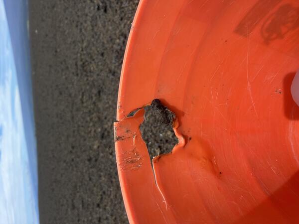
Photo of a partially melted bucket with an embedded tephra clast erupted during episode 25 of the ongoing eruption at Kīlauea. Buckets are used to collect tephra, and emptied between episodes, to ensure that samples from each episode are isolated to track geochemical changes and determine the amount of tephra that fell at each site. During episode 25, hot to partially molten tephra landed in and on bucket, causing the observed damage. The bucket also had small (less than 5 mm or 0.2 of a inch) tephra clasts that were embedded into the bottom of the bucket. USGS photo by N. Deligne.
Sources/Usage: Public Domain. View Media Details
Media

This reference map depicts the Kīlauea summit eruption within Halema‘uma‘u crater that began on December 23, 2024. As of this posting on June 13, the eruption continues episodically. Most of the map data included here were collected during a Hawaiian Volcano Observatory helicopter overflight on June 10, between episodes 24 and 25; for this reason, the provided statistics only reflect the first twenty-four episodes of the eruption.
Sources/Usage: Public Domain. View Media Details
Media
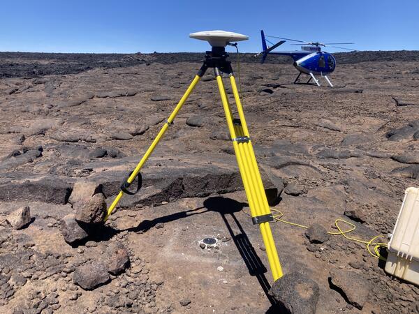
USGS Hawaiian Volcano Observatory staff are conducting the annual Mauna Loa GPS campaign. During the survey, GPS instruments are deployed at established benchmarks so that their recorded positions can be compared with those from previous years to discern small changes in ground deformation associated with volcanic activity. Temporary GPS receivers and antennas are placed on tripods centered over benchmarks, which serve as a reference point for centering of the antenna. The equipment is left in place to collect data for a couple of days at each site. USGS photo by A. Ellis.
Sources/Usage: Public Domain. View Media Details
Media
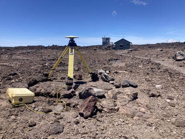
Campaign, also known as 'survey', GPS data augment the permanent, continuously recording GPS instruments in HVO's monitoring network. In this photo, a tripod mounted with a GPS antenna is temporarily installed over a benchmark the rim of Moku‘āweoweo, the caldera at the summit of Mauna Loa. Hawai‘i Volcanoes National Park Mauna Loa Summit Cabin is visible in the background. USGS image by A. Ellis.
Sources/Usage: Public Domain. View Media Details
Media
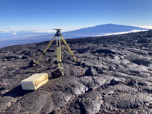
A benchmark on the northwest side of Mauna Loa's summit being surveyed by GPS campaign instruments. The metal disk on the ground beneath the tripod is the benchmark, which is cemented to the lava flow surface so that the specific spot can be measured each year. Mauna Kea is visible in the background. USGS photo by A. Ellis.
Sources/Usage: Public Domain. View Media Details
Media
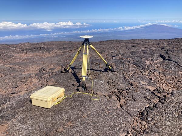
A GPS benchmark on west side of Mauna Loa's summit being measured with campaign GPS equipment during the annual Mauna Loa GPS campaign survey. Hualālai is visible in the background. USGS photo by A. Ellis.
Sources/Usage: Public Domain. View Media Details
Media

Another GPS survey benchmark being occupied on Mauna Loa's lower southwest flank. USGS photo by A. Ellis.
Sources/Usage: Public Domain. View Media Details