U.S. flag

An official website of the United States government

Images

Explore our planet through photography and imagery, including climate change and water all the way back to the 1800s when the USGS was surveying the country by horse and buggy.

Filter Total Items: 21394
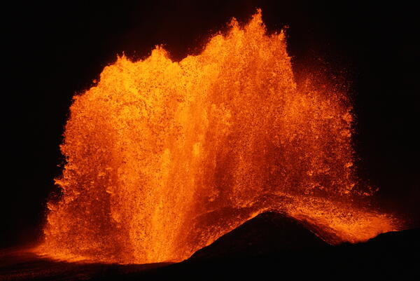
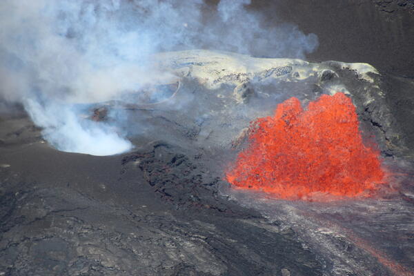
Color photograph of lava fountain
August 25, 2026 — Episode 54 of lava fountaining at Kīlauea summit begins

Around 11 a.m. HST on August 25, 2026, USGS Hawaiian Volcano Observatory field crews had an aerial view of a growing lava fountain at the summit of Kīlauea during the onset of episode 54.
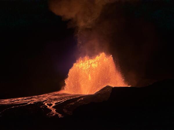
Color photograph of lava fountain and flow
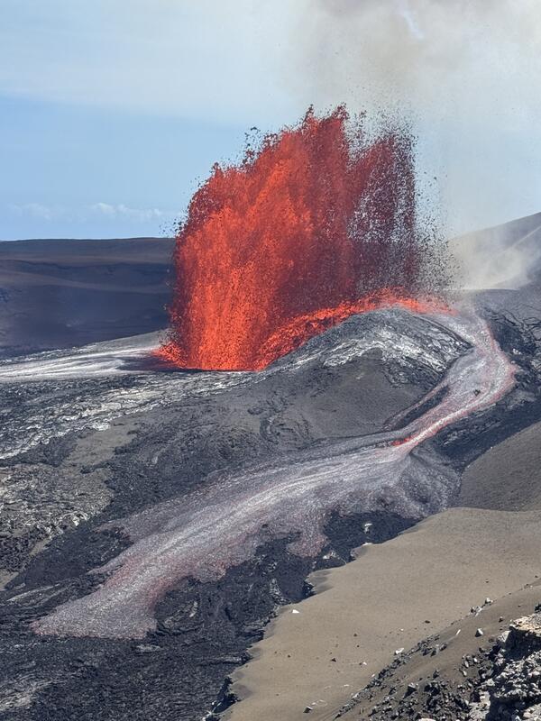
August 25, 2026 — Kīlauea summit north vent fountain and flow

The lava fountain erupting from the north vent in Halemaʻumaʻu at the summit of Kīlauea during episode 54 on August 25, 2026, generated a lava flow on the caldera-wall side of the vent complex. This lava flow skirted the northwest part of the caldera wall.

The lava fountain erupting from the north vent in Halemaʻumaʻu at the summit of Kīlauea during episode 54 on August 25, 2026, generated a lava flow on the caldera-wall side of the vent complex. This lava flow skirted the northwest part of the caldera wall.

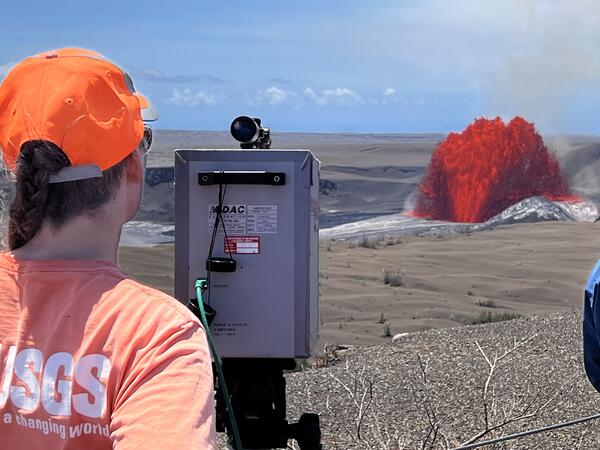
Color photograph of gas measurements during eruption
August 25, 2026 — Measuring gas emissions during episode 54 at Kīlauea summit

A USGS Hawaiian Volcano Observatory gas scientist collects FTIR (Fourier transform infrared spectrometer) data during lava fountaining episode 54 in Halemaʻumaʻu crater at the summit of Kīlauea. This data is used to measure the chemical composition of volcanic gas being emitted during eruptive episodes. USGS photo by C. Gansecki. 

A USGS Hawaiian Volcano Observatory gas scientist collects FTIR (Fourier transform infrared spectrometer) data during lava fountaining episode 54 in Halemaʻumaʻu crater at the summit of Kīlauea. This data is used to measure the chemical composition of volcanic gas being emitted during eruptive episodes. USGS photo by C. Gansecki. 

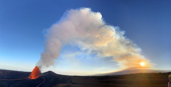
Color photograph of lava fountain and volcanic plume at sunset
August 12, 2026 — Episode 53 plume at sunset

This wide-angle, panoramic photo from the northwest rim of Halemaʻumaʻu shows the outgassing plume from Kīlauea summit eruption episode 53 lofting vertically and then drifting west—towards the summit of Mauna Loa—on August 12, 2026. The sun was setting behind the plume, creating an orange tint in the early evening. USGS photo by M. Patrick.

This wide-angle, panoramic photo from the northwest rim of Halemaʻumaʻu shows the outgassing plume from Kīlauea summit eruption episode 53 lofting vertically and then drifting west—towards the summit of Mauna Loa—on August 12, 2026. The sun was setting behind the plume, creating an orange tint in the early evening. USGS photo by M. Patrick.

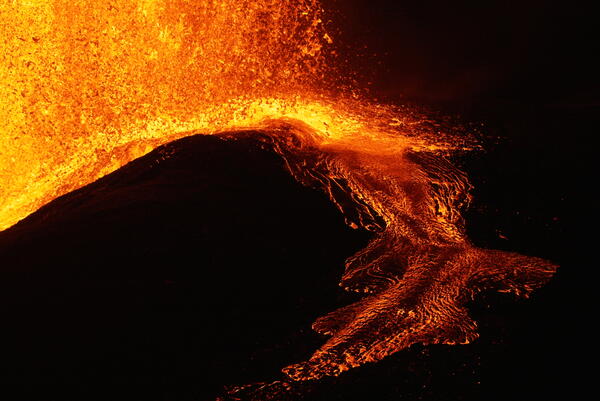
Color photograph of lava flow at night
August 12, 2026 — Episode 53 spatter-fed flow

The spatter-fed flow on the north side of the vent was intermittent during Kīlauea summit eruption episode 53 lava fountaining on August 12, 2026. Changes in the shape of the fountain and spatter fallout zone often restarted the flow down the steep slopes of the vent cone. USGS photo by M. Patrick.

The spatter-fed flow on the north side of the vent was intermittent during Kīlauea summit eruption episode 53 lava fountaining on August 12, 2026. Changes in the shape of the fountain and spatter fallout zone often restarted the flow down the steep slopes of the vent cone. USGS photo by M. Patrick.

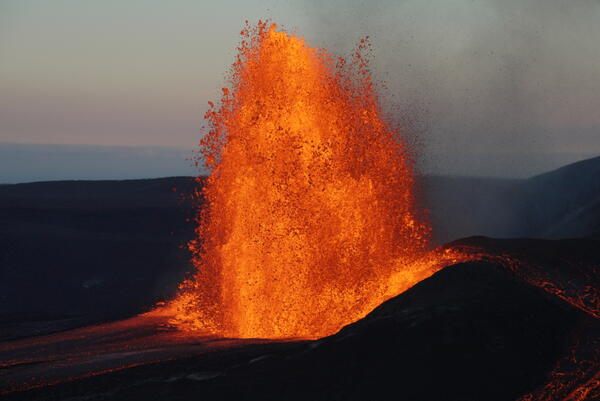
Color photograph of lava fountain in the evening
August 12, 2026 — Evening view of episode 53 lava fountain

As the sun set on August 12, USGS Hawaiian Volcano Observatory geologists had excellent views of Kīlauea summit eruption episode 53 lava fountaining in the clear weather. The fountain shape changed rapidly, often shutting off the spatter-fed flow on the north side of the vent (right side of photo). USGS photo by M. Patrick.

As the sun set on August 12, USGS Hawaiian Volcano Observatory geologists had excellent views of Kīlauea summit eruption episode 53 lava fountaining in the clear weather. The fountain shape changed rapidly, often shutting off the spatter-fed flow on the north side of the vent (right side of photo). USGS photo by M. Patrick.

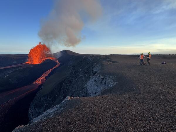
Color photograph of geologists on volcanic crater rim watching lava fountain
August 12, 2026 — Monitoring Kīlauea summit eruption episode 53

USGS Hawaiian Volcano Observatory geologists on the northwest rim of Halemaʻumaʻu capture video and make observations of the fountain behavior during Kīlauea summit eruption episode 53 on August 12, 2026. USGS photo by M. Patrick.

USGS Hawaiian Volcano Observatory geologists on the northwest rim of Halemaʻumaʻu capture video and make observations of the fountain behavior during Kīlauea summit eruption episode 53 on August 12, 2026. USGS photo by M. Patrick.

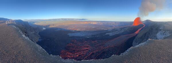
Color panoramic photo of volcanic crater with lava fountain and flows
August 12, 2026 — Panorama of Halemaʻumaʻu during episode 53

This panoramic photo from the northwest rim of Halemaʻumaʻu on August 12 shows Kīlauea summit eruption episode 53 lava fountaining and the spatter-fed flow running along the northern perimeter of the crater floor (bottom of photo). The V1cam and KWcam site is visible at the left edge of the photo. USGS photo by M. Patrick.

This panoramic photo from the northwest rim of Halemaʻumaʻu on August 12 shows Kīlauea summit eruption episode 53 lava fountaining and the spatter-fed flow running along the northern perimeter of the crater floor (bottom of photo). The V1cam and KWcam site is visible at the left edge of the photo. USGS photo by M. Patrick.

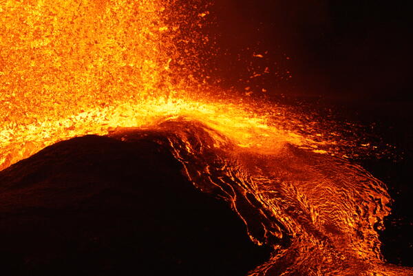
Color photograph of molten volcanic spatter landing in a lava flow
August 12, 2026 — Telephoto view of episode 53 spatter fallout

A closer look at the spatter fallout zone during Kīlauea summit eruption episode 53 lava fountaining on August 12, 2026. This was the source of the spatter-fed flow directed towards the northern portion of Halemaʻumaʻu crater. USGS photo by M. Patrick.

A closer look at the spatter fallout zone during Kīlauea summit eruption episode 53 lava fountaining on August 12, 2026. This was the source of the spatter-fed flow directed towards the northern portion of Halemaʻumaʻu crater. USGS photo by M. Patrick.

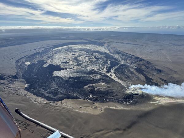
Color photograph of caldera at summit of volcano with gas plume from eruptive vents
August 11, 2026 — Wide-angle view of Kaluapele

This wide-angle photo looks east over Kaluapele, the summit caldera of Kīlauea, during the USGS Hawaiian Volcano Observatory helicopter overflight on August 11. The Halema‘uma‘u eruptive vents are in the lower-right corner of the photo, with the volcanic gas plume carried southwest in the trade winds.

This wide-angle photo looks east over Kaluapele, the summit caldera of Kīlauea, during the USGS Hawaiian Volcano Observatory helicopter overflight on August 11. The Halema‘uma‘u eruptive vents are in the lower-right corner of the photo, with the volcanic gas plume carried southwest in the trade winds.

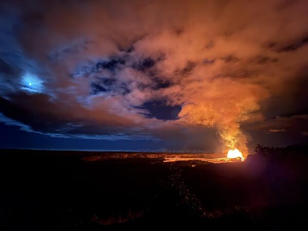
Color photograph of volcanic eruption and full moon
July 28, 2026 — Kīlauea summit eruption episode 52 and full moon

A full moon and a lava fountain illuminated the evening sky on July 28, 2026, as the summit of Kīlauea erupted a lava fountain for the 52nd time since December 2024. USGS photo by D. Downs. 

A full moon and a lava fountain illuminated the evening sky on July 28, 2026, as the summit of Kīlauea erupted a lava fountain for the 52nd time since December 2024. USGS photo by D. Downs. 

Color photograph of lava fountain at night
July 28, 2026 — Kīlauea summit eruption episode 52 at night

Only the north vent erupted a lava fountain during episode 52 at the summit of Kīlauea. The south vent did not erupt any lava during precursory activity or the eruptive episode, but it did emit flames at the end of the episode. The north vent lava fountain reached a peak height of approximately 500 feet (150 meters) around 9:00 p.m. HST on July 28, 2026.

Only the north vent erupted a lava fountain during episode 52 at the summit of Kīlauea. The south vent did not erupt any lava during precursory activity or the eruptive episode, but it did emit flames at the end of the episode. The north vent lava fountain reached a peak height of approximately 500 feet (150 meters) around 9:00 p.m. HST on July 28, 2026.

Color photograph of lava fountain
July 28, 2026 — North vent lava fountain during episode 52 at Kīlauea summit

Another view of the north vent lava fountain during episode 52 at the summit of Kīlauea on July 28, 2026. Precursory activity began from the north vent on the morning of July 28 with 6 overflows between 10:22 a.m. and 1:53 p.m. HST, the longest lasting over 30 minutes.

Another view of the north vent lava fountain during episode 52 at the summit of Kīlauea on July 28, 2026. Precursory activity began from the north vent on the morning of July 28 with 6 overflows between 10:22 a.m. and 1:53 p.m. HST, the longest lasting over 30 minutes.

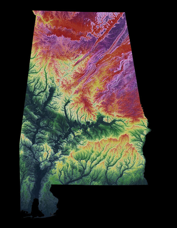
3DEP As Art - Alabama

A modern illustration of each state's landscape uses 3DEP data to showcase subtle beauty in their elevation differences like never before. Every state has been consistently adjusted and colorized using the seamless 3DEP 1/3rd arc-second data according to its highest and lowest elevations, which helps accentuate differences even in states with low relief.

A modern illustration of each state's landscape uses 3DEP data to showcase subtle beauty in their elevation differences like never before. Every state has been consistently adjusted and colorized using the seamless 3DEP 1/3rd arc-second data according to its highest and lowest elevations, which helps accentuate differences even in states with low relief.

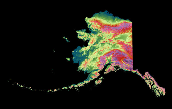
3DEP As Art - Alaska

A modern illustration of each state's landscape uses 3DEP data to showcase subtle beauty in their elevation differences like never before. Every state has been consistently adjusted and colorized using the seamless 3DEP 1/3rd arc-second data according to its highest and lowest elevations, which helps accentuate differences even in states with low relief.

A modern illustration of each state's landscape uses 3DEP data to showcase subtle beauty in their elevation differences like never before. Every state has been consistently adjusted and colorized using the seamless 3DEP 1/3rd arc-second data according to its highest and lowest elevations, which helps accentuate differences even in states with low relief.

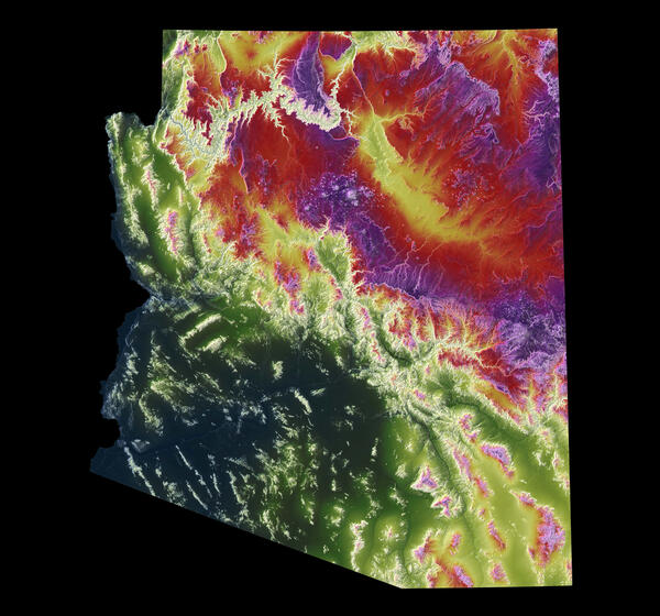
3DEP As Art - Arizona

A modern illustration of each state's landscape uses 3DEP data to showcase subtle beauty in their elevation differences like never before. Every state has been consistently adjusted and colorized using the seamless 3DEP 1/3rd arc-second data according to its highest and lowest elevations, which helps accentuate differences even in states with low relief.

A modern illustration of each state's landscape uses 3DEP data to showcase subtle beauty in their elevation differences like never before. Every state has been consistently adjusted and colorized using the seamless 3DEP 1/3rd arc-second data according to its highest and lowest elevations, which helps accentuate differences even in states with low relief.

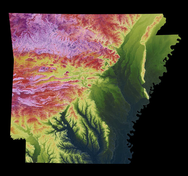
3DEP As Art - Arkansas

A modern illustration of each state's landscape uses 3DEP data to showcase subtle beauty in their elevation differences like never before. Every state has been consistently adjusted and colorized using the seamless 3DEP 1/3rd arc-second data according to its highest and lowest elevations, which helps accentuate differences even in states with low relief.

A modern illustration of each state's landscape uses 3DEP data to showcase subtle beauty in their elevation differences like never before. Every state has been consistently adjusted and colorized using the seamless 3DEP 1/3rd arc-second data according to its highest and lowest elevations, which helps accentuate differences even in states with low relief.

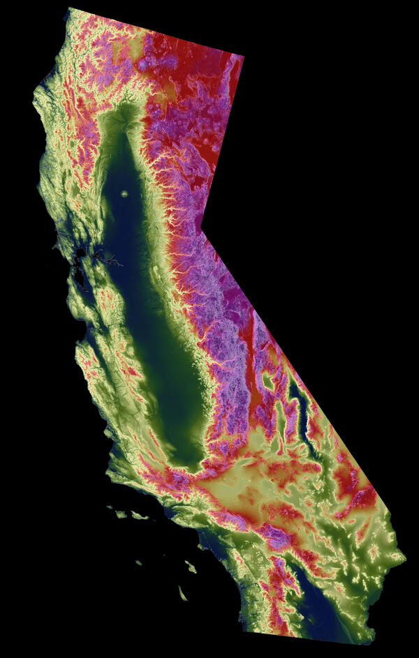
3DEP As Art - California

A modern illustration of each state's landscape uses 3DEP data to showcase subtle beauty in their elevation differences like never before. Every state has been consistently adjusted and colorized using the seamless 3DEP 1/3rd arc-second data according to its highest and lowest elevations, which helps accentuate differences even in states with low relief.

A modern illustration of each state's landscape uses 3DEP data to showcase subtle beauty in their elevation differences like never before. Every state has been consistently adjusted and colorized using the seamless 3DEP 1/3rd arc-second data according to its highest and lowest elevations, which helps accentuate differences even in states with low relief.

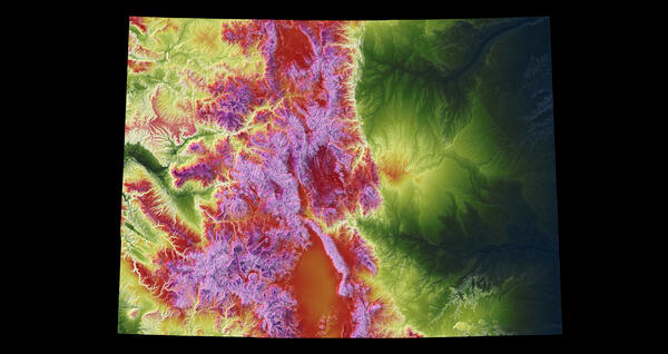
3DEP As Art - Colorado

A modern illustration of each state's landscape uses 3DEP data to showcase subtle beauty in their elevation differences like never before. Every state has been consistently adjusted and colorized using the seamless 3DEP 1/3rd arc-second data according to its highest and lowest elevations, which helps accentuate differences even in states with low relief.

A modern illustration of each state's landscape uses 3DEP data to showcase subtle beauty in their elevation differences like never before. Every state has been consistently adjusted and colorized using the seamless 3DEP 1/3rd arc-second data according to its highest and lowest elevations, which helps accentuate differences even in states with low relief.

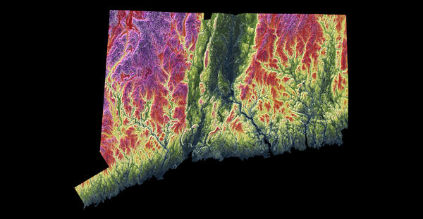
3DEP As Art - Connecticut

A modern illustration of each state's landscape uses 3DEP data to showcase subtle beauty in their elevation differences like never before. Every state has been consistently adjusted and colorized using the seamless 3DEP 1/3rd arc-second data according to its highest and lowest elevations, which helps accentuate differences even in states with low relief.

A modern illustration of each state's landscape uses 3DEP data to showcase subtle beauty in their elevation differences like never before. Every state has been consistently adjusted and colorized using the seamless 3DEP 1/3rd arc-second data according to its highest and lowest elevations, which helps accentuate differences even in states with low relief.

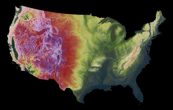
3DEP As Art - Conterminous United States

A modern illustration of each state's landscape uses 3DEP data to showcase subtle beauty in their elevation differences like never before. Every state has been consistently adjusted and colorized using the seamless 3DEP 1/3rd arc-second data according to its highest and lowest elevations, which helps accentuate differences even in states with low relief.

A modern illustration of each state's landscape uses 3DEP data to showcase subtle beauty in their elevation differences like never before. Every state has been consistently adjusted and colorized using the seamless 3DEP 1/3rd arc-second data according to its highest and lowest elevations, which helps accentuate differences even in states with low relief.

Was this page helpful?