
Across the country, CASC-supported scientists are working with natural resource managers to turn science into action. Explore success stories where co-produced and decision-focused science is informing real management choices that support ecosystems, infrastructure, and communities in a changing climate.
Timely, Relevant, Usable Science
Natural resource managers across the country face difficult decisions, from balancing wildlife habitat with public land use to planning for future water supplies and recreational opportunities. Scientists supported by the Climate Adaptation Science Centers (CASCs) work alongside these managers to co-produce science designed for decision-making. This science meets immediate management needs, is delivered on practical timelines, reduces uncertainties, and improves effectiveness and efficiency where it matters most.
Explore examples from across the CASC network that use advanced technology and cutting-edge science to support infrastructure siting on federal lands, design fish and wildlife management plans to sustain game and at-risk species, prepare communities for emerging hazards, and plan for uncertain futures. These stories span a wide range of landscapes, species, and decision needs, but in all examples, scientists are collaborating closely with federal, state, Tribal, and local partners to ensure that science is timely, relevant, and usable. The projects outlined below demonstrate how collaborative, co-produced science can reduce risks in the face of an uncertain future, improve management outcomes, and support strong ecosystems, economies, and communities.
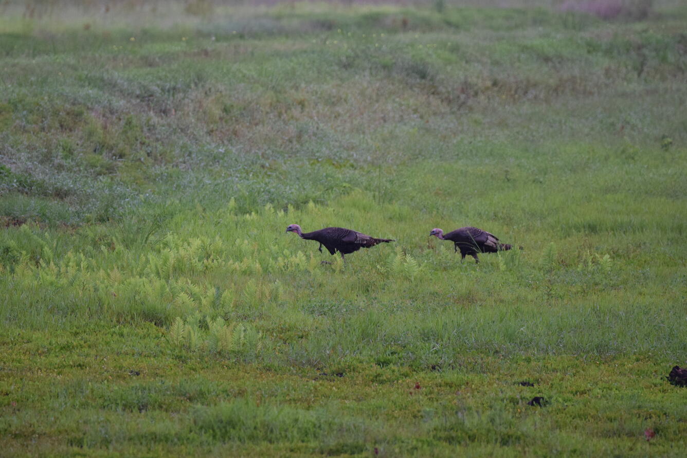
Turkeys on the clock: When turkeys nest, and why it matters for management
Wildlife agencies are using science from the Southeast CASC to refine wild turkey management strategies, like adjusting hunter harvest timing, in response to recent population declines. By pairing eight years of turkey nesting data from five states with weather records, the team found that the timing and success of nesting is largely unresponsive to temperature, rainfall, and shifting spring ‘green-up.’ Instead, future climatic conditions are more likely to indirectly affect turkeys by creating mismatches between their fixed spring nesting schedules and when food and cover become available.
Because nesting timing itself is unlikely to shift, managers can focus on more immediate factors contributing to population declines, such as harvest pressure or habitat conditions. This work was co-produced by Southeast CASC scientists and state wildlife agencies, including the Arkansas Game and Fish Commission. Learn More >>
A spatial mapping tool for Hawaiʻi balances species conservation and recreation
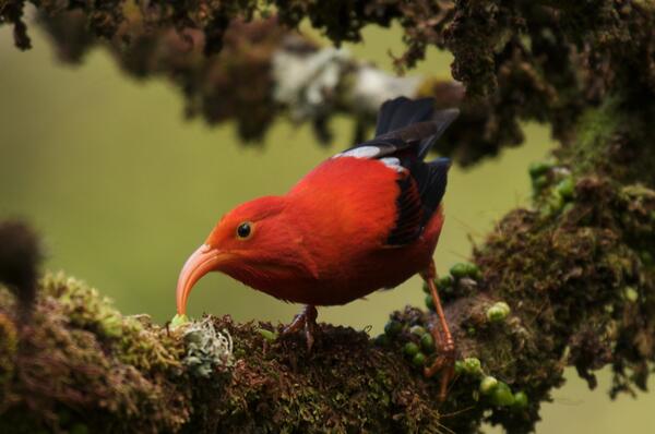
A new planning tool was developed by local land managers and community members in Hawaiʻi to support coordinated land management. The tool enables land managers to meet multiple goals at once by focusing conservation efforts where they will be most effective while expanding land access for hunting, fishing, hiking, and bird watching. Co-produced through a partnership between USGS Ecosystems Mission Area scientists, the Pacific Islands CASC, and the Hawaiʻi Department of Land and Natural Resources (DLNR), the tool helps managers prioritize where conservation actions will have the greatest impact. It combines data on wildlife habitat needs, management options, and other landscape pressures, allowing users to visualize and map priority conservation locations.
By considering how people use the land, including hunting and fishing, the tool provides a comprehensive view of how different management choices affect land access and conservation outcomes for more than 400 endangered and at-risk species, including Hawaiian forest birds. On Maui, the Hawaiʻi DLNR has already used the tool to shape a forest reserve management plan, helping teams coordinate their efforts, focus actions, maintain public access to lands, and measure progress for high-priority and rare species. Learn More >>
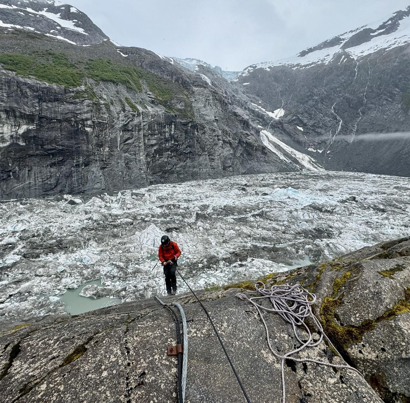
Science that buys time: Preparing Juneau for glacial flooding
Destructive glacial outburst floods are a near-annual summer occurrence in Juneau, Alaska, but local officials now have critical lead time to prepare residents thanks to new forecasting tools. Alaska CASC-funded scientists and partners developed models that track how much meltwater is stored in Suicide Basin throughout the year, allowing them to predict when flooding is likely. These models were integrated into the National Weather Service’s Juneau Suicide Basin forecasting webpage, which is used to issue flood watches and warnings that are viewed by nearly one million people each year.
To support community-level decision-making, the Alaska CASC also created the Juneau Flood Dashboard, an interactive tool that allows residents to explore how different flood scenarios could affect specific neighborhoods, even individual homes. Together, these adaptation tools give local authorities invaluable time to prepare, respond, and make decisions such as road closures and issuing evacuation notices, while strengthening community preparedness for glacial outburst floods in Southeast Alaska. Learn More >>
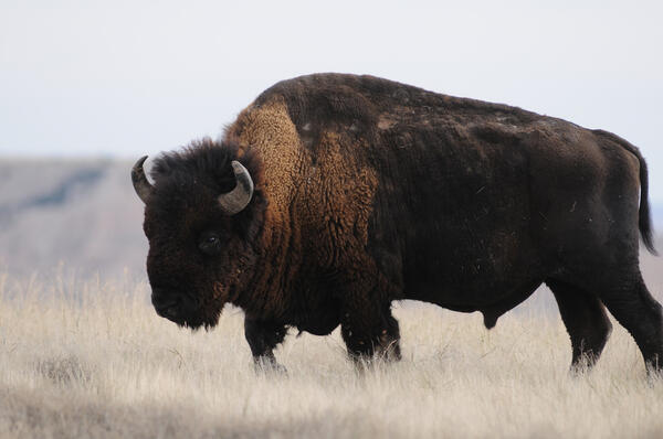
Turning uncertainty into action for Great Plains national parks
North Central CASC-supported scientists partnered with four national parks across the northern Great Plains to apply scenario planning, a structured process that considers key resources, major uncertainties, and multiple plausible climate futures to evaluate different management options. Results from this work have already shaped on-the-ground decisions.
At Devils Tower National Monument in Wyoming, several plausible futures raised concerns about surface water availability for plants and wildlife, prompting managers to revise plans to remove water collection infrastructure around a spring, and instead retain—even consider augmenting—systems that safeguard future water supplies.
At Badlands National Park in South Dakota, scenario planning and simulation modeling of multiple climate futures and management alternatives showed that current practices of keeping bison numbers low to avoid forage shortages in dry years could harm native plant diversity. These findings motivated new research on how bison affect native plants, helping managers determine bison population sizes that work to achieve multiple management goals. By planning for a range of possible futures and translating science into place-specific guidance, this collaboration is helping park managers more effectively allocate limited resources to support water, vegetation, and wildlife. Learn More >>
Using models to slow the spread of invasive bass in the Colorado River
Southwest CASC-funded scientists and managers turned science into action to prevent the spread of invasive smallmouth bass, which threatened to erase years of conservation gains in the Grand Canyon ecosystem. Warm water released from Glen Canyon Dam allows the invasive bass to move downstream from Lake Powell into the Grand Canyon to reproduce.
To slow the invasion, the Bureau of Reclamation used newly developed models that suggested sustained cold-water flow from the dam could deter smallmouth bass reproduction. Coordinating with the Western Area Power Administration to balance hydropower demand, they released colder water from deep within Lake Powell, keeping water temperatures low enough to control smallmouth bass without changing total water releases from the dam. By early fall, no young smallmouth bass were detected downstream, showing that timely, model-driven temperature management could slow invasion and safeguard native fish in a critical area of the river. Learn More>>

Targeted walleye stocking: Matching fish to lakes
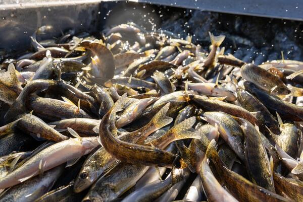
Stocking – raising fish in hatcheries and releasing them in lakes – is a common fisheries management practice, but efforts are costly and success varies from lake to lake. Midwest and National CASC-funded scientists partnered with state natural resource agencies to create a decision-support tool that estimates the likelihood of successful walleye stocking in individual lakes under future conditions, including warmer water.
Developed from data on thousands of previous stocking events, the team evaluated how lake size, climate, and fish communities affected stocking success. They found that walleye stocking is least effective in warmer lakes with abundant largemouth bass, though these factors matter less in larger lakes. By translating complex data into a user-friendly tool, this project helps state agencies across the Midwest make more informed and cost-effective walleye stocking decisions as warming lakes threaten the iconic recreational fishery. Learn More >>
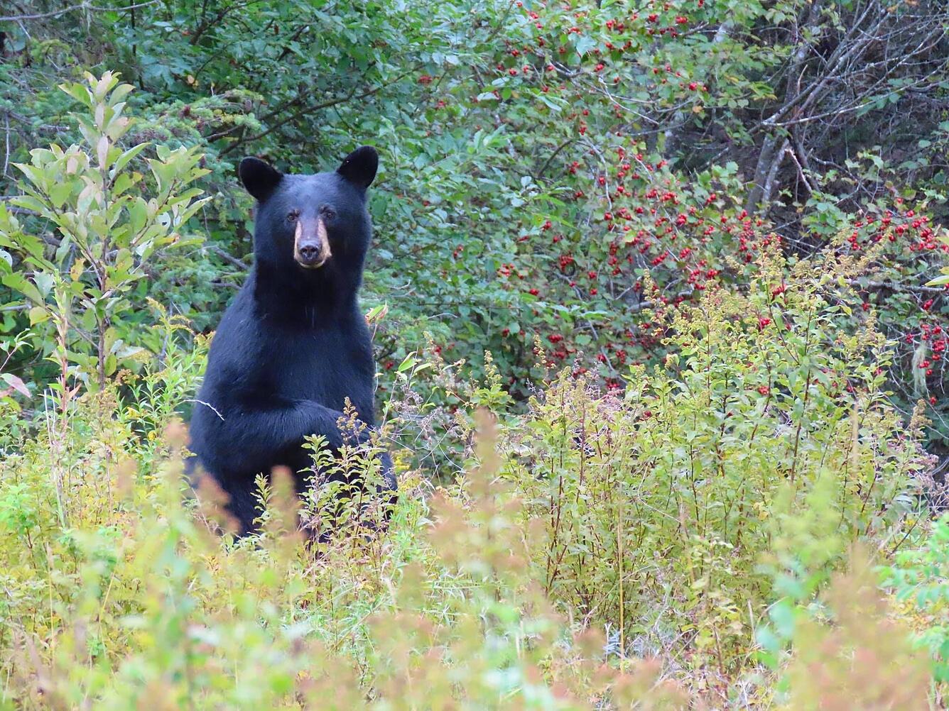
Forest adaptation in action for black bears
Land managers in northern New Hampshire are taking action to support healthy black bear populations as forest pests and disease alter the availability of key food sources for bears. Northeast CASC scientists and managers conducted forest adaptation plantings designed to offset the losses of beech and oak mast (nuts and seeds that provide an important highly nutritious food for bears) caused by beech leaf disease and spongy moth.
In 2025, this work took center stage during a field tour with New Hampshire Fish and Game wildlife biologists, U.S. Forest Service staff, private lands foresters, and landowners. The demonstrated success of red oak adaptation plantings in northern New Hampshire is now informing plans for much larger-scale adaptation actions and targeted plantings across state, federal, and private lands, helping maintain black bear habitat and food sources while also sustaining the wildlife watching and hunting opportunities that are vital to local communities. Learn More >>
Powering technology on public lands
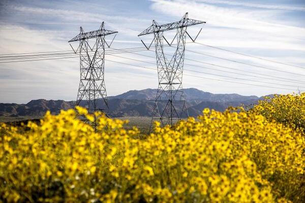
The CASC Climate Adaptation Technical Support (CATS) program helps natural resource managers use science for timely, real-world decisions. The CATS team is working with the Bureau of Land Management (BLM) to explore the key considerations involved in developing artificial intelligence data centers and related energy infrastructure on federal lands, ensuring such projects can be built efficiently and cost-effectively. Because data centers require massive amounts of electricity, building them near existing or planned energy infrastructure can reduce transmission losses, improve efficiency, and lower long-term costs. The CATS team distills the most relevant science into clear, practical guidance to help BLM navigate complex decisions, including evaluating potential environmental impacts, comparing alternatives, and incorporating public input through National Environmental Policy Act (NEPA) analyses. By clarifying benefits and risks, this work can support decision-making and reduce delays in expanding infrastructure to meet growing technological and energy demands while managing public land and natural resources.
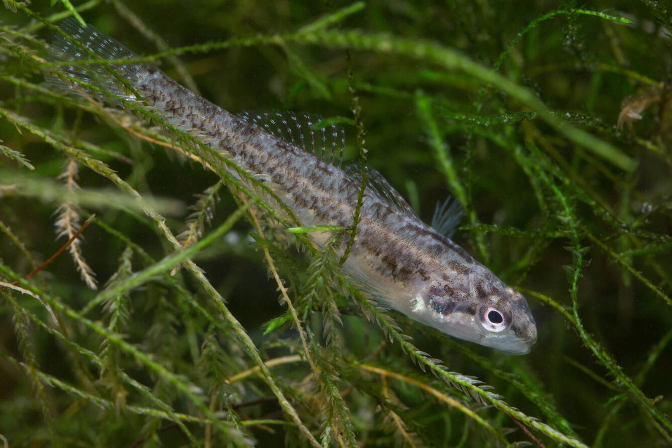
Safeguarding a Texas lifeline: Drought planning for the Edwards Aquifer
The Edwards Aquifer is the lifeline of south-central Texas, supplying water to more than 2.5 million people, fueling a regional economy valued at over \$200 billion, and sustaining diverse ecosystems. Recognizing the growing pressures of drought, the South Central CASC partnered with the Edwards Aquifer Authority (EAA) in 2019 to tackle scientific questions that will help the EAA manage the aquifer.
The team evaluated how warming temperatures could alter flows at San Marcos and Comal Springs, which provide critical habitat for several threatened and endangered species, including the fountain darter, a species endemic to the Comal and San Marcos Rivers. They also tested whether EAA’s existing drought mitigation strategies, such as groundwater pumping restrictions, would remain effective under future conditions. The collaboration has already informed the renewal of the Edwards Aquifer Habitat Conservation Plan’s Incidental Take Permit issued by the U.S. Fish and Wildlife Service. Learn More >>

Putting adaptive capacity to work: Distilling a complex concept into a tool
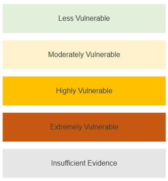
A major gap in climate vulnerability assessments has been the ability to consistently account for species’ adaptive capacity – their ability to persist in place or move to more suitable locations as conditions change. To address this gap, the Northwest CASC played a key role in advancing NatureServe’s next generation Climate Change Vulnerability Index (CCVI 4.0), a nationally used tool that supports conservation planning and species prioritization.
The Northwest CASC, in collaboration with federal, state, academic, and NGO partners, developed a new framework that translates 37 complex ecological factors into seven categories (e.g., movement) that allow adaptive capacity to be ranked on a scale of low to high. Tested and refined for real-world use, CCVI 4.0 now provides managers across the country with a more complete, useable picture of climate risk to inform State Wildlife Action Plans, species status assessments, recovery planning, and other conservation and management decisions. Learn More >>
From Research to Real-World Impact
Science in action means moving research beyond data collection and analyses into real-world management settings. These projects showcase how CASC-supported science, which is co-produced with the managers who use it, informs decisions and actions that strengthen ecosystems, economies, infrastructure, and communities across the nation.
Learn More
About the CASCs
Explore CASC Projects
More Deep Dives
Across the country, CASC-supported scientists are working with natural resource managers to turn science into action. Explore success stories where co-produced and decision-focused science is informing real management choices that support ecosystems, infrastructure, and communities in a changing climate.
Timely, Relevant, Usable Science
Natural resource managers across the country face difficult decisions, from balancing wildlife habitat with public land use to planning for future water supplies and recreational opportunities. Scientists supported by the Climate Adaptation Science Centers (CASCs) work alongside these managers to co-produce science designed for decision-making. This science meets immediate management needs, is delivered on practical timelines, reduces uncertainties, and improves effectiveness and efficiency where it matters most.
Explore examples from across the CASC network that use advanced technology and cutting-edge science to support infrastructure siting on federal lands, design fish and wildlife management plans to sustain game and at-risk species, prepare communities for emerging hazards, and plan for uncertain futures. These stories span a wide range of landscapes, species, and decision needs, but in all examples, scientists are collaborating closely with federal, state, Tribal, and local partners to ensure that science is timely, relevant, and usable. The projects outlined below demonstrate how collaborative, co-produced science can reduce risks in the face of an uncertain future, improve management outcomes, and support strong ecosystems, economies, and communities.
Turkeys on the clock: When turkeys nest, and why it matters for management
Wildlife agencies are using science from the Southeast CASC to refine wild turkey management strategies, like adjusting hunter harvest timing, in response to recent population declines. By pairing eight years of turkey nesting data from five states with weather records, the team found that the timing and success of nesting is largely unresponsive to temperature, rainfall, and shifting spring ‘green-up.’ Instead, future climatic conditions are more likely to indirectly affect turkeys by creating mismatches between their fixed spring nesting schedules and when food and cover become available.
Because nesting timing itself is unlikely to shift, managers can focus on more immediate factors contributing to population declines, such as harvest pressure or habitat conditions. This work was co-produced by Southeast CASC scientists and state wildlife agencies, including the Arkansas Game and Fish Commission. Learn More >>
A spatial mapping tool for Hawaiʻi balances species conservation and recreation
A new planning tool was developed by local land managers and community members in Hawaiʻi to support coordinated land management. The tool enables land managers to meet multiple goals at once by focusing conservation efforts where they will be most effective while expanding land access for hunting, fishing, hiking, and bird watching. Co-produced through a partnership between USGS Ecosystems Mission Area scientists, the Pacific Islands CASC, and the Hawaiʻi Department of Land and Natural Resources (DLNR), the tool helps managers prioritize where conservation actions will have the greatest impact. It combines data on wildlife habitat needs, management options, and other landscape pressures, allowing users to visualize and map priority conservation locations.
By considering how people use the land, including hunting and fishing, the tool provides a comprehensive view of how different management choices affect land access and conservation outcomes for more than 400 endangered and at-risk species, including Hawaiian forest birds. On Maui, the Hawaiʻi DLNR has already used the tool to shape a forest reserve management plan, helping teams coordinate their efforts, focus actions, maintain public access to lands, and measure progress for high-priority and rare species. Learn More >>
Science that buys time: Preparing Juneau for glacial flooding
Destructive glacial outburst floods are a near-annual summer occurrence in Juneau, Alaska, but local officials now have critical lead time to prepare residents thanks to new forecasting tools. Alaska CASC-funded scientists and partners developed models that track how much meltwater is stored in Suicide Basin throughout the year, allowing them to predict when flooding is likely. These models were integrated into the National Weather Service’s Juneau Suicide Basin forecasting webpage, which is used to issue flood watches and warnings that are viewed by nearly one million people each year.
To support community-level decision-making, the Alaska CASC also created the Juneau Flood Dashboard, an interactive tool that allows residents to explore how different flood scenarios could affect specific neighborhoods, even individual homes. Together, these adaptation tools give local authorities invaluable time to prepare, respond, and make decisions such as road closures and issuing evacuation notices, while strengthening community preparedness for glacial outburst floods in Southeast Alaska. Learn More >>
Turning uncertainty into action for Great Plains national parks
North Central CASC-supported scientists partnered with four national parks across the northern Great Plains to apply scenario planning, a structured process that considers key resources, major uncertainties, and multiple plausible climate futures to evaluate different management options. Results from this work have already shaped on-the-ground decisions.
At Devils Tower National Monument in Wyoming, several plausible futures raised concerns about surface water availability for plants and wildlife, prompting managers to revise plans to remove water collection infrastructure around a spring, and instead retain—even consider augmenting—systems that safeguard future water supplies.
At Badlands National Park in South Dakota, scenario planning and simulation modeling of multiple climate futures and management alternatives showed that current practices of keeping bison numbers low to avoid forage shortages in dry years could harm native plant diversity. These findings motivated new research on how bison affect native plants, helping managers determine bison population sizes that work to achieve multiple management goals. By planning for a range of possible futures and translating science into place-specific guidance, this collaboration is helping park managers more effectively allocate limited resources to support water, vegetation, and wildlife. Learn More >>
Using models to slow the spread of invasive bass in the Colorado River
Southwest CASC-funded scientists and managers turned science into action to prevent the spread of invasive smallmouth bass, which threatened to erase years of conservation gains in the Grand Canyon ecosystem. Warm water released from Glen Canyon Dam allows the invasive bass to move downstream from Lake Powell into the Grand Canyon to reproduce.
To slow the invasion, the Bureau of Reclamation used newly developed models that suggested sustained cold-water flow from the dam could deter smallmouth bass reproduction. Coordinating with the Western Area Power Administration to balance hydropower demand, they released colder water from deep within Lake Powell, keeping water temperatures low enough to control smallmouth bass without changing total water releases from the dam. By early fall, no young smallmouth bass were detected downstream, showing that timely, model-driven temperature management could slow invasion and safeguard native fish in a critical area of the river. Learn More>>
Targeted walleye stocking: Matching fish to lakes
Stocking – raising fish in hatcheries and releasing them in lakes – is a common fisheries management practice, but efforts are costly and success varies from lake to lake. Midwest and National CASC-funded scientists partnered with state natural resource agencies to create a decision-support tool that estimates the likelihood of successful walleye stocking in individual lakes under future conditions, including warmer water.
Developed from data on thousands of previous stocking events, the team evaluated how lake size, climate, and fish communities affected stocking success. They found that walleye stocking is least effective in warmer lakes with abundant largemouth bass, though these factors matter less in larger lakes. By translating complex data into a user-friendly tool, this project helps state agencies across the Midwest make more informed and cost-effective walleye stocking decisions as warming lakes threaten the iconic recreational fishery. Learn More >>
Forest adaptation in action for black bears
Land managers in northern New Hampshire are taking action to support healthy black bear populations as forest pests and disease alter the availability of key food sources for bears. Northeast CASC scientists and managers conducted forest adaptation plantings designed to offset the losses of beech and oak mast (nuts and seeds that provide an important highly nutritious food for bears) caused by beech leaf disease and spongy moth.
In 2025, this work took center stage during a field tour with New Hampshire Fish and Game wildlife biologists, U.S. Forest Service staff, private lands foresters, and landowners. The demonstrated success of red oak adaptation plantings in northern New Hampshire is now informing plans for much larger-scale adaptation actions and targeted plantings across state, federal, and private lands, helping maintain black bear habitat and food sources while also sustaining the wildlife watching and hunting opportunities that are vital to local communities. Learn More >>
Powering technology on public lands
The CASC Climate Adaptation Technical Support (CATS) program helps natural resource managers use science for timely, real-world decisions. The CATS team is working with the Bureau of Land Management (BLM) to explore the key considerations involved in developing artificial intelligence data centers and related energy infrastructure on federal lands, ensuring such projects can be built efficiently and cost-effectively. Because data centers require massive amounts of electricity, building them near existing or planned energy infrastructure can reduce transmission losses, improve efficiency, and lower long-term costs. The CATS team distills the most relevant science into clear, practical guidance to help BLM navigate complex decisions, including evaluating potential environmental impacts, comparing alternatives, and incorporating public input through National Environmental Policy Act (NEPA) analyses. By clarifying benefits and risks, this work can support decision-making and reduce delays in expanding infrastructure to meet growing technological and energy demands while managing public land and natural resources.
Safeguarding a Texas lifeline: Drought planning for the Edwards Aquifer
The Edwards Aquifer is the lifeline of south-central Texas, supplying water to more than 2.5 million people, fueling a regional economy valued at over \$200 billion, and sustaining diverse ecosystems. Recognizing the growing pressures of drought, the South Central CASC partnered with the Edwards Aquifer Authority (EAA) in 2019 to tackle scientific questions that will help the EAA manage the aquifer.
The team evaluated how warming temperatures could alter flows at San Marcos and Comal Springs, which provide critical habitat for several threatened and endangered species, including the fountain darter, a species endemic to the Comal and San Marcos Rivers. They also tested whether EAA’s existing drought mitigation strategies, such as groundwater pumping restrictions, would remain effective under future conditions. The collaboration has already informed the renewal of the Edwards Aquifer Habitat Conservation Plan’s Incidental Take Permit issued by the U.S. Fish and Wildlife Service. Learn More >>
Putting adaptive capacity to work: Distilling a complex concept into a tool
A major gap in climate vulnerability assessments has been the ability to consistently account for species’ adaptive capacity – their ability to persist in place or move to more suitable locations as conditions change. To address this gap, the Northwest CASC played a key role in advancing NatureServe’s next generation Climate Change Vulnerability Index (CCVI 4.0), a nationally used tool that supports conservation planning and species prioritization.
The Northwest CASC, in collaboration with federal, state, academic, and NGO partners, developed a new framework that translates 37 complex ecological factors into seven categories (e.g., movement) that allow adaptive capacity to be ranked on a scale of low to high. Tested and refined for real-world use, CCVI 4.0 now provides managers across the country with a more complete, useable picture of climate risk to inform State Wildlife Action Plans, species status assessments, recovery planning, and other conservation and management decisions. Learn More >>
From Research to Real-World Impact
Science in action means moving research beyond data collection and analyses into real-world management settings. These projects showcase how CASC-supported science, which is co-produced with the managers who use it, informs decisions and actions that strengthen ecosystems, economies, infrastructure, and communities across the nation.