
Data
Browse real-time data, data releases, software/code releases and more.
Filter Total Items: 194
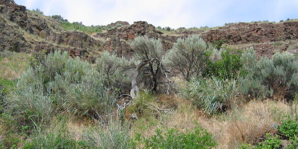
Ungulate Migrations of the Western United States, Volume 3 Ungulate Migrations of the Western United States, Volume 3
This is the data archive for the publication Ungulate Migrations of the Western United States, Volume 3 (Kauffman et al. 2022) and includes the collection of GIS map files that are mapped and described in the report. These map files are meant to provide a common spatial representation of the mapped migrations. This data release provides the means for ungulate migrations to be mapped and...
Simulations to understand and validate models Simulations to understand and validate models
This software release contains one R script file that allows the user to download data and reproduce all of the figures and analyses associated with DiRenzo et al. In the R script, we provide a guide to understanding and validating complex models using data simulations. In an effort to facilitate the implementation of these methods, we provide a running example throughout DiRenzo et al...
Daily ages of young-of-year Silver Chub from western Lake Erie, 2017-2018 Daily ages of young-of-year Silver Chub from western Lake Erie, 2017-2018
Daily ages of young-of-year Silver Chub were estimated from counts of rings in lapilli otoliths. Lapilli were mounted to glass slides with thermoplastic cement and sanded to the core with 2000 grit sandpaper to expose daily rings. To improve clarity, sanded otoliths were polished with 0.3 μm alumina powder and a polishing cloth prior to viewing. To estimate daily age, counts of rings in...
Biogeochemical data from microcosm experiments to evaluate treatment of acid-rock drainage in selected counties in Tennessee Biogeochemical data from microcosm experiments to evaluate treatment of acid-rock drainage in selected counties in Tennessee
The U.S. Geological Survey, in cooperation with the Tennessee Department of Transportation, conducted an investigation of acid-rock drainage from road cuts in Tennessee during 2014-2015. The Devonian Chattanooga Shale contains disseminated pyrite and is a primary producer of acid-rock drainage (ARD) in Tennessee. One objective of the overall investigation was to attenuate ARD by...
American alligator growth simulation and integrated population model American alligator growth simulation and integrated population model
The software consists of three scripts to be run in the R statistical program: 1) Alligator growth simulation; 2) alligator integrated population model file; and 3) data visualization script. Script #1 produces growth transition probabilities that are used in script #2. The second script uses the outputs from #1 as well as other data files to run an integrated population model. The last...
Integrated population model for red knot in Delaware Bay Integrated population model for red knot in Delaware Bay
This is code for an integrated population model developed to understand the effect of horseshoe crab abundance on population demographics of red knot, an Arctic-breeding shorebird. This model was developed as part of the revision to the Atlantic States Marine Fisheries Commission Adaptive Resource Management Plan for horseshoe crabs.
Optimal horseshoe crab harvest policies via approximate dynamic programming Optimal horseshoe crab harvest policies via approximate dynamic programming
Approximate Dynamic Programming relies on forward simulation of the system, so two population projection models are used, one for crabs and one for red knots. The two models are linked: HSC abundance is a predictor variable in the REKN model. Other useful outputs are produced as well, such as predictions of future harvest.
Spatial modeling of two mosquito vectors of West Nile virus using integrated nested Laplace approximation Spatial modeling of two mosquito vectors of West Nile virus using integrated nested Laplace approximation
This software involves R script to fit models of abundance of mosquito vectors (' Script_for_ECS22-0193_9_13_2215.R') to landscape and environmental covariates using INLA and SPDE. The dataset used for this analysis were originally provided by the Pennsylvania Department of Environmental Protection (DEP) with a confidentiality agreement. The majority of the data used in this study...
Predicting climate change impacts on poikilotherms Predicting climate change impacts on poikilotherms
This software involves files to fit the physiologically-guided abundance (PGA) model ('fish_predictions_pga.R'), a naive model ('fish_predictions_naive.R'), and a PGA model using simulated data ('PGA_sim.R'). Each R file calls as associated .stan file that contains the model code that is executed by stan when running the R code ('fish_prediction.stan', 'fish_prediction_naive.stan', and...
AMMonitor AMMonitor
AMMonitor is an open source R package dedicated to collecting, storing, and analyzing AMU information in a way that 1) is cost-effective, 2) can efficiently process and store information, and 3) can take advantage of the vast and growing community of R analytics.
Stream Temperature and Dissolved Oxygen Responses to Small Dams and Dam Removal in Massachusetts Stream Temperature and Dissolved Oxygen Responses to Small Dams and Dam Removal in Massachusetts
Small, surface-release dams are ubiquitous across the U.S. and have the potential to alter stream flow, impede sediment and nutrient transport, and fragment biotic assemblages. To mitigate these and other ecological impacts and reduce public safety hazards, dam removal has become an increasingly prevalent method of stream restoration. However, few streams have been consistently monitored...
Movement Data of Partially Migratory Brown Pelicans from the South Atlantic Bight Movement Data of Partially Migratory Brown Pelicans from the South Atlantic Bight
This dataset contains locations acquired from GPS-tagged Brown Pelicans in the South Atlantic Bight. Locations correspond to the movements of pelicans tracked during the autumn migratory period (post-breed to the following spring, with length of deployment varying individually) from 2017-2020. Additional metrics include intrinsic and extrinsic variables both measured and acquired which...