
Data
Browse real-time data, data releases, software/code releases and more.
Filter Total Items: 194
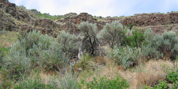
Pygmy Rabbit capture locations in Rich county, Utah, 2006-2008 Pygmy Rabbit capture locations in Rich county, Utah, 2006-2008
Capture locations for pygmy rabbits (Brachylagus idahoensis) in Rich County Utah. These records contain capture records for rabbits in 3 allotments in Rich County, Utah during 2006-2008. Basic morphological data were collected at the time of capture. Some rabbits recorded here are part of a telemetry study (https://doi.org/10.5066/P147ZKDU.).
Wild Turkey Summer Sighting Survey Observations Wild Turkey Summer Sighting Survey Observations
R code to analyze these data to estimate proportion of hens with poults and poults per brood, and estimate temporal trends in proportion of hens with poults is available at https://doi.org/10.5066/P14VYTVN. The state wildlife agencies in Maryland, New Jersey, New York, Ohio, Pennsylvania, Virginia, and West Virginia collected observations of wild turkeys during June-August, 2000-2023...
Effects of Simulated Drought on Yellowcheek Darter (Nothonotus moorei) and Yoke Darter (Nothonotus juliae) Growth, Survival, and Refuge-use, 2024 Dataset Effects of Simulated Drought on Yellowcheek Darter (Nothonotus moorei) and Yoke Darter (Nothonotus juliae) Growth, Survival, and Refuge-use, 2024 Dataset
We used mesocosms to evaluate the effects of drought on Nothonotus moorei (Yellowcheek Darter) and Nothonotus juliae (Yoke Darter) survival, growth, and behavior. Survival was low and did not differ between treatments. Yoke Darters gained mass in control treatments, whereas Yellowcheek Darters did not differ between treatments. Habitat-use varied between treatment and species, with...
Pygmy rabbit telemetry data 2008-2009 in Utah Pygmy rabbit telemetry data 2008-2009 in Utah
This dataset accompanies manuscripts "Effects of sagebrush treatments on multi-scale resource selection by pygmy rabbits" (https://doi.org/10.1002/jwmg.51) and "Spatial ecology of refuge selection by an herbivore under risk of predation" (http://dx.doi.org/10.1890/ES11-00247.1). It is a single table that includes telemetry locations for 16 pygmy rabbits (Brachylagus idahoensis). The...
Sediment and fish data to develop severity of ill effect dose-response models Sediment and fish data to develop severity of ill effect dose-response models
We synthesized existing literature to develop this dataset which relates suspended sediment concentration and exposure duration to biological effects on fishes. Our dataset contains a total of 3,610 dose-response data triplicates consisting of (a) suspended sediment concentration, (b) duration of exposure, and (c) fish severity of ill effects (SEV). There is no original data in the...
Two-stage models improve machine learning classifiers in wildlife research: A case study in identifying false positive detections of Ruffed Grouse Two-stage models improve machine learning classifiers in wildlife research: A case study in identifying false positive detections of Ruffed Grouse
Autonomous recording units are increasingly being used to monitor wildlife on large geographic and temporal scales, paired with machine learning (ML) to automate detection of wildlife. However, false positive detections from ML classifiers can result in erroneous ecological models that can lead to misguided management and conservation actions. We used a two-stage general approach to...
Bird point count and covariate data from wetland easements in Iowa, 2007-2009 and 2022-2023 (ver. 2.0, May 2025) Bird point count and covariate data from wetland easements in Iowa, 2007-2009 and 2022-2023 (ver. 2.0, May 2025)
This dataset contains records from bird point count and vegetation surveys conducted at 55 sites in 2007-2009 and 52 sites in 2022-2023. Sites were enrolled in wetland easement programs (e.g., Wetlands Reserve Program). There were 7-10 points per property. Bird surveys were conducted between May 15 and July 31 each year. Vegetation data were collected between mid-July and early September...
Unified antlerless harvest records for firearm white-tailed deer harvest in the Midwestern United States 2001-2023 Unified antlerless harvest records for firearm white-tailed deer harvest in the Midwestern United States 2001-2023
This data set contains harvest regulations and annual harvest for antlerless white-tailed deer in 8 Midwestern US states. The data includes harvest regulations for each unit and year as well as the annual harvest for antlerless white-tailed deer by firearm or during a modern firearm season depending on individual state record keeping. Spatial change of support has been applied to unify...
Dataset for Antigone canadensis (sandhill crane) foraging patterns influenced by crop, roost distance, and tillage intensity during spring and autumn migration at a primary stopover area Dataset for Antigone canadensis (sandhill crane) foraging patterns influenced by crop, roost distance, and tillage intensity during spring and autumn migration at a primary stopover area
We used data from 2.5 years of A. canadensis observations in the San Luis Valley to examine their foraging patterns during spring and autumn migration. We counted cranes weekly or bi-weekly each season and year during roadside surveys. We determined crop type (alfalfa, barley, pasture, potatoes, other grain, and other) during roadside surveys. We also recorded tillage intensity for grain...
Landscape transcriptomics identify Landscape transcriptomics identify
Rapid heating events, such as heatwaves, are becoming more frequent and intense as a result of climate change. Importantly, such extreme weather events can be more important drivers of extirpation and selection than changes in annual or seasonal averages and they pose a particularly large threat to poikilothermic organisms. In this study, we evaluate the thermal stress response of a...
DeepFaune New England - Data DeepFaune New England - Data
DeepFaune New England (DFNE) is a model for species classification in trail camera imagery. This model is a re-trained version of the DeepFaune model for classifying European species in trial cameras, fine-tuned to classify taxa from northeastern North America. The DFNE model takes as input cropped images of each animal, which can be generated by an object detection model. DFNE...
Stream Temperature, Intermittency, and Conductivity (STIC) logger and comparison datasets for quantifying river connectivity in tributaries of the Colorado River, TX Stream Temperature, Intermittency, and Conductivity (STIC) logger and comparison datasets for quantifying river connectivity in tributaries of the Colorado River, TX
Stream Temperature, Intermittency, and Conductivity (STIC) loggers were deployed in tributaries of the Colorado River, TX to monitor for water presence. These loggers were deployed in a riffle and pool mesohabitat at 19 sites and recorded a measurement every six hours from June 2022 to March 2024. The loggers record temperature and relative conductivity. We calculated drying metrics...