



USGS Ecosystems’ Land Change Science Program: Science That Advances National Priorities
The USGS Ecosystems' Land Change Science Program provides trusted, place‑based science to strengthen wildfire resilience, support local preparedness, and protect natural and recreational resources.
In the United States, communities are facing growing environmental challenges. From extreme flooding and severe drought to shifting forest conditions, these challenges are impacting our natural resources and public lands. The U.S. Geological Survey Ecosystems’ Land Change Science (ELCS) Program provides the trusted, place‑based science needed to meet these challenges. Through research that strengthens wildfire resilience, supports local preparedness, and protects natural and recreational resources, the ELCS Program helps decision‑makers act with confidence and meet national priorities
Supporting Local Preparedness
Communities across the country are experiencing more extreme flooding. ELCS provides science‑based tools that help state and local partners prepare for hazards, invest in resilience, and protect lives, ecosystems, and infrastructure.
Extreme Flooding and Learning from a River’s Past
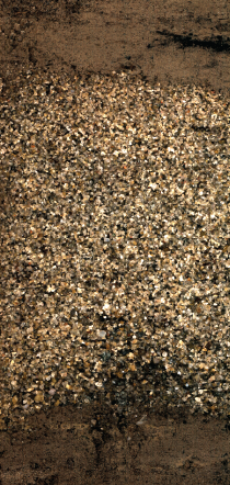
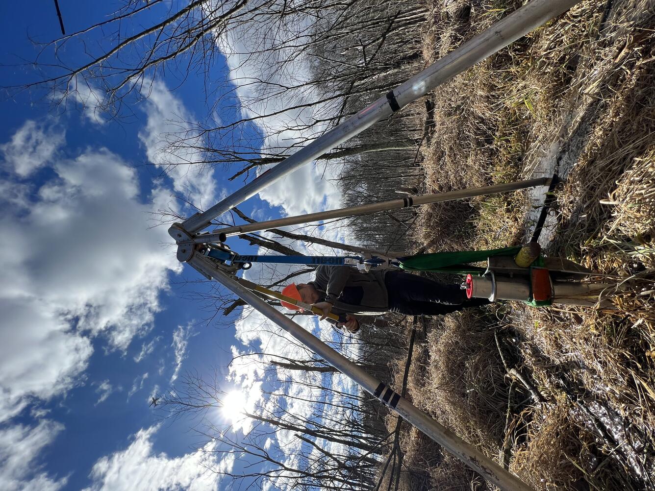
Washington, D.C. faces some of the highest flood risks on the East Coast, driven by storm surges and major Potomac River flooding. New research from Drs. Michael Toomey, Jessica Rodysill, Debra Willard and others of the Florence Bascom Geoscience Center shows that the city’s most extreme floods occurred before modern instruments. By examining historical engineering notes, decades of water‑level records, and flood deposits preserved in marshlands, the team revealed a 500-year record of rising water levels and increasing flood frequency over the past two centuries with some of the most extreme events occurring more than 100 years ago as well as a massive ice-jam flood in 1784.
This long-term perspective helps communities better understand how rainfall patterns, land‑use changes, and river conditions shape today’s risks. The research also supports land managers as they develop updated design benchmarks for critical infrastructure like culverts and bridges, ensuring these structures are built to withstand truly extreme floods.
The work supports local D.C. efforts to better understand, plan for, and address community needs by using lessons from the past to prepare for tomorrow’s extremes.
Advancing Wildfire Science
America’s forests are undergoing rapid change as drought intensifies, fire seasons lengthen, and tree mortality increases across the West. The ELCS Program provides long‑term wildfire science that helps partners understand how forests have changed and where fuel‑reduction and controlled‑burn treatments can be most effective.
Strategies for Reducing Wildfire Risk
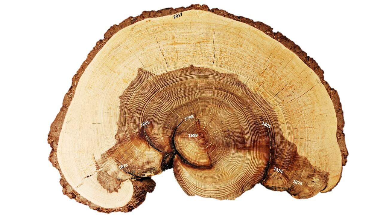
Dr. Ellis Margolis, Research Ecologist with the USGS Fort Collins Science Center, leads research that uncovers how wildfire, drought, and forest conditions have shifted over centuries and provides critical insight into modern forest management. Using tree‑ring records and fire scars, their work at the New Mexico Landscapes Field Station reconstructs pre‑1900 fire regimes, revealing how often fires burned, how intense they were, and how they shaped forest ecosystems before widespread fire suppression.
These historical baselines guide prescribed‑fire plans and fuel‑treatment strategies in places like the Santa Fe Watershed, a vital water source for nearby communities. Margolis’ research also tracks how vegetation responds to drought and disturbance and identifies the drivers of increasing tree mortality.
Together, this science helps several partners including the city of Santa Fe, to actively manage the surrounding forests to reduce wildfire risk protecting lives, livelihoods, and infrastructure.

Supporting Access to Public Lands
Millions of people visit America’s national parks and other public lands each year, supporting local economies and connecting with landscapes that define the Nation’s natural heritage. The ELCS Program provides long‑term environmental research and clear scientific communication that helps land managers maintain safe operations, conserve natural resources, and keep local economies functioning.
Avalanche Forecasting on the Going-to-the-Sun Road in Glacier National Park
Each spring, Glacier National Park prepares for the reopening of Going‑to‑the‑Sun Road (GTSR), its most iconic and widely visited attraction. This high‑alpine route becomes one of the Park Service’s most hazardous areas in winter due to deep snow, unstable snowpacks, cornice failures, and frequent avalanches.
Since 2003, the National Park Service has relied on a partnership with USGS avalanche scientists to safely open the road. Dr. Erich Peitzsch, Research Physical Scientist with the USGS Northern Rocky Mountain Science Center, and his team of avalanche forecasters works on-site to assess snow stability, monitor storms, dig snow pits, and deliver real‑time avalanche forecasts that guide when it is safe to allow crews back onsite to plow the dangerous terrain.
This applied science helps ensure GTSR can open safely each year, protecting staff, supporting visitor access, and sustaining the regional tourism economy.

Looking Ahead: Science That Serves the Nation
From strengthening flooding resilience and wildfire preparedness to supporting safe access in national parks, the USGS Ecosystems’ Land Change Science Program provides the science that helps federal priorities become real‑world solutions. Through rigorous, transparent, place‑based research, the ELCS Program ensures that communities, economies, and public lands have the knowledge they need to face environmental change with confidence and to protect the places Americans call home, explore, and treasure.
The USGS Ecosystems' Land Change Science Program provides trusted, place‑based science to strengthen wildfire resilience, support local preparedness, and protect natural and recreational resources.
In the United States, communities are facing growing environmental challenges. From extreme flooding and severe drought to shifting forest conditions, these challenges are impacting our natural resources and public lands. The U.S. Geological Survey Ecosystems’ Land Change Science (ELCS) Program provides the trusted, place‑based science needed to meet these challenges. Through research that strengthens wildfire resilience, supports local preparedness, and protects natural and recreational resources, the ELCS Program helps decision‑makers act with confidence and meet national priorities
Supporting Local Preparedness
Communities across the country are experiencing more extreme flooding. ELCS provides science‑based tools that help state and local partners prepare for hazards, invest in resilience, and protect lives, ecosystems, and infrastructure.
Extreme Flooding and Learning from a River’s Past
Washington, D.C. faces some of the highest flood risks on the East Coast, driven by storm surges and major Potomac River flooding. New research from Drs. Michael Toomey, Jessica Rodysill, Debra Willard and others of the Florence Bascom Geoscience Center shows that the city’s most extreme floods occurred before modern instruments. By examining historical engineering notes, decades of water‑level records, and flood deposits preserved in marshlands, the team revealed a 500-year record of rising water levels and increasing flood frequency over the past two centuries with some of the most extreme events occurring more than 100 years ago as well as a massive ice-jam flood in 1784.
This long-term perspective helps communities better understand how rainfall patterns, land‑use changes, and river conditions shape today’s risks. The research also supports land managers as they develop updated design benchmarks for critical infrastructure like culverts and bridges, ensuring these structures are built to withstand truly extreme floods.
The work supports local D.C. efforts to better understand, plan for, and address community needs by using lessons from the past to prepare for tomorrow’s extremes.
Advancing Wildfire Science
America’s forests are undergoing rapid change as drought intensifies, fire seasons lengthen, and tree mortality increases across the West. The ELCS Program provides long‑term wildfire science that helps partners understand how forests have changed and where fuel‑reduction and controlled‑burn treatments can be most effective.
Strategies for Reducing Wildfire Risk
Dr. Ellis Margolis, Research Ecologist with the USGS Fort Collins Science Center, leads research that uncovers how wildfire, drought, and forest conditions have shifted over centuries and provides critical insight into modern forest management. Using tree‑ring records and fire scars, their work at the New Mexico Landscapes Field Station reconstructs pre‑1900 fire regimes, revealing how often fires burned, how intense they were, and how they shaped forest ecosystems before widespread fire suppression.
These historical baselines guide prescribed‑fire plans and fuel‑treatment strategies in places like the Santa Fe Watershed, a vital water source for nearby communities. Margolis’ research also tracks how vegetation responds to drought and disturbance and identifies the drivers of increasing tree mortality.
Together, this science helps several partners including the city of Santa Fe, to actively manage the surrounding forests to reduce wildfire risk protecting lives, livelihoods, and infrastructure.
Supporting Access to Public Lands
Millions of people visit America’s national parks and other public lands each year, supporting local economies and connecting with landscapes that define the Nation’s natural heritage. The ELCS Program provides long‑term environmental research and clear scientific communication that helps land managers maintain safe operations, conserve natural resources, and keep local economies functioning.
Avalanche Forecasting on the Going-to-the-Sun Road in Glacier National Park
Each spring, Glacier National Park prepares for the reopening of Going‑to‑the‑Sun Road (GTSR), its most iconic and widely visited attraction. This high‑alpine route becomes one of the Park Service’s most hazardous areas in winter due to deep snow, unstable snowpacks, cornice failures, and frequent avalanches.
Since 2003, the National Park Service has relied on a partnership with USGS avalanche scientists to safely open the road. Dr. Erich Peitzsch, Research Physical Scientist with the USGS Northern Rocky Mountain Science Center, and his team of avalanche forecasters works on-site to assess snow stability, monitor storms, dig snow pits, and deliver real‑time avalanche forecasts that guide when it is safe to allow crews back onsite to plow the dangerous terrain.
This applied science helps ensure GTSR can open safely each year, protecting staff, supporting visitor access, and sustaining the regional tourism economy.
Looking Ahead: Science That Serves the Nation
From strengthening flooding resilience and wildfire preparedness to supporting safe access in national parks, the USGS Ecosystems’ Land Change Science Program provides the science that helps federal priorities become real‑world solutions. Through rigorous, transparent, place‑based research, the ELCS Program ensures that communities, economies, and public lands have the knowledge they need to face environmental change with confidence and to protect the places Americans call home, explore, and treasure.