U.S. flag

An official website of the United States government

Images

All items in this gallery are considered public domain unless otherwise noted.

Filter Total Items: 518
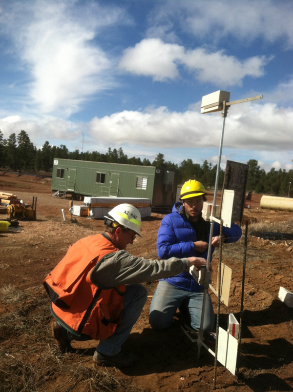
USGS Scientists Collecting Soil Samples on the Canyon Mine Property

U.S. Geological Survey (USGS) scientists collecting soil samples on the Canyon Mine property, Arizona. The mine's headframe and mine workshop are visible in the background.

Canyon Mine Sampling

USGS scientists collecting soil samples at Canyon Mine.

Infectious Disease Transmission Pathways Illustration

Illustration showing examples of infectious disease transmission pathways. This illustration is a higher resolution version of figure 5 of USGS Circular 1383-E.

The illustration visually conveys the following environmental health priority topics of study:

Illustration showing examples of infectious disease transmission pathways. This illustration is a higher resolution version of figure 5 of USGS Circular 1383-E.

The illustration visually conveys the following environmental health priority topics of study:

Environmental Contaminant Source and Transport Pathways Illustration

Illustration showing examples of environmental contaminant source and transport pathways. This illustration is a higher resolution version of figure 4 of USGS Circular 1383-E and figure 1 of USGS Open-file Report 2015-1113.

Two images, 1) a man holding a mason jar of water, 2) a man pours water onto a sample bottle held by another person.
Studies of contaminant biogeochemistry and microbial processes in surface waters

Left: USGS Employee L. Windham-Myers showing a surface water sample collected in acid-cleaned mason jar (deployed for 24 hours) for a mercury study conducted at the Cosumnes River Nature Preserve (CA).  Photographer: M. Marvin-DiPasquale. Date: 10/29/2014.

USGS analyst performs DNA extractions in a laboratory
USGS Analyst Performs DNA Extractions in a Laboratory

A U.S. Geological Survey analyst performs DNA extractions on enriched cultures of water from the study area. Once the DNA was extracted it was used to detect pathogen gene markers using polymerase chain reaction (PCR).

A U.S. Geological Survey analyst performs DNA extractions on enriched cultures of water from the study area. Once the DNA was extracted it was used to detect pathogen gene markers using polymerase chain reaction (PCR).

Bacteria contained in filter chambers placed in downgradient observation wells were exposed to sulfamethoxazole
Bacteria contained in filter chambers

Microbial-Contaminant Interactions Laboratory — Boulder, Colorado. Bacteria contained in filter chambers placed in downgradient observation wells were exposed to sulfamethoxazole for 30 days as it traveled past the wells.

Microbial-Contaminant Interactions Laboratory — Boulder, Colorado. Bacteria contained in filter chambers placed in downgradient observation wells were exposed to sulfamethoxazole for 30 days as it traveled past the wells.

Bacteria contained in filter chambers placed in downgradient observation wells were exposed to sulfamethoxazole for 30 days
Bacteria contained in filter chambers

Bacteria contained in filter chambers placed in downgradient observation wells were exposed to sulfamethoxazole for 30 days as it traveled past the wells

Bacteria contained in filter chambers placed in downgradient observation wells were exposed to sulfamethoxazole for 30 days as it traveled past the wells

Picture of dead waterbird covered in algae
Dead Green Winged Teal covered in algae

Picture of a dead Green Winged Teal (Anas carolinensis) covered with algae in Chesapeake Bay.

Algae near sandy shore of Island
Algae near the shoreline in Chesapeake Bay

Algae near the shore of Poplar Island-a 3-mile-long (4.8-kilometer-long) island located on the Chesapeake Bay, part of Talbot County, Maryland.

Algae near the shore of Poplar Island-a 3-mile-long (4.8-kilometer-long) island located on the Chesapeake Bay, part of Talbot County, Maryland.

USGS scientist pauses during field work in a stream impacted by acidic runoff and metal contamination
Field work in a stream impacted by acid mine drainage

USGS scientist pauses during field work in a stream impacted by acidic runoff and metal contamination. Iron precipitates are visible on the stream's rocks. The mesh pyramid is an insect emergence trap.

USGS scientist pauses during field work in a stream impacted by acidic runoff and metal contamination. Iron precipitates are visible on the stream's rocks. The mesh pyramid is an insect emergence trap.

East Fork of the Upper Arkansas River
USGS scientists samples the East Fork of the Upper Arkansas River

USGS Scientists study the effects of trace metal contamination on diets of stream fish. Vegetation surrounding this relatively pristine stream is dominated by deciduous willow, which are inhabited by riparian spiders that consume adult aquatic insects emerging from the stream. Regionally, streams are impacted by acid mine drainage and natural mineralization.

USGS Scientists study the effects of trace metal contamination on diets of stream fish. Vegetation surrounding this relatively pristine stream is dominated by deciduous willow, which are inhabited by riparian spiders that consume adult aquatic insects emerging from the stream. Regionally, streams are impacted by acid mine drainage and natural mineralization.

Game camera image of an osprey taken on Poplar Island, Maryland

Game camera image of an osprey taken on Poplar Island, Maryland. Game cameras were used to identify species of fish fed to osprey nestlings. The image was taken during a U.S.

USGS scientist standing in a stream. The rocks in the stream have iron precipitates
USGS Scientist Standing in a Metal Contaminated Stream

U.S. Geological Survey (USGS) scientist pauses during field work in a stream impacted by acidic runoff and metal contamination. Iron precipitates are visible on the stream's rocks. The mesh pyramid is an insect emergence trap. A riparian zone rich in terrestrial insects can provide an alternate food source for fish in metal-impacted watersheds.

U.S. Geological Survey (USGS) scientist pauses during field work in a stream impacted by acidic runoff and metal contamination. Iron precipitates are visible on the stream's rocks. The mesh pyramid is an insect emergence trap. A riparian zone rich in terrestrial insects can provide an alternate food source for fish in metal-impacted watersheds.

Was this page helpful?