
Mapping the grid: The United States Magnetotelluric Array
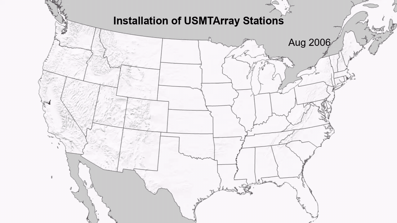
The United States has been mapped from space to the ground across its surface; however never from the perspective of the planet’s own electrical heartbeat. Over nearly two decades, the United States Magnetotelluric Array quietly marched across the country, station by station, building the first-ever electrical portrait of the crust and upper mantle beneath the contiguous U.S. An ambitious, multi‑agency effort spanning 2006 to 2024 aims to improve our understanding of: critical minerals, our continent’s deep structure, protecting the power grid from solar storms.
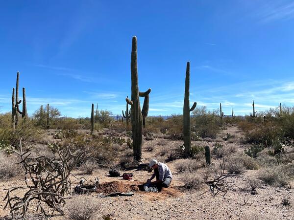
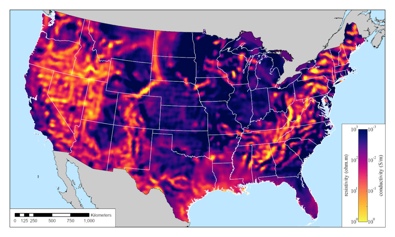
The USMTArray provides the first continent‑wide map of Earth’s electrical structure beneath the United States., revealing everything from ancient tectonic scars to modern space‑weather vulnerabilities. By installing over 1,800 stations over 18 years, scientists used a scientific technique called magnetotellurics to measure variations in our planet's magnetic and electric fields. These signals could vary depending on what type of rock sits underground. By analyzing this data, scientists can pinpoint where different types of rock come together. Using these stations, a few valuable applications were produced such as a 3D model of the crust and mantle, a high resolution model for forecasting space weather hazards, and a national map to examine how electricity flows deep beneath our feet.
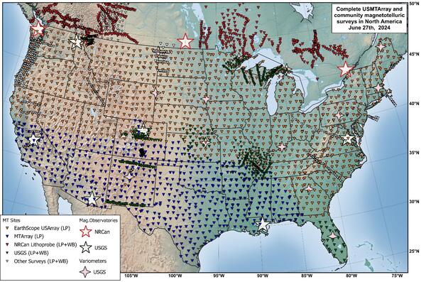
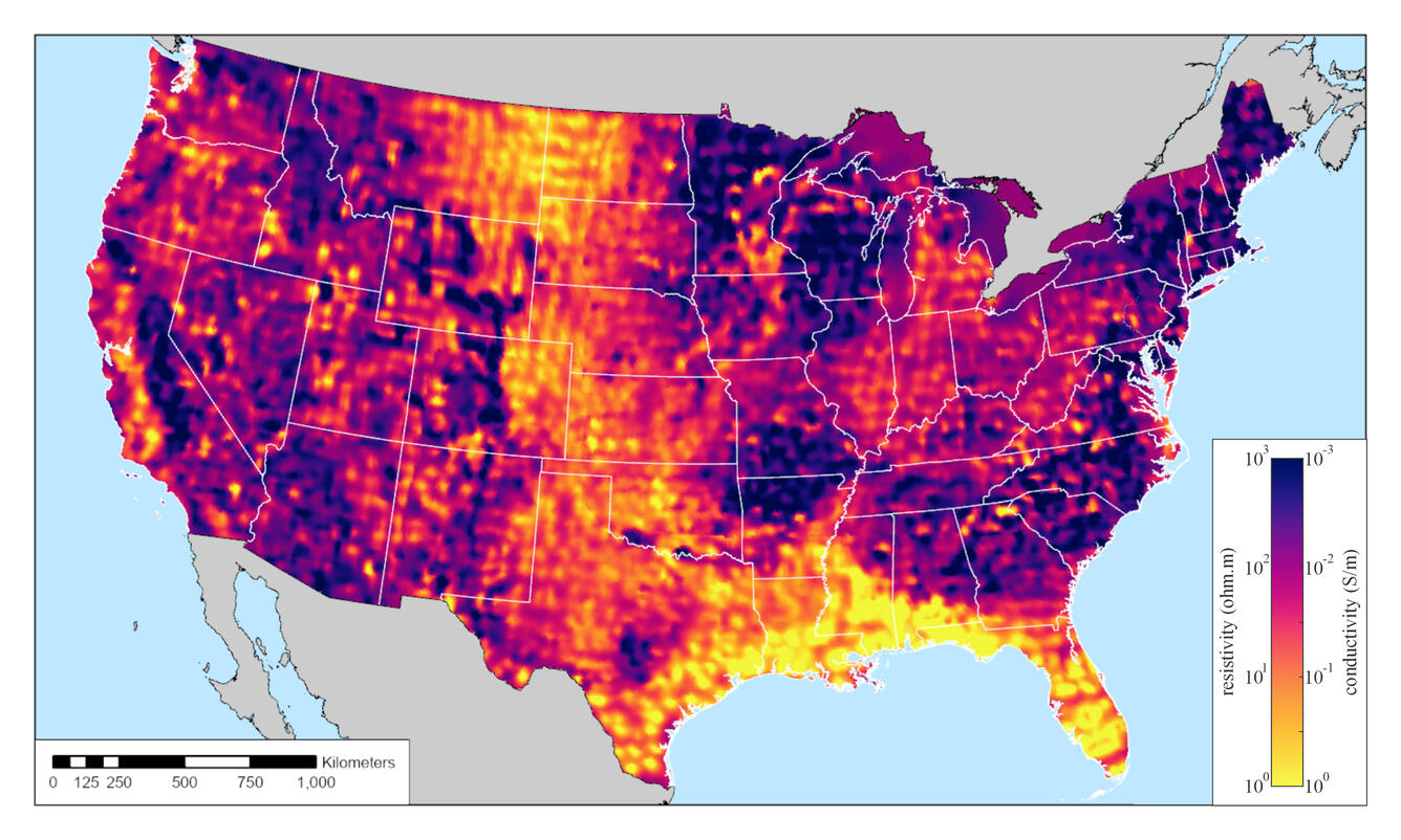
The United States magnetotelluric array impedance map (AIM) is one of the successes of the USMTArray project. It displays a snapshot of how electrical currents move through the ground across the United States. This map can identify how currents vary with depth from the surface to a depth of 100 miles or more! AIM resulted in a consistent nationwide dataset that supports research ranging from mineral discovery to tectonic studies.
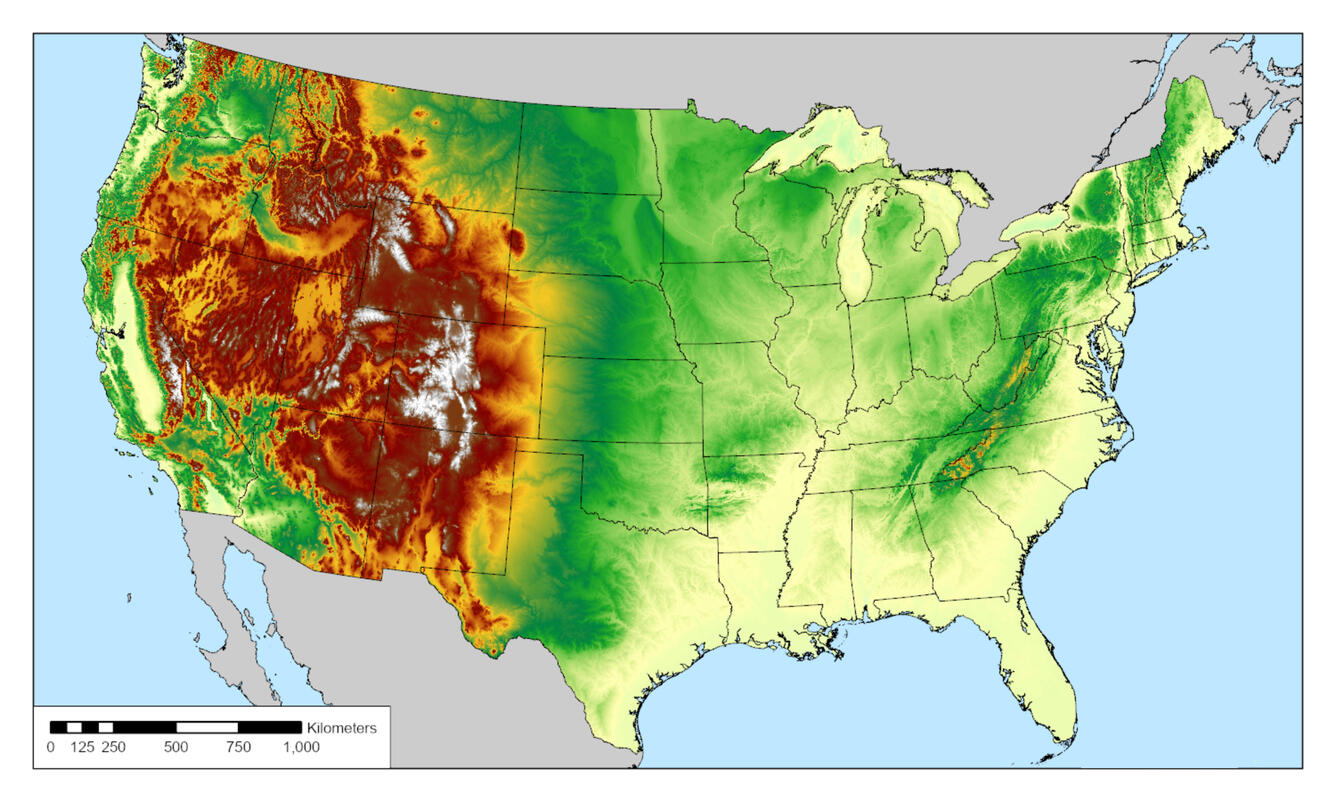
Another unique outcome of the USMTArray project is a 3-D model of the United States crust and upper mantle. This 3-D model is similar to a snapshot of what is beneath our feet. Using this model, we can improve current scientific models by identifying different types of rock, as well as where fluids are found - both water and in some areas magma. The model also reveals the geologic puzzle pieces that were assembled over billions of years to form North America. Enhancing our current scientific knowledge also allows us to improve space‑weather hazard forecasting to protect the electric infrastructure of the United States.
Key Findings
Improved Protection Against Space Weather Hazards
Geomagnetic storms can generate unwanted currents in the power grid. USMTArray data help determine where the ground is more or less conductive, which directly affects how much risk a region faces. This project produced a National Impedance Map and a high-resolution 3D electrical conductivity model of the nation. Unlike older one-dimensional models that often under or overestimated risks, the USMTArray’s additions provide the precise local and directional data needed to accurately assess how the Earth's electrical architecture influences the impact of geomagnetic storms. Integrating the USMTArray dataset into the NOAA-USGS Geoelectric Field Map allows for real-time estimates of storm-induced ground currents across the country. By allowing power companies to perform targeted real-time reconfigurations of the grid during magnetic superstorms, the USMTArray helps prevent widespread power blackouts and protects high-voltage transformers from permanent damage.
Mapping the Nation's Mineral and Geothermal Resources
Shaping the Future of Scientific Exploration
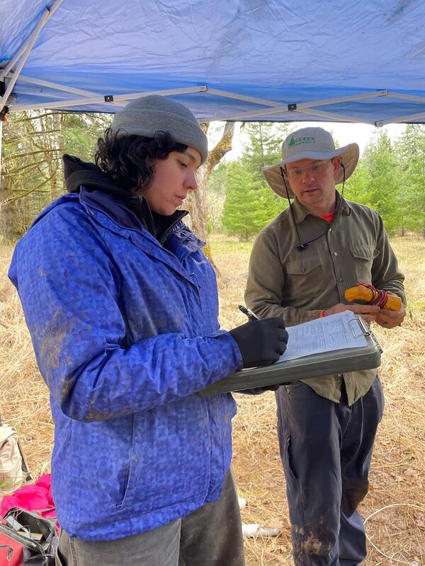
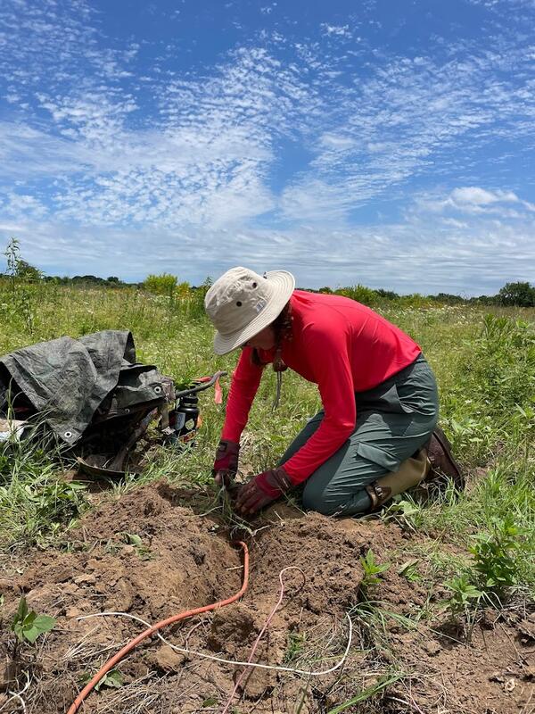
Well over 50 students and early‑career researchers participated in the United States Magnetotelluric Array project through fieldwork, data processing, modeling, developing skills, gaining valuable work experience, and exploring career interests. Training the next generation of Earth scientists strengthens long‑term scientific programs by expanding university partnerships and mentorship opportunities. Early‑career researchers contribute new perspectives and innovative techniques that enhance ongoing scientific work. These training efforts also help build a strong workforce pipeline, supporting students as they progress from academic programs into federal research roles. Additionally, early‑career researchers working in public‑safety–focused scientific programs gain a clear understanding of how their work directly benefits society.
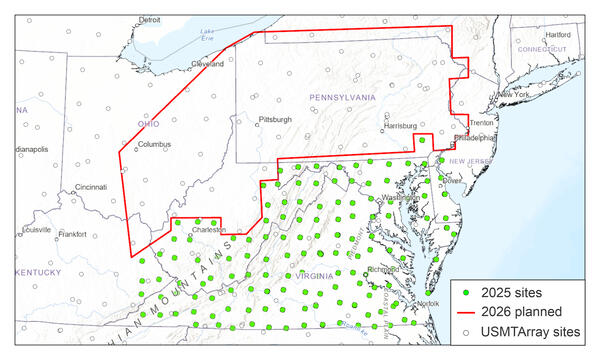
One legacy of the USMTArray is a focus on new data collection in areas at elevated risk from space-weather (Lucas et al., 2020). Starting in 2025, the USGS kicked off a project collecting magnetotelluric data in the mid-Atlantic states on a finer grid than the USMTArray and with instruments able to image both shallow and deep structure. As of April 2026, more than 135 stations across Virginia, West Virginia, Maryland, Kentucky, and Delaware have been covered with data collection moving to Ohio and Pennsylvania in the near future. Modeling of these data will help refine hazard models along the Eastern Seaboard while helping to unravel the complex tectonic evolution of the Appalachian Mountains.
The United States has been mapped from space to the ground across its surface; however never from the perspective of the planet’s own electrical heartbeat. Over nearly two decades, the United States Magnetotelluric Array quietly marched across the country, station by station, building the first-ever electrical portrait of the crust and upper mantle beneath the contiguous U.S. An ambitious, multi‑agency effort spanning 2006 to 2024 aims to improve our understanding of: critical minerals, our continent’s deep structure, protecting the power grid from solar storms.
The USMTArray provides the first continent‑wide map of Earth’s electrical structure beneath the United States., revealing everything from ancient tectonic scars to modern space‑weather vulnerabilities. By installing over 1,800 stations over 18 years, scientists used a scientific technique called magnetotellurics to measure variations in our planet's magnetic and electric fields. These signals could vary depending on what type of rock sits underground. By analyzing this data, scientists can pinpoint where different types of rock come together. Using these stations, a few valuable applications were produced such as a 3D model of the crust and mantle, a high resolution model for forecasting space weather hazards, and a national map to examine how electricity flows deep beneath our feet.
The United States magnetotelluric array impedance map (AIM) is one of the successes of the USMTArray project. It displays a snapshot of how electrical currents move through the ground across the United States. This map can identify how currents vary with depth from the surface to a depth of 100 miles or more! AIM resulted in a consistent nationwide dataset that supports research ranging from mineral discovery to tectonic studies.
Another unique outcome of the USMTArray project is a 3-D model of the United States crust and upper mantle. This 3-D model is similar to a snapshot of what is beneath our feet. Using this model, we can improve current scientific models by identifying different types of rock, as well as where fluids are found - both water and in some areas magma. The model also reveals the geologic puzzle pieces that were assembled over billions of years to form North America. Enhancing our current scientific knowledge also allows us to improve space‑weather hazard forecasting to protect the electric infrastructure of the United States.
Key Findings
Improved Protection Against Space Weather Hazards
Geomagnetic storms can generate unwanted currents in the power grid. USMTArray data help determine where the ground is more or less conductive, which directly affects how much risk a region faces. This project produced a National Impedance Map and a high-resolution 3D electrical conductivity model of the nation. Unlike older one-dimensional models that often under or overestimated risks, the USMTArray’s additions provide the precise local and directional data needed to accurately assess how the Earth's electrical architecture influences the impact of geomagnetic storms. Integrating the USMTArray dataset into the NOAA-USGS Geoelectric Field Map allows for real-time estimates of storm-induced ground currents across the country. By allowing power companies to perform targeted real-time reconfigurations of the grid during magnetic superstorms, the USMTArray helps prevent widespread power blackouts and protects high-voltage transformers from permanent damage.
Mapping the Nation's Mineral and Geothermal Resources
Shaping the Future of Scientific Exploration
Well over 50 students and early‑career researchers participated in the United States Magnetotelluric Array project through fieldwork, data processing, modeling, developing skills, gaining valuable work experience, and exploring career interests. Training the next generation of Earth scientists strengthens long‑term scientific programs by expanding university partnerships and mentorship opportunities. Early‑career researchers contribute new perspectives and innovative techniques that enhance ongoing scientific work. These training efforts also help build a strong workforce pipeline, supporting students as they progress from academic programs into federal research roles. Additionally, early‑career researchers working in public‑safety–focused scientific programs gain a clear understanding of how their work directly benefits society.
One legacy of the USMTArray is a focus on new data collection in areas at elevated risk from space-weather (Lucas et al., 2020). Starting in 2025, the USGS kicked off a project collecting magnetotelluric data in the mid-Atlantic states on a finer grid than the USMTArray and with instruments able to image both shallow and deep structure. As of April 2026, more than 135 stations across Virginia, West Virginia, Maryland, Kentucky, and Delaware have been covered with data collection moving to Ohio and Pennsylvania in the near future. Modeling of these data will help refine hazard models along the Eastern Seaboard while helping to unravel the complex tectonic evolution of the Appalachian Mountains.