



The U.S. Geological Survey Cooperative Landslide Hazard Mapping and Assessment Program offers competitive grants to support efforts that reduce landslide risks and enhance public safety. These grants offer federal assistance to state, territorial, local, and Tribal governments for projects that map, assess, educate, and collect data on landslide hazards.
View Eligibility
View Funded Risk Reduction Projects
View Risk Reduction Priorities
Competitive grant application notification
Since 2024, the grant program launches a Notice of Funding Opportunity annually on grants.gov. For those interested in an email alert when the next round of landslide grants launch, please send a blank email to sslaughter@usgs.gov with the subject line “landslide grants”.
During each application cycle, the USGS invites proposals for competitive grants supporting landslide risk‑reduction efforts, including communication, planning, coordination, mapping, assessments, and data collection. Eligible applicants include state, territorial, local, and Tribal governments. State geological surveys and state offices within a university system are also eligible. All proposals and required documentation must be submitted through Grants.gov; paper submissions are not accepted. Proposal requirements, guidance, and annual research priorities (the Program Announcement) are available exclusively on Grants.gov.
This grant program supports priorities outlined in the National Landslide Preparedness Act and the National Strategy for Landslide Loss Reduction. These priorities support the mission of the USGS Landslide Hazards Program to reduce the loss of life and property from landslides and to improve public safety and community resilience across the Nation and territories.
Funded through Congressional appropriations to the USGS, this program provides competitive federal assistance to eligible governments for projects aimed at reducing landslide loss within their jurisdictions.
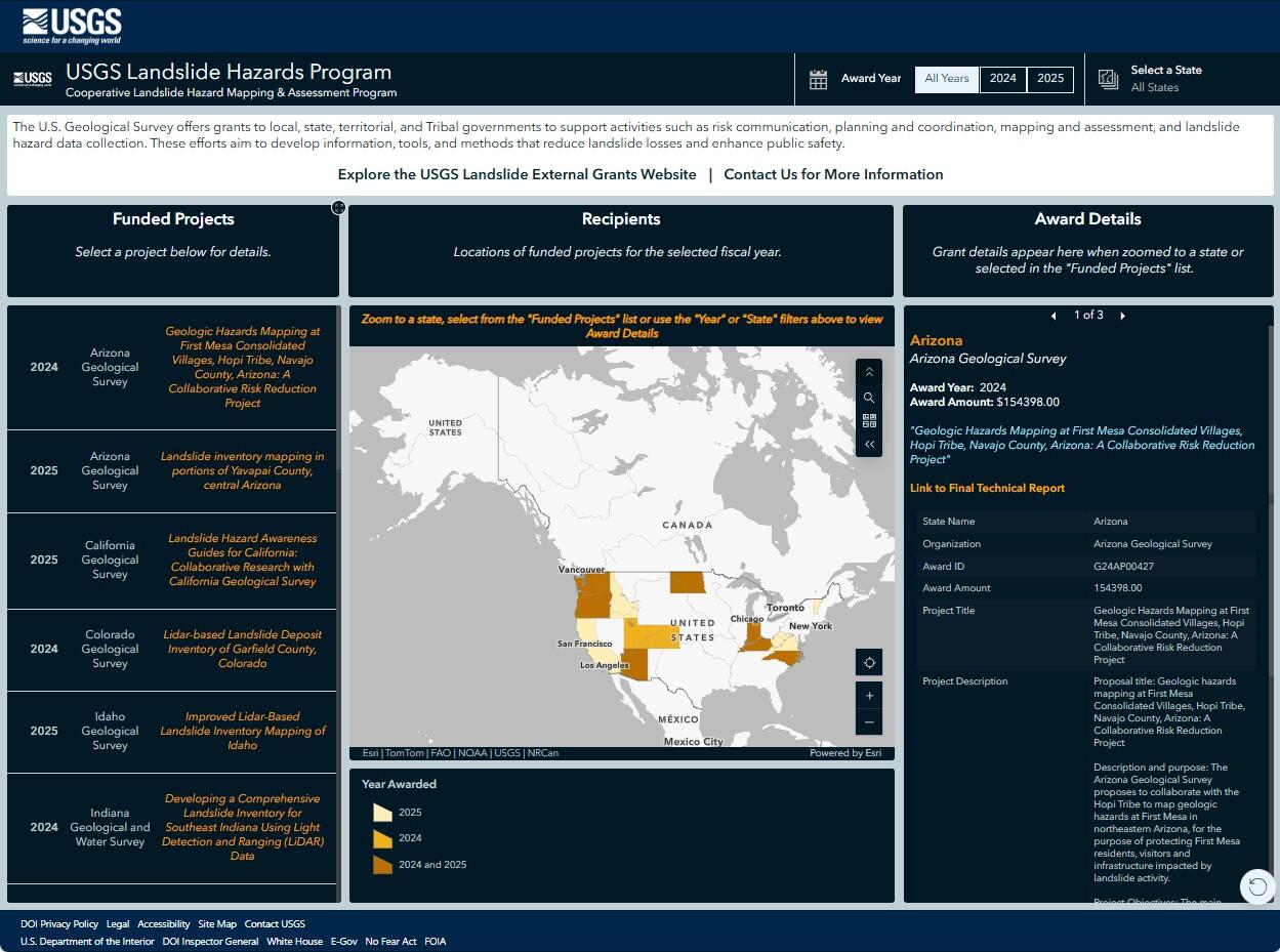
To explore previous awards, including recipients, project descriptions, and the states where projects were funded, click the map below to open the interactive web map:
Annual Competitive Grants
The USGS Cooperative Landslide Hazard Mapping and Assessment Program provides federal assistance to state, territorial, local, and Tribal governments to help reduce loss of life and property from landslides and to strengthen public safety and community resilience. This assistance is funded through annual appropriations to the USGS and is awarded on a competitive basis.
During the application period, the USGS invites proposals for a competitive grant that support landslide risk‑reduction activities, including communication, planning, coordination, mapping, assessments, and data collection. Eligible applicants include state, territorial, local, and Tribal governments. State geological surveys or state offices operating within a state university system are also eligible. Applicants must submit proposals and required documentation through Grants.gov; paper submissions are not accepted. Please note that proposal requirements, guidance, and annual research priorities (referred to as the Program Announcement) are available only through grants.gov.
To view previous awards, including recipients, project descriptions, and the states where projects were funded, click the map below to open the interactive web map:
The U.S. Geological Survey Cooperative Landslide Hazard Mapping and Assessment Program offers competitive grants to support efforts that reduce landslide risks and enhance public safety. These grants offer federal assistance to state, territorial, local, and Tribal governments for projects that map, assess, educate, and collect data on landslide hazards.
View Eligibility
View Funded Risk Reduction Projects
View Risk Reduction Priorities
Competitive grant application notification
Since 2024, the grant program launches a Notice of Funding Opportunity annually on grants.gov. For those interested in an email alert when the next round of landslide grants launch, please send a blank email to sslaughter@usgs.gov with the subject line “landslide grants”.
During each application cycle, the USGS invites proposals for competitive grants supporting landslide risk‑reduction efforts, including communication, planning, coordination, mapping, assessments, and data collection. Eligible applicants include state, territorial, local, and Tribal governments. State geological surveys and state offices within a university system are also eligible. All proposals and required documentation must be submitted through Grants.gov; paper submissions are not accepted. Proposal requirements, guidance, and annual research priorities (the Program Announcement) are available exclusively on Grants.gov.
This grant program supports priorities outlined in the National Landslide Preparedness Act and the National Strategy for Landslide Loss Reduction. These priorities support the mission of the USGS Landslide Hazards Program to reduce the loss of life and property from landslides and to improve public safety and community resilience across the Nation and territories.
Funded through Congressional appropriations to the USGS, this program provides competitive federal assistance to eligible governments for projects aimed at reducing landslide loss within their jurisdictions.
To explore previous awards, including recipients, project descriptions, and the states where projects were funded, click the map below to open the interactive web map:
Annual Competitive Grants
The USGS Cooperative Landslide Hazard Mapping and Assessment Program provides federal assistance to state, territorial, local, and Tribal governments to help reduce loss of life and property from landslides and to strengthen public safety and community resilience. This assistance is funded through annual appropriations to the USGS and is awarded on a competitive basis.
During the application period, the USGS invites proposals for a competitive grant that support landslide risk‑reduction activities, including communication, planning, coordination, mapping, assessments, and data collection. Eligible applicants include state, territorial, local, and Tribal governments. State geological surveys or state offices operating within a state university system are also eligible. Applicants must submit proposals and required documentation through Grants.gov; paper submissions are not accepted. Please note that proposal requirements, guidance, and annual research priorities (referred to as the Program Announcement) are available only through grants.gov.
To view previous awards, including recipients, project descriptions, and the states where projects were funded, click the map below to open the interactive web map: