



Flood-inundation extents and hydraulic characteristics of Carson Slough, Ash Meadows National Wildlife Refuge, Nevada
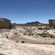
Mud Lake Dam, a rock and earth embankment structure, crosses an ephemeral stream that once flowed naturally into Carson Slough, the largest wetland complex in southern Nevada and a critical habitat for several threatened and endangered species. The dam was breached in the 1990s, rerouting stormwater into a new channel. The Bureau of Land Management and U.S. Fish and Wildlife Service are considering possible dam modifications to establish streamflow back to the natural channel.
The U.S. Geological Survey, in collaboration with the Bureau of Land Management and U.S. Fish and Wildlife Service, developed hydrologic and hydraulic models to assess how peak-flow breach expansion and possible dam modifications could affect flooding in Carson Slough. A precipitation-runoff model was developed to estimate 6-hour and 24-hour flood streamflows for 10-, 25-, 50-, and 100-year floods, which were used as inputs to a hydraulic model simulating three scenarios: 2023 conditions, peak-flow breach expansion, and possible dam modifications. Model outputs included flood-inundation extents and hydraulic characteristics such as water depth and velocity. Under 2023 conditions, streamflow enters the dam breach and follows the breach channel to the west into Carson Slough, inundating Soda Spring. Only under the highest flood scenario (24-hour duration, 100-year rainfall recurrence interval) did streamflow also enter the natural channel directly downstream from the dam. Under possible dam modification conditions, streamflow remained solely in the natural channel and flowed southwest into Carson Slough. Under peak-flow breach expansion, streamflow entered the breach and natural channels and into Carson Slough. Compared to 2023 conditions, the total inundated extent for peak-flow breach expansion increased by 7–11 percent, whereas possible dam modification conditions decreased by 4–7 percent. Inundation extents remained largely similar throughout most of the study area, and the primary exception was in the 1-mile segment directly downstream from the dam.
Citation Information
| Publication Year | 2026 |
|---|---|
| Title | Flood-inundation extents and hydraulic characteristics of Carson Slough, Ash Meadows National Wildlife Refuge, Nevada |
| DOI | 10.3133/sir20265053 |
| Authors | Laura A. Dye, Christopher M. Morris, Harold Jones |
| Publication Type | Report |
| Publication Subtype | USGS Numbered Series |
| Series Title | Scientific Investigations Report |
| Series Number | 2026-5053 |
| Index ID | sir20265053 |
| Record Source | USGS Publications Warehouse |
| USGS Organization | Nevada Water Science Center |
Related
Streamflow Modeling Studies in Nevada
Related