Laura A. Dye
Laura Dye is a hydrologist in the Southern Nevada Studies Unit.
Education and Certifications
Bachelor of Science in Geology, Eastern Kentucky University, 2015
Master of Science in Geoscience, University of Nevada Las Vegas, 2021
Science and Products
Flood-inundation extents and hydraulic characteristics of Carson Slough, Ash Meadows National Wildlife Refuge, Nevada Flood-inundation extents and hydraulic characteristics of Carson Slough, Ash Meadows National Wildlife Refuge, Nevada
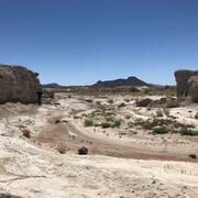
Mud Lake Dam, a rock and earth embankment structure, crosses an ephemeral stream that once flowed naturally into Carson Slough, the largest wetland complex in southern Nevada and a critical habitat for several threatened and endangered species. The dam was breached in the 1990s, rerouting stormwater into a new channel. The Bureau of Land Management and U.S. Fish and Wildlife Service are
Authors
Laura A. Dye, Christopher M. Morris, Harold Jones
Streamflow extents and hydraulic characteristics of Meadow Valley Wash at Stuart Ranch, near Rox, Nevada Streamflow extents and hydraulic characteristics of Meadow Valley Wash at Stuart Ranch, near Rox, Nevada
The former Stuart Ranch, now managed by the Bureau of Land Management, is transected by Meadow Valley Wash, where 4,600 feet of perennial stream and adjacent riparian vegetation provide critical habitat for several wildlife and aquatic species protected under the Endangered Species Act. The stream has been altered by prior construction of irrigation diversions, gravel mining, and removal...
Authors
Laura A. Dye, Christopher M. Morris, Hampton K. Childres
Streamflow Modeling Studies in Nevada
The USGS Nevada Water Science Center (NVWSC), in partnership with the Bureau of Land Management (BLM), is conducting hydrologic and hydraulic modeling studies to support stream restoration.
Geospatial data, precipitation-runoff model archive, and surface-water model archive for streamflow extents of Carson Slough, Ash Meadows National Wildlife Refuge, Nevada Geospatial data, precipitation-runoff model archive, and surface-water model archive for streamflow extents of Carson Slough, Ash Meadows National Wildlife Refuge, Nevada
This U.S. Geological Survey data release presents flood-inundation extents and hydraulic characteristics of the Carson Slough, Ash Meadows National Wildlife Refuge, Nevada. These datasets were created by simulating streamflow conditions for eight rainfall scenarios (100-, 50-, 25-, 10-year floods under 6- and 24-hour rainfall durations), under three terrain conditions (2023, peak-flow...
Geospatial data, flood-frequency analysis, and surface-water model archive for streamflow extents and hydraulic characteristics of Meadow Valley Wash at Stuart Ranch, near Rox, Nevada Geospatial data, flood-frequency analysis, and surface-water model archive for streamflow extents and hydraulic characteristics of Meadow Valley Wash at Stuart Ranch, near Rox, Nevada
This U.S. Geological Survey data release consists of multiple datasets used to simulate the streamflow extents and hydraulic characteristics of Meadow Valley Wash at Stuart Ranch near Rox, Nevada. Streamflow extents equal the maximum area of flow inundation and were estimated using a two-dimensional (2D) hydraulic model. The modeled extents represent baseflow and six annual exceedance
Science and Products
Flood-inundation extents and hydraulic characteristics of Carson Slough, Ash Meadows National Wildlife Refuge, Nevada Flood-inundation extents and hydraulic characteristics of Carson Slough, Ash Meadows National Wildlife Refuge, Nevada
Mud Lake Dam, a rock and earth embankment structure, crosses an ephemeral stream that once flowed naturally into Carson Slough, the largest wetland complex in southern Nevada and a critical habitat for several threatened and endangered species. The dam was breached in the 1990s, rerouting stormwater into a new channel. The Bureau of Land Management and U.S. Fish and Wildlife Service are
Authors
Laura A. Dye, Christopher M. Morris, Harold Jones
Streamflow extents and hydraulic characteristics of Meadow Valley Wash at Stuart Ranch, near Rox, Nevada Streamflow extents and hydraulic characteristics of Meadow Valley Wash at Stuart Ranch, near Rox, Nevada
The former Stuart Ranch, now managed by the Bureau of Land Management, is transected by Meadow Valley Wash, where 4,600 feet of perennial stream and adjacent riparian vegetation provide critical habitat for several wildlife and aquatic species protected under the Endangered Species Act. The stream has been altered by prior construction of irrigation diversions, gravel mining, and removal...
Authors
Laura A. Dye, Christopher M. Morris, Hampton K. Childres
Streamflow Modeling Studies in Nevada
The USGS Nevada Water Science Center (NVWSC), in partnership with the Bureau of Land Management (BLM), is conducting hydrologic and hydraulic modeling studies to support stream restoration.
Geospatial data, precipitation-runoff model archive, and surface-water model archive for streamflow extents of Carson Slough, Ash Meadows National Wildlife Refuge, Nevada Geospatial data, precipitation-runoff model archive, and surface-water model archive for streamflow extents of Carson Slough, Ash Meadows National Wildlife Refuge, Nevada
This U.S. Geological Survey data release presents flood-inundation extents and hydraulic characteristics of the Carson Slough, Ash Meadows National Wildlife Refuge, Nevada. These datasets were created by simulating streamflow conditions for eight rainfall scenarios (100-, 50-, 25-, 10-year floods under 6- and 24-hour rainfall durations), under three terrain conditions (2023, peak-flow...
Geospatial data, flood-frequency analysis, and surface-water model archive for streamflow extents and hydraulic characteristics of Meadow Valley Wash at Stuart Ranch, near Rox, Nevada Geospatial data, flood-frequency analysis, and surface-water model archive for streamflow extents and hydraulic characteristics of Meadow Valley Wash at Stuart Ranch, near Rox, Nevada
This U.S. Geological Survey data release consists of multiple datasets used to simulate the streamflow extents and hydraulic characteristics of Meadow Valley Wash at Stuart Ranch near Rox, Nevada. Streamflow extents equal the maximum area of flow inundation and were estimated using a two-dimensional (2D) hydraulic model. The modeled extents represent baseflow and six annual exceedance