
Coastal National Elevation Database (CoNED) Applications Project
Topobathymetric elevation model of Majuro Atoll
Republic of the Marshall Islands
High-resolution coastal elevation data is required to identify flood, hurricane, and sea-level rise inundation hazard zones and other earth science applications, such as the development of sediment transport and storm surge models. Light detection and ranging (lidar) enables the rapid collection of very accurate elevation data over large areas, and during the last decade, airborne laser altimetry has been widely applied to map coastal geomorphology, leading to improved knowledge of coastal geomorphic processes. In addition, high-resolution elevation data from lidar has applications to coastal hazard prediction and mitigation, forest and wetland ecology, and benthic habitat structure and ecosystem function.

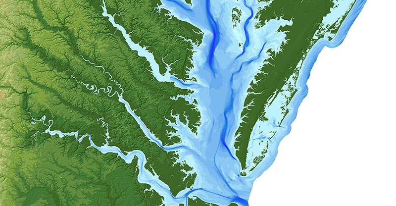
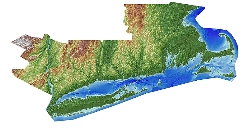
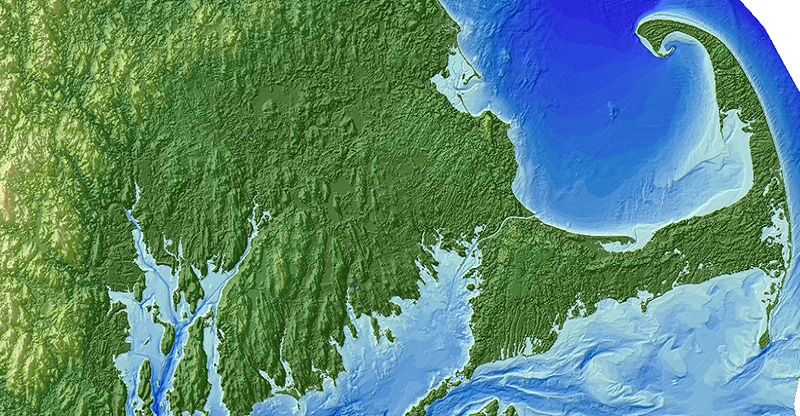
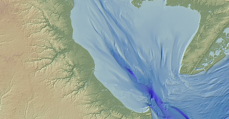
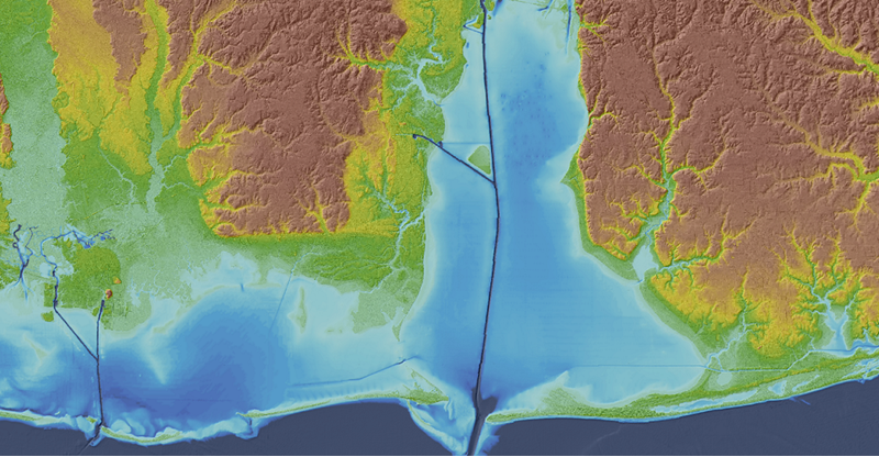
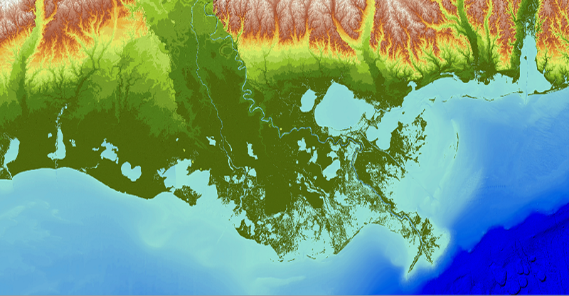
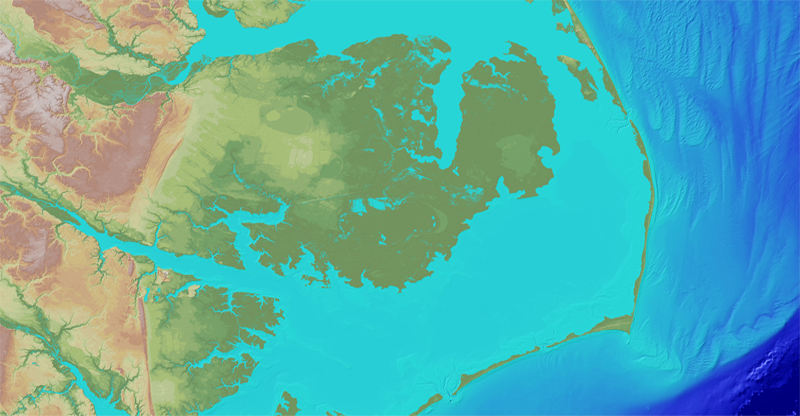


During the coming decades, coastlines will respond to widely predicted sea-level rise. Vulnerability maps that depict regions prone to flooding and sea-level rise are essential to planners and managers responsible for mitigating the associated risks and costs to both human communities and ecosystems. InSAR, subaerial lidar, terrestrial lidar, GPS point measurements, topobathymetric lidar, bathymetric lidar, and sonar are key sources of topographic and bathymetric data used to develop detailed, onshore-offshore, cross-ecosystem information on coastal elevation. By progressively constructing enhanced topobathymetric databases for an evolving set of U.S. coastal regions/ecosystems, the USGS Coastal National Elevation Database Applications Project is extending and improving the USGS National Elevation Dataset within coastal regions to enable the widespread creation of flood, hurricane, and sea-level rise inundation hazard maps.
The USGS Coastal National Elevation Database Applications Project provides important information for a range of applications needed for climate change analysis in sensitive coastal regions, including:
- Flood hazard mapping and inundation
- Sea-level rise
- Sediment transport
- Storm surge
- Coastal redevelopment planning
- Restoration, redevelopment, and protection
- Cliff metric development and analysis
- Coastal geomorphology analysis
High-resolution coastal elevation data is required to identify flood, hurricane, and sea-level rise inundation hazard zones and other earth science applications, such as the development of sediment transport and storm surge models. Light detection and ranging (lidar) enables the rapid collection of very accurate elevation data over large areas, and during the last decade, airborne laser altimetry has been widely applied to map coastal geomorphology, leading to improved knowledge of coastal geomorphic processes. In addition, high-resolution elevation data from lidar has applications to coastal hazard prediction and mitigation, forest and wetland ecology, and benthic habitat structure and ecosystem function.
During the coming decades, coastlines will respond to widely predicted sea-level rise. Vulnerability maps that depict regions prone to flooding and sea-level rise are essential to planners and managers responsible for mitigating the associated risks and costs to both human communities and ecosystems. InSAR, subaerial lidar, terrestrial lidar, GPS point measurements, topobathymetric lidar, bathymetric lidar, and sonar are key sources of topographic and bathymetric data used to develop detailed, onshore-offshore, cross-ecosystem information on coastal elevation. By progressively constructing enhanced topobathymetric databases for an evolving set of U.S. coastal regions/ecosystems, the USGS Coastal National Elevation Database Applications Project is extending and improving the USGS National Elevation Dataset within coastal regions to enable the widespread creation of flood, hurricane, and sea-level rise inundation hazard maps.
The USGS Coastal National Elevation Database Applications Project provides important information for a range of applications needed for climate change analysis in sensitive coastal regions, including:
- Flood hazard mapping and inundation
- Sea-level rise
- Sediment transport
- Storm surge
- Coastal redevelopment planning
- Restoration, redevelopment, and protection
- Cliff metric development and analysis
- Coastal geomorphology analysis