
Rivers Contain Groundwater
Groundwater Information by Topic
Surface Water Information by Topic
Naturally, the water running in rivers comes from precipitation that runs off the landscape into the river. But since precipitation also seeps into (and moves) into the ground, you don't often consider that a significant amount of the water flowing in rivers comes from water in the ground seeping back "up" into the river from below.
• Water Science School HOME • Groundwater topics • Surface Water topics •
Rivers Contain Groundwater
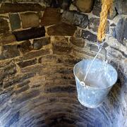
Water in streams contains groundwater

Credit: R.A. McNish, USGS
It is probably a common conception that the water flowing in rivers and streams comes from precipitation runoff from the landscape into the river. Of course that is true, but it is not entirely true. What I mean is, groundwater contributes to streams in most physiographic and climatic settings to a certain degree; some of the water flowing in rivers comes from seepage of groundwater into the streambed. The water flowing in rivers still originates from precipitation, but it is not all from surface runoff. This groundwater seepage is vitally important to the hydrologic settings of the world because it is responsible for keeping water in rivers during times of no rainfall (base flow conditions).
Groundwater contributes to streamflow in most physiographic and climatic settings in the world. Many things, such as a region's geography, geology, soil type and saturation, and climate, determine the proportion of stream water that comes from groundwater. Hydrologists (water scientists) can determine the amount of water that groundwater contributes to streams by analyzing streamflow hydrographs and precipitation records. From these studies, hydrologists can determine how much of a stream's flow comes from runoff and how much comes from groundwater discharging into the streambed.
Streams interact with groundwater in all types of landscapes
The interaction takes place in three basic ways:
- streams gain water from inflow of groundwater through the streambed (gaining stream),
- streams lose water to groundwater by outflow through the streambed (losing stream), or
- they do both, gaining in some reaches and losing in other reaches.
For groundwater to discharge into a stream channel, the altitude of the water table in the vicinity of the stream must be higher than the altitude of the stream-water surface. Conversely, for surface water to seep to groundwater, the altitude of the water table in the vicinity of the stream must be lower than the altitude of the stream-water surface. Surface-water depletion is directly associated with chronic lowering of groundwater levels. The amount of water that is gained by a stream from groundwater is called baseflow.
The movement of water between groundwater and surface water provides a major pathway for chemical transfer between the ground and stream. As chemicals are transferred between groundwater and surface water, the supply of carbon, oxygen, nutrients such as nitrogen and phosphorus, and other chemicals that have effects on eco-biological processes on both sides of the interface can be affected. This transfer can affect the biological and chemical characteristics of the stream and ecosystems downstream.
Looking at the diagram...
This diagram is a very general schematic of how groundwater contributes water into surface water (streams, rivers, and lakes). In this case, this is a "gaining stream", which generally gains water from the ground. Other streams are "losing streams", which lose water from the streambed out into the ground. Rivers can be gaining and losing at different locations; they can be gaining one time of the year and losing in another time of year. And, as the yellow arrow shows, even a gaining stream will be losing some water, and the other way around. In this diagram, though, we're showing a gaining stream where groundwater is entering the streambed.

Of course, the source of all water is precipitation, the downward arrows coming down from the top in the diagram. Some of the water hitting the landscape runs downhill and into the stream (purple arrow)—this is runoff. The tan area is the unsaturated zone, which is the top layer of the ground which gets saturated during a heavy rainfall, stays wet but not saturated, after a rainfall, and can become quite dry during times when no precipitation falls. This zone is the area that plants put down roots in, and thus draw water from. The green arrow shows that water moves up from the unsaturated zone into the plants and then out of the plants as evapotranspiration.
A lot of water will keep moving downward into the ground to fill the aquifer, in which all of the open pores and spaces are full of water (from which people can drill wells into and get water out). The top point of this saturated zone is the water table. All of the blue arrows underground show how, in this situation, some water moves towards the stream, since the bottom of the streambed is lower than the water table, and thus intersects the aquifer. In this way, even if no rain has fallen in a while, water is still entering the streambed, even if you can't see it happening. And, you can't see the smiles on the faces of the fish in the river who don't have to worry (too much) about their living space drying up during periods of no rainfall.
Below are other science topics associated with rivers and groundwater.

Groundwater Information by Topic

Aquifers and Groundwater

Infiltration and the Water Cycle

Groundwater True/False Quiz
Groundwater Storage and the Water Cycle

How the U.S. Geological Survey Monitors Water

Nitrogen and Water
Naturally, the water running in rivers comes from precipitation that runs off the landscape into the river. But since precipitation also seeps into (and moves) into the ground, you don't often consider that a significant amount of the water flowing in rivers comes from water in the ground seeping back "up" into the river from below.
• Water Science School HOME • Groundwater topics • Surface Water topics •
Rivers Contain Groundwater
Water in streams contains groundwater
Credit: R.A. McNish, USGS
It is probably a common conception that the water flowing in rivers and streams comes from precipitation runoff from the landscape into the river. Of course that is true, but it is not entirely true. What I mean is, groundwater contributes to streams in most physiographic and climatic settings to a certain degree; some of the water flowing in rivers comes from seepage of groundwater into the streambed. The water flowing in rivers still originates from precipitation, but it is not all from surface runoff. This groundwater seepage is vitally important to the hydrologic settings of the world because it is responsible for keeping water in rivers during times of no rainfall (base flow conditions).
Groundwater contributes to streamflow in most physiographic and climatic settings in the world. Many things, such as a region's geography, geology, soil type and saturation, and climate, determine the proportion of stream water that comes from groundwater. Hydrologists (water scientists) can determine the amount of water that groundwater contributes to streams by analyzing streamflow hydrographs and precipitation records. From these studies, hydrologists can determine how much of a stream's flow comes from runoff and how much comes from groundwater discharging into the streambed.
Streams interact with groundwater in all types of landscapes
The interaction takes place in three basic ways:
- streams gain water from inflow of groundwater through the streambed (gaining stream),
- streams lose water to groundwater by outflow through the streambed (losing stream), or
- they do both, gaining in some reaches and losing in other reaches.
For groundwater to discharge into a stream channel, the altitude of the water table in the vicinity of the stream must be higher than the altitude of the stream-water surface. Conversely, for surface water to seep to groundwater, the altitude of the water table in the vicinity of the stream must be lower than the altitude of the stream-water surface. Surface-water depletion is directly associated with chronic lowering of groundwater levels. The amount of water that is gained by a stream from groundwater is called baseflow.
The movement of water between groundwater and surface water provides a major pathway for chemical transfer between the ground and stream. As chemicals are transferred between groundwater and surface water, the supply of carbon, oxygen, nutrients such as nitrogen and phosphorus, and other chemicals that have effects on eco-biological processes on both sides of the interface can be affected. This transfer can affect the biological and chemical characteristics of the stream and ecosystems downstream.
Looking at the diagram...
This diagram is a very general schematic of how groundwater contributes water into surface water (streams, rivers, and lakes). In this case, this is a "gaining stream", which generally gains water from the ground. Other streams are "losing streams", which lose water from the streambed out into the ground. Rivers can be gaining and losing at different locations; they can be gaining one time of the year and losing in another time of year. And, as the yellow arrow shows, even a gaining stream will be losing some water, and the other way around. In this diagram, though, we're showing a gaining stream where groundwater is entering the streambed.
Of course, the source of all water is precipitation, the downward arrows coming down from the top in the diagram. Some of the water hitting the landscape runs downhill and into the stream (purple arrow)—this is runoff. The tan area is the unsaturated zone, which is the top layer of the ground which gets saturated during a heavy rainfall, stays wet but not saturated, after a rainfall, and can become quite dry during times when no precipitation falls. This zone is the area that plants put down roots in, and thus draw water from. The green arrow shows that water moves up from the unsaturated zone into the plants and then out of the plants as evapotranspiration.
A lot of water will keep moving downward into the ground to fill the aquifer, in which all of the open pores and spaces are full of water (from which people can drill wells into and get water out). The top point of this saturated zone is the water table. All of the blue arrows underground show how, in this situation, some water moves towards the stream, since the bottom of the streambed is lower than the water table, and thus intersects the aquifer. In this way, even if no rain has fallen in a while, water is still entering the streambed, even if you can't see it happening. And, you can't see the smiles on the faces of the fish in the river who don't have to worry (too much) about their living space drying up during periods of no rainfall.
Below are other science topics associated with rivers and groundwater.
Groundwater Information by Topic
Aquifers and Groundwater
Infiltration and the Water Cycle
Groundwater True/False Quiz
Groundwater Storage and the Water Cycle
How the U.S. Geological Survey Monitors Water