
Alex Gorr
Alex Gorr is a Research Physical Scientist in the Landslide Hazards Program.
Alex uses a combination of field, modeling, and remote sensing techniques to study postfire processes at a range of spatial scales. His current research aims to better understand the impacts of postfire debris-flow hazards in the western United States through statistical modeling and data collection.
Science and Products
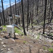
Elk Postfire Monitoring Station near Dayton, Wyoming
Wildfire can radically change a mountainous landscape such that even a modest rainstorm can produce deadly and destructive flash flooding and debris flows.
Science and Products
Elk Postfire Monitoring Station near Dayton, Wyoming
Wildfire can radically change a mountainous landscape such that even a modest rainstorm can produce deadly and destructive flash flooding and debris flows.