
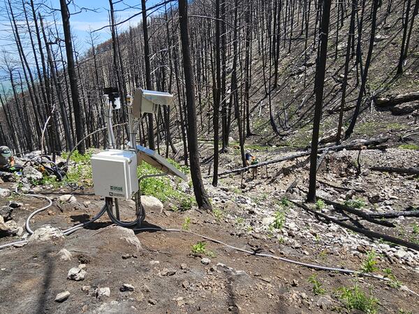
Elk Postfire Monitoring Station near Dayton, Wyoming
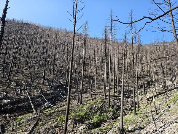
Wildfire can radically change a mountainous landscape such that even a modest rainstorm can produce deadly and destructive flash flooding and debris flows.
Project Background
The 2024 Elk Fire burned nearly 100,000 acres in the Bighorn National Forest, west of Dayton, Wyoming. An emergency assessment of postfire debris-flow hazards (USGS, 2024) indicated many drainages across the burn area have a high likelihood of debris-flow activity. In the summer following the 2024 Elk Fire, the USGS Landslide Hazards Program installed one telemetered hillslope hydrologic monitoring station on a channel reach that was determined to have a high-level of debris-flow hazard. The goals of this station are to (1) collect verification data to inform USGS hazard assessment models, and (2) to pair observations of postfire flows to rainfall intensity during the storms that triggered the flows.
Recent Conditions
Instrumentation was installed in summer 2025 following the 2024 Elk Fire and is used to monitor and detect changes in local hillslope hydrologic conditions and rainfall. Data collected at this site include:
July 15, 2025 Storm
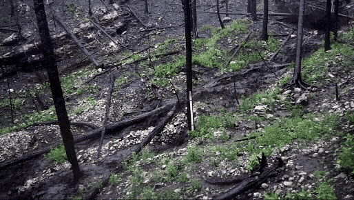
A thunderstorm on the evening of July 15, 2025, triggered a debris flow in the watershed selected by the USGS for postfire monitoring. A short clip of the video shows the debris flow in the channel adjacent to the monitoring station. The flow is carrying trees, water, and small boulders.
Elk Fire Burn Area Debris-flow Hazard
Emergency post-fire debris-flow hazard assessment for the Elk Fire, 2024

Postfire debris-flow hazards
Wildfire can radically change a mountainous landscape such that even a modest rainstorm can produce deadly and destructive flash flooding and debris flows.
Project Background
The 2024 Elk Fire burned nearly 100,000 acres in the Bighorn National Forest, west of Dayton, Wyoming. An emergency assessment of postfire debris-flow hazards (USGS, 2024) indicated many drainages across the burn area have a high likelihood of debris-flow activity. In the summer following the 2024 Elk Fire, the USGS Landslide Hazards Program installed one telemetered hillslope hydrologic monitoring station on a channel reach that was determined to have a high-level of debris-flow hazard. The goals of this station are to (1) collect verification data to inform USGS hazard assessment models, and (2) to pair observations of postfire flows to rainfall intensity during the storms that triggered the flows.
Recent Conditions
Instrumentation was installed in summer 2025 following the 2024 Elk Fire and is used to monitor and detect changes in local hillslope hydrologic conditions and rainfall. Data collected at this site include:
July 15, 2025 Storm
A thunderstorm on the evening of July 15, 2025, triggered a debris flow in the watershed selected by the USGS for postfire monitoring. A short clip of the video shows the debris flow in the channel adjacent to the monitoring station. The flow is carrying trees, water, and small boulders.
Elk Fire Burn Area Debris-flow Hazard
Emergency post-fire debris-flow hazard assessment for the Elk Fire, 2024