
Alexander Pitman
Alex Pitman is a Physical Scientist with the USGS Nevada Water Science Center.
Alex contributes to both research and operations with a focus on the development of software and data products relevant to estimating water supply and streamflow in snow dominated watersheds. His main interests emphasize better understanding spatial and temporal variability of hydrometeorological processes in mountainous environments that are critically important to water resource management decisions and flood hazard assessment.
Professional Experience
2024 to present: Physical Scientist, USGS Nevada Water Science Center
Education and Certifications
2016. B.A., Geography, California State University, Northridge
Science and Products
Nevada StreamStats
The USGS Nevada Water Science Center (NVWSC), in partnership with the Bureau of Land Management (BLM) and the Nevada Division of Water Resources (NDWR), is updating streamflow statistics for Nevada. Additionally, the project includes launching StreamStats, a web-based Geographic Information Systems (GIS) tool that provides streamflow statistics and information about drainage basins. Work on this...
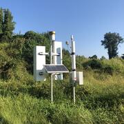
Next Generation Water Observing System (NGWOS) - Advancing Soil Moisture Monitoring
Soil moisture is an important part of the climate system, but it remains difficult to measure accurately. In 2022, the U.S. Geological Survey (USGS) began building a soil moisture monitoring network to provide high-quality continuous soil moisture data, standardize data collection methods, and test new technologies. Stations are placed in different climates and land cover types to capture a broad...
Study Area Boundary and Surficial Hydrogeologic Units for the Great Basin Hydrologic Province and a portion of the Northern Mojave Desert Study Area Boundary and Surficial Hydrogeologic Units for the Great Basin Hydrologic Province and a portion of the Northern Mojave Desert
This U.S. Geological Survey data release presents the study area boundary and surficial hydrogeologic units for the Great Basin Hydrologic Province and a portion of the Northern Mojave Desert. The study area boundary delineates a spatial extent defined to include the Great Basin Hydrologic Province and a portion of the Northern Mojave Desert. Within this boundary, surficial hydrogeologic...
Geospatial Data for Characterizing Drainage Basins in the Nevada StreamStats Study Area Geospatial Data for Characterizing Drainage Basins in the Nevada StreamStats Study Area
This data release contains raster geospatial data for characterizing drainage basins in the Nevada StreamStats study area. Included are precipitation, temperature, elevation, slope, and land cover data. There are 70 full or partial 8-digit hydrologic units (HU8) represented in the Nevada StreamStats study area: 15010005 (partial), 15010006 (partial), 15010008, 15010009, 15010010...
Science and Products
Nevada StreamStats
The USGS Nevada Water Science Center (NVWSC), in partnership with the Bureau of Land Management (BLM) and the Nevada Division of Water Resources (NDWR), is updating streamflow statistics for Nevada. Additionally, the project includes launching StreamStats, a web-based Geographic Information Systems (GIS) tool that provides streamflow statistics and information about drainage basins. Work on this...
Next Generation Water Observing System (NGWOS) - Advancing Soil Moisture Monitoring
Soil moisture is an important part of the climate system, but it remains difficult to measure accurately. In 2022, the U.S. Geological Survey (USGS) began building a soil moisture monitoring network to provide high-quality continuous soil moisture data, standardize data collection methods, and test new technologies. Stations are placed in different climates and land cover types to capture a broad...
Study Area Boundary and Surficial Hydrogeologic Units for the Great Basin Hydrologic Province and a portion of the Northern Mojave Desert Study Area Boundary and Surficial Hydrogeologic Units for the Great Basin Hydrologic Province and a portion of the Northern Mojave Desert
This U.S. Geological Survey data release presents the study area boundary and surficial hydrogeologic units for the Great Basin Hydrologic Province and a portion of the Northern Mojave Desert. The study area boundary delineates a spatial extent defined to include the Great Basin Hydrologic Province and a portion of the Northern Mojave Desert. Within this boundary, surficial hydrogeologic...
Geospatial Data for Characterizing Drainage Basins in the Nevada StreamStats Study Area Geospatial Data for Characterizing Drainage Basins in the Nevada StreamStats Study Area
This data release contains raster geospatial data for characterizing drainage basins in the Nevada StreamStats study area. Included are precipitation, temperature, elevation, slope, and land cover data. There are 70 full or partial 8-digit hydrologic units (HU8) represented in the Nevada StreamStats study area: 15010005 (partial), 15010006 (partial), 15010008, 15010009, 15010010...