Andrew Graber is a Research Geologist in the Landslide Hazards Program.
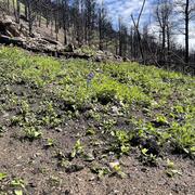
Andrew uses field, modeling, and remote sensing tools to study landslide hazards at a variety of spatial scales. His current projects focus on the changes in debris flow hazards following wildfire in response to recovery of vegetation and soil in burned areas.
Professional Experience
2022-Present: Research Geologist (Mendenhall post-doc), USGS Geologic Hazards Science Center, Golden, CO
Education and Certifications
2017-2022 Colorado School of Mines, Ph.D. Geological Engineering
2012-2016 Wheaton College, B.S. Geology
Science and Products
How long do runoff-generated debris-flow hazards persist after wildfire?
The rainfall intensity-duration control of debris flows after wildfire
Non-USGS Publications**
**Disclaimer: The views expressed in Non-USGS publications are those of the author and do not represent the views of the USGS, Department of the Interior, or the U.S. Government.
Science and Products
- Publications
How long do runoff-generated debris-flow hazards persist after wildfire?
Runoff-generated debris flows are a potentially destructive and deadly response to wildfire until sufficient vegetation and soil-hydraulic recovery have reduced susceptibility to the hazard. Elevated debris-flow susceptibility may persist for several years, but the controls on the timespan of the susceptible period are poorly understood. To evaluate the connection between vegetation recovery and dAuthorsAndrew Paul Graber, Matthew A. Thomas, Jason W. KeanThe rainfall intensity-duration control of debris flows after wildfire
Increased wildfire activity in the western United States has exposed regional gaps in our understanding of postfire debris-flow generation. To address this problem, we characterized flows in an unstudied area to test the rainfall intensity-duration control of the hazard. Our rainfall measurements and field observations from the northern Sierra Nevada (California, USA) show that debris flows resultAuthorsMatthew A. Thomas, Donald N. Lindsay, David B. Cavagnaro, Jason W. Kean, Scott W. McCoy, Andrew Paul GraberNon-USGS Publications**
Graber, A., Santi, P. (2023) UAV-photogrammetry rockfall monitoring of natural slopes in Glenwood Canyon, CO, USA: background activity and post-wildfire impacts. Landslides 20, 229–248. https://doi.org/10.1007/s10346-022-01974-9Graber, A., & Santi, P. (2022). Power law models for rockfall frequency-magnitude distributions: review and identification of factors that influence the scaling exponent. Geomorphology, 418, 108463. https://doi.org/10.1016/J.GEOMORPH.2022.108463Graber, A., & Santi, P. (2022). Inferring rockfall frequency-magnitude relationships and talus accumulation times from lichenometric study of talus deposits, Glenwood Canyon, CO, USA. Geomorphology, 408, 108253. https://doi.org/10.1016/J.GEOMORPH.2022.108253Graber, A., Santi, P. & Meza Arestegui, P. (2021) Constraining the critical groundwater conditions for initiation of large, irrigation-induced landslides, Siguas River Valley, Peru. Landslides 18, 3753–3767. https://doi.org/10.1007/s10346-021-01767-6**Disclaimer: The views expressed in Non-USGS publications are those of the author and do not represent the views of the USGS, Department of the Interior, or the U.S. Government.