
Andrew Lange (Former Employee)
Science and Products
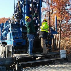
Hydrogeology and Extent of Saltwater Intrusion in the Northern Part of the Town of Oyster Bay, Nassau County, New York: 1995–98 Hydrogeology and Extent of Saltwater Intrusion in the Northern Part of the Town of Oyster Bay, Nassau County, New York: 1995–98
The Oyster Bay study area, in the northern part of Nassau County, N.Y., is underlain by unconsolidated deposits that form a sequence of aquifers and confining units. At least one production well has been affected by the intrusion of saltwater from Hempstead Harbor, Long Island Sound, and Cold Spring Harbor. Nineteen boreholes were drilled during 1995-98 for the collection of...
Authors
Frederick Stumm, Andrew D. Lange, Jennifer L. Candela
Hydrogeology and extent of saltwater intrusion on Manhasset Neck, Nassau County, New York Hydrogeology and extent of saltwater intrusion on Manhasset Neck, Nassau County, New York
Manhasset Neck, a peninsula on the northern shore of Long Island, N.Y., is underlain by unconsolidated deposits that form a sequence of aquifers and confning units. Ground water at several public-supply wells has been affected by the intrusion of saltwater from the surrounding embayments (Manhasset Bay, Long Island Sound, Hempstead Harbor). Twenty-two boreholes were drilled during 1992...
Authors
Frederick Stumm, Andrew D. Lange, J.L. Candela
Use of advanced borehole geophysical techniques to delineate fractured-rock ground-water flow, faults, foliation, and fractures along the western part of Manhattan, New York Use of advanced borehole geophysical techniques to delineate fractured-rock ground-water flow, faults, foliation, and fractures along the western part of Manhattan, New York
No abstract available.
Authors
Frederick Stumm, Anthony Chu, Andrew D. Lange
Use of advanced borehole geophysical techniques to delineate fractured-rock ground-water flow and fractures along water-tunnel facilities in northern Queens County, New York Use of advanced borehole geophysical techniques to delineate fractured-rock ground-water flow and fractures along water-tunnel facilities in northern Queens County, New York
Advanced borehole geophysical methods were used to assess the geohydrology of crystalline bedrock along the course of a new water tunnel for New York City. The logging methods include natural gamma, spontaneous potential, single-point resistance, mechanical and acoustic caliper, focused electromagnetic induction, electromagnetic resistivity, magnetic susceptibility, borehole-fluid...
Authors
Frederick Stumm, Anthony Chu, Andrew D. Lange, Frederick L. Paillet, John H. Williams, John W. Lane
Hydrogeologic-Framework Mapping - Long Island, New York
Long Island is underlain by unconsolidated Holocene deposits, glacial deposits of Pleistocene age, and coastal-plain deposits of Late Cretaceous age. These sediments consist of gravel, sand, silt, and clay underlain by crystalline bedrock of early Paleozoic age (figure 2b). The bedrock is relatively impermeable, and forms the base of the groundwater-flow system on Long Island. The geologic and...
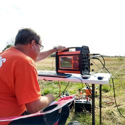
Saltwater-Interface Mapping - Long Island, New York
Saltwater intrusion is the most common type of water-quality degradation in coastal-plain aquifers. In coastal areas, the hydraulic head under predevelopment (nonpumping) conditions is higher on land than in the surrounding saltwater embayments; thus, fresh groundwater flows seaward (from areas of high potential to areas of lower potential) and meets saltwater at an equilibrium point (interface)...
Science and Products
Hydrogeology and Extent of Saltwater Intrusion in the Northern Part of the Town of Oyster Bay, Nassau County, New York: 1995–98 Hydrogeology and Extent of Saltwater Intrusion in the Northern Part of the Town of Oyster Bay, Nassau County, New York: 1995–98
The Oyster Bay study area, in the northern part of Nassau County, N.Y., is underlain by unconsolidated deposits that form a sequence of aquifers and confining units. At least one production well has been affected by the intrusion of saltwater from Hempstead Harbor, Long Island Sound, and Cold Spring Harbor. Nineteen boreholes were drilled during 1995-98 for the collection of...
Authors
Frederick Stumm, Andrew D. Lange, Jennifer L. Candela
Hydrogeology and extent of saltwater intrusion on Manhasset Neck, Nassau County, New York Hydrogeology and extent of saltwater intrusion on Manhasset Neck, Nassau County, New York
Manhasset Neck, a peninsula on the northern shore of Long Island, N.Y., is underlain by unconsolidated deposits that form a sequence of aquifers and confning units. Ground water at several public-supply wells has been affected by the intrusion of saltwater from the surrounding embayments (Manhasset Bay, Long Island Sound, Hempstead Harbor). Twenty-two boreholes were drilled during 1992...
Authors
Frederick Stumm, Andrew D. Lange, J.L. Candela
Use of advanced borehole geophysical techniques to delineate fractured-rock ground-water flow, faults, foliation, and fractures along the western part of Manhattan, New York Use of advanced borehole geophysical techniques to delineate fractured-rock ground-water flow, faults, foliation, and fractures along the western part of Manhattan, New York
No abstract available.
Authors
Frederick Stumm, Anthony Chu, Andrew D. Lange
Use of advanced borehole geophysical techniques to delineate fractured-rock ground-water flow and fractures along water-tunnel facilities in northern Queens County, New York Use of advanced borehole geophysical techniques to delineate fractured-rock ground-water flow and fractures along water-tunnel facilities in northern Queens County, New York
Advanced borehole geophysical methods were used to assess the geohydrology of crystalline bedrock along the course of a new water tunnel for New York City. The logging methods include natural gamma, spontaneous potential, single-point resistance, mechanical and acoustic caliper, focused electromagnetic induction, electromagnetic resistivity, magnetic susceptibility, borehole-fluid...
Authors
Frederick Stumm, Anthony Chu, Andrew D. Lange, Frederick L. Paillet, John H. Williams, John W. Lane
Hydrogeologic-Framework Mapping - Long Island, New York
Long Island is underlain by unconsolidated Holocene deposits, glacial deposits of Pleistocene age, and coastal-plain deposits of Late Cretaceous age. These sediments consist of gravel, sand, silt, and clay underlain by crystalline bedrock of early Paleozoic age (figure 2b). The bedrock is relatively impermeable, and forms the base of the groundwater-flow system on Long Island. The geologic and...
Saltwater-Interface Mapping - Long Island, New York
Saltwater intrusion is the most common type of water-quality degradation in coastal-plain aquifers. In coastal areas, the hydraulic head under predevelopment (nonpumping) conditions is higher on land than in the surrounding saltwater embayments; thus, fresh groundwater flows seaward (from areas of high potential to areas of lower potential) and meets saltwater at an equilibrium point (interface)...