
USGS scientist rinsing white plastic Teflon sample bottle with deionized water in a laboratory.
Jamie Velkoverh
Jamie Velkoverh is an Information Specialist with the Upper Midwest Water Science Center.
Jamie started her USGS career as a graduate student in 2007, working with the Minnesota Water Science Center conducting research for her master's thesis on the role of calcium in sorption of the herbicide glyphosate to agricultural soil, and implications for subsurface transport in Iowa. After graduating, she continued with the Minnesota Water Science Center as a laboratory chemist, conducting Enzyme-Linked Immunosorbent Assay (ELISA) analyses of agricultural groundwater samples in Minnesota.
After her early experience with the USGS, she worked in the private sector as an environmental engineering consultant in Phoenix, Arizona. Her projects ranged from indoor air quality analyses to water quality studies to health and safety compliance. After utilizing geographic information systems (GIS) technology on-the-job for multiple projects, she pursued a second graduate degree in GIS technology.
Jamie returned to the USGS in 2015 and worked with the Web Informatics and Mapping (WIM) team as a GIS Specialist. She was instrumental in developing and documenting the use of interactive spatial and story-telling web applications, “geonarratives”, as a new and innovative science communication tool to be utilized by the USGS. In the spring of 2016, she was a co-presenter at the plenary session of the ESRI Federal GIS conference, demonstrating the successful use of geonarratives within the USGS. Jamie worked for WIM on various GIS projects through 2020.
Jamie is now an Information Specialist for the Upper Midwest Water Science Center (UMid), managing the web presence of UMid, conducting outreach efforts, managing social media and continuing to work on GIS projects.
Science and Products
Filter Total Items: 63
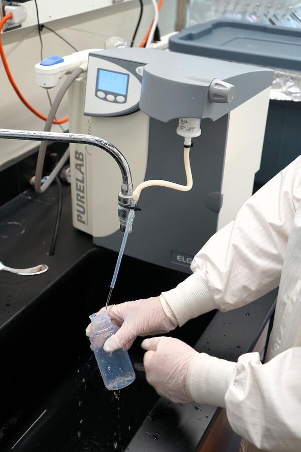
Cleaning Teflon bottles for trace metal sampling
USGS scientist rinsing white plastic Teflon sample bottle with deionized water in a laboratory.
Scientist conducting manual total mercury analysis
Scientist conducting manual total mercury analysisUSGS scientist conducting manual total mercury analysis in a laboratory.
Scientist conducting manual total mercury analysis
Scientist conducting manual total mercury analysisUSGS scientist conducting manual total mercury analysis in a laboratory.
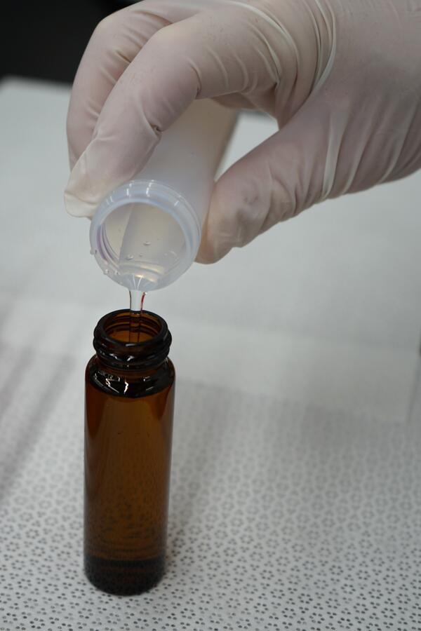
Pouring water sample from plastic tube to amber glass sample bottle
Pouring water sample from plastic tube to amber glass sample bottleUSGS scientist preparing a sample for metal analysis. A close up view of gloved hand pouring water sample from Teflon plastic tube to amber glass sample bottle.
Pouring water sample from plastic tube to amber glass sample bottle
Pouring water sample from plastic tube to amber glass sample bottleUSGS scientist preparing a sample for metal analysis. A close up view of gloved hand pouring water sample from Teflon plastic tube to amber glass sample bottle.
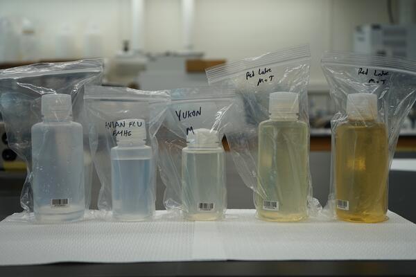
Five plastic sample bottles with water color ranging from clear to yellow
Five plastic sample bottles with water color ranging from clear to yellowFive plastic sample bottles with water samples from around the United States, with water color ranging from clear to yellow, being prepared for analysis.

View of downtown Milwaukee, Wisconsin at Pier Wisconsin Cruise Dock in winter
View of downtown Milwaukee, Wisconsin at Pier Wisconsin Cruise Dock in winterView of downtown Milwaukee, Wisconsin from Pier Wisconsin Cruise Dock in winter.
View of downtown Milwaukee, Wisconsin at Pier Wisconsin Cruise Dock in winter
View of downtown Milwaukee, Wisconsin at Pier Wisconsin Cruise Dock in winterView of downtown Milwaukee, Wisconsin from Pier Wisconsin Cruise Dock in winter.

View of downtown Milwaukee, Wisconsin from Pier Wisconsin Cruise dock in winter
View of downtown Milwaukee, Wisconsin from Pier Wisconsin Cruise dock in winterView of downtown Milwaukee, Wisconsin from Pier Wisconsin Cruise dock in winter.
View of downtown Milwaukee, Wisconsin from Pier Wisconsin Cruise dock in winter
View of downtown Milwaukee, Wisconsin from Pier Wisconsin Cruise dock in winterView of downtown Milwaukee, Wisconsin from Pier Wisconsin Cruise dock in winter.
Upper Midwest Water Science Center Fall/Winter 2022 Newsletter
Upper Midwest Water Science Center Fall/Winter 2022 NewsletterWelcome to the Fall/Winter 2022 edition of the Upper Midwest Water Science Center (UMid WSC) newsletter.
This edition contains office news, a 2022 quarter 4 data highlight, thre project features, two employee features, a social media holiday feature, and all UMid WSC products published October 2022 through December 2022.

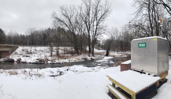
Streamgage 04085074, Dutchman Creek at Cyrus Street near Ashwaubenon, Wisconsin in winter
Streamgage 04085074, Dutchman Creek at Cyrus Street near Ashwaubenon, Wisconsin in winterA snow-covered Streamgage 04085074 with a green USGS sign in front of a red barn on an overcast snowy day at Dutchman Creek at Cyrus Street near Ashwaubenon, Wisconsin.
Streamgage 04072150 at Duck Creek near Howard, Wisconsin in winter
Streamgage 04072150 at Duck Creek near Howard, Wisconsin in winterUSGS streamgage 04072150 at Duck Creek near Howard, Wisconsin covered in layer of snow overcast December day.
View this streamgage's data here: https://waterdata.usgs.gov/monitoring-location/04072150/
Upper Midwest Water Science Center Fiscal Year 2022 Newsletter
Upper Midwest Water Science Center Fiscal Year 2022 NewsletterWelcome to the inaugural edition of the USGS Upper Midwest Water Science Center newsletter! We expect this to be the first of a set of regular quarterly publications keeping you informed of the activities of our Center.

National Park Service Units of the Upper Midwest
Map displaying National Park Service Units of the Upper Midwest, including Minnesota, Wisconsin and Michigan.
Map displaying National Park Service Units of the Upper Midwest, including Minnesota, Wisconsin and Michigan.

Southern Wisconsin Airborne Electromagnetic Survey 2022
Southern Wisconsin Airborne Electromagnetic Survey 2022Low-flying helicopter with geophysical equipment loop deployed below it via slingload. In March 2022, a helicopter carried an airborne electromagnetic induction sensor over parts of southeast and southwest Wisconsin as part of a USGS study to map the aquifers in the region.

Helicopter starting liftoff towing hoop for airborne electromagnetic (AEM) survey 2022
Helicopter starting liftoff towing hoop for airborne electromagnetic (AEM) survey 2022Helicopter lifting off with geophysical equipment loop on ground below attached via slingload. Technician on ground for scale. In March 2022, a helicopter carried an airborne electromagnetic induction sensor over parts of southeast and southwest Wisconsin as part of a USGS study to map the aquifers in the region.

Sensor on back of geophysical equipment hoop for AEM survey southern Wisconsin 2022
Sensor on back of geophysical equipment hoop for AEM survey southern Wisconsin 2022Geophysical equipment loop with sensor from SKYTEM for electromagnetic (AEM) survey in southwest Wisconsin 2022. In March 2022, a helicopter carried an airborne electromagnetic induction sensor over parts of southeast and southwest Wisconsin as part of a USGS study to map the aquifers in the region.

Helicopter for AEM survey southern Wisconsin 2022
Helicopter used to tow electromagnetic (AEM) survey equipment at AEM survey in southwest Wisconsin 2022. In March 2022, a helicopter carried an airborne electromagnetic induction sensor over parts of southeast and southwest Wisconsin as part of a USGS study to map the aquifers in the region.
Helicopter used to tow electromagnetic (AEM) survey equipment at AEM survey in southwest Wisconsin 2022. In March 2022, a helicopter carried an airborne electromagnetic induction sensor over parts of southeast and southwest Wisconsin as part of a USGS study to map the aquifers in the region.
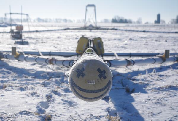
Smiley face on front of AEM survey equipment southern Wisconsin 2022
Smiley face on front of AEM survey equipment southern Wisconsin 2022Smiley face on front of electromagnetic (AEM) survey equipment at AEM survey in southwest Wisconsin 2022. In March 2022, a helicopter carried an airborne electromagnetic induction sensor over parts of southeast and southwest Wisconsin as part of a USGS study to map the aquifers in the region.

Group of USGS employees and Cooperators gathered at AEM survey in southwest Wisconsin 2022
Group of USGS employees and Cooperators gathered at AEM survey in southwest Wisconsin 2022Research geophysicist Burke Minsley discussing aerial electromagnetic (AEM) survey equipment with group of USGS employees and Cooperators at AEM survey in southwest Wisconsin 2022. In March 2022, a helicopter carried an airborne electromagnetic induction sensor over parts of southeast and southwest Wisconsin as part of a USGS study to map the aquifers in t

Burke Minsley explaining AEM technology to group of USGS employees and Cooperators at AEM survey in southwest Wisconsin 2022
Burke Minsley explaining AEM technology to group of USGS employees and Cooperators at AEM survey in southwest Wisconsin 2022Research geophysicist Burke Minsley discussing aerial electromagnetic (AEM) survey equipment with group of USGS employees and Cooperators at AEM survey in southwest Wisconsin 2022. In March 2022, a helicopter carried an airborne electromagnetic induction sensor over parts of southeast and southwest Wisconsin as part of a USGS study to map the aquifers in t

Burke Minsley speaking to group of USGS employees and SkyTEM employees about AEM survey
Burke Minsley speaking to group of USGS employees and SkyTEM employees about AEM surveyResearch geophysicist Burke Minsley discussing aerial electromagnetic (AEM) survey equipment with group of USGS employees and Cooperators at AEM survey in southwest Wisconsin 2022. In March 2022, a helicopter carried an airborne electromagnetic induction sensor over parts of southeast and southwest Wisconsin as part of a USGS study to map the aquifers in t

Airborne electromagnetic (AEM) survey hoop on snowy ground with technician preparing for liftoff
Airborne electromagnetic (AEM) survey hoop on snowy ground with technician preparing for liftoffGeophysical equipment loop for airborne electromagnetic (AEM) survey on ground prior to liftoff. Technician on ground for scale. In March 2022, a helicopter carried an airborne electromagnetic induction sensor over parts of southeast and southwest Wisconsin as part of a USGS study to map the aquifers in the region.

Airborne electromagnetic (AEM) survey hoop on snowy ground with technician walking by for scale
Airborne electromagnetic (AEM) survey hoop on snowy ground with technician walking by for scaleGeophysical equipment loop for airborne electromagnetic (AEM) survey on ground prior to liftoff. Technician on ground for scale. In March 2022, a helicopter carried an airborne electromagnetic induction sensor over parts of southeast and southwest Wisconsin as part of a USGS study to map the aquifers in the region.
Science and Products
Filter Total Items: 63
Cleaning Teflon bottles for trace metal sampling
USGS scientist rinsing white plastic Teflon sample bottle with deionized water in a laboratory.
USGS scientist rinsing white plastic Teflon sample bottle with deionized water in a laboratory.
Scientist conducting manual total mercury analysis
Scientist conducting manual total mercury analysisUSGS scientist conducting manual total mercury analysis in a laboratory.
Scientist conducting manual total mercury analysis
Scientist conducting manual total mercury analysisUSGS scientist conducting manual total mercury analysis in a laboratory.
Pouring water sample from plastic tube to amber glass sample bottle
Pouring water sample from plastic tube to amber glass sample bottleUSGS scientist preparing a sample for metal analysis. A close up view of gloved hand pouring water sample from Teflon plastic tube to amber glass sample bottle.
Pouring water sample from plastic tube to amber glass sample bottle
Pouring water sample from plastic tube to amber glass sample bottleUSGS scientist preparing a sample for metal analysis. A close up view of gloved hand pouring water sample from Teflon plastic tube to amber glass sample bottle.
Five plastic sample bottles with water color ranging from clear to yellow
Five plastic sample bottles with water color ranging from clear to yellowFive plastic sample bottles with water samples from around the United States, with water color ranging from clear to yellow, being prepared for analysis.
View of downtown Milwaukee, Wisconsin at Pier Wisconsin Cruise Dock in winter
View of downtown Milwaukee, Wisconsin at Pier Wisconsin Cruise Dock in winterView of downtown Milwaukee, Wisconsin from Pier Wisconsin Cruise Dock in winter.
View of downtown Milwaukee, Wisconsin at Pier Wisconsin Cruise Dock in winter
View of downtown Milwaukee, Wisconsin at Pier Wisconsin Cruise Dock in winterView of downtown Milwaukee, Wisconsin from Pier Wisconsin Cruise Dock in winter.
View of downtown Milwaukee, Wisconsin from Pier Wisconsin Cruise dock in winter
View of downtown Milwaukee, Wisconsin from Pier Wisconsin Cruise dock in winterView of downtown Milwaukee, Wisconsin from Pier Wisconsin Cruise dock in winter.
View of downtown Milwaukee, Wisconsin from Pier Wisconsin Cruise dock in winter
View of downtown Milwaukee, Wisconsin from Pier Wisconsin Cruise dock in winterView of downtown Milwaukee, Wisconsin from Pier Wisconsin Cruise dock in winter.
Upper Midwest Water Science Center Fall/Winter 2022 Newsletter
Upper Midwest Water Science Center Fall/Winter 2022 NewsletterWelcome to the Fall/Winter 2022 edition of the Upper Midwest Water Science Center (UMid WSC) newsletter.
This edition contains office news, a 2022 quarter 4 data highlight, thre project features, two employee features, a social media holiday feature, and all UMid WSC products published October 2022 through December 2022.
Streamgage 04085074, Dutchman Creek at Cyrus Street near Ashwaubenon, Wisconsin in winter
Streamgage 04085074, Dutchman Creek at Cyrus Street near Ashwaubenon, Wisconsin in winterA snow-covered Streamgage 04085074 with a green USGS sign in front of a red barn on an overcast snowy day at Dutchman Creek at Cyrus Street near Ashwaubenon, Wisconsin.
Streamgage 04072150 at Duck Creek near Howard, Wisconsin in winter
Streamgage 04072150 at Duck Creek near Howard, Wisconsin in winterUSGS streamgage 04072150 at Duck Creek near Howard, Wisconsin covered in layer of snow overcast December day.
View this streamgage's data here: https://waterdata.usgs.gov/monitoring-location/04072150/
Upper Midwest Water Science Center Fiscal Year 2022 Newsletter
Upper Midwest Water Science Center Fiscal Year 2022 NewsletterWelcome to the inaugural edition of the USGS Upper Midwest Water Science Center newsletter! We expect this to be the first of a set of regular quarterly publications keeping you informed of the activities of our Center.
National Park Service Units of the Upper Midwest
Map displaying National Park Service Units of the Upper Midwest, including Minnesota, Wisconsin and Michigan.
Map displaying National Park Service Units of the Upper Midwest, including Minnesota, Wisconsin and Michigan.
Southern Wisconsin Airborne Electromagnetic Survey 2022
Southern Wisconsin Airborne Electromagnetic Survey 2022Low-flying helicopter with geophysical equipment loop deployed below it via slingload. In March 2022, a helicopter carried an airborne electromagnetic induction sensor over parts of southeast and southwest Wisconsin as part of a USGS study to map the aquifers in the region.
Helicopter starting liftoff towing hoop for airborne electromagnetic (AEM) survey 2022
Helicopter starting liftoff towing hoop for airborne electromagnetic (AEM) survey 2022Helicopter lifting off with geophysical equipment loop on ground below attached via slingload. Technician on ground for scale. In March 2022, a helicopter carried an airborne electromagnetic induction sensor over parts of southeast and southwest Wisconsin as part of a USGS study to map the aquifers in the region.
Sensor on back of geophysical equipment hoop for AEM survey southern Wisconsin 2022
Sensor on back of geophysical equipment hoop for AEM survey southern Wisconsin 2022Geophysical equipment loop with sensor from SKYTEM for electromagnetic (AEM) survey in southwest Wisconsin 2022. In March 2022, a helicopter carried an airborne electromagnetic induction sensor over parts of southeast and southwest Wisconsin as part of a USGS study to map the aquifers in the region.
Helicopter for AEM survey southern Wisconsin 2022
Helicopter used to tow electromagnetic (AEM) survey equipment at AEM survey in southwest Wisconsin 2022. In March 2022, a helicopter carried an airborne electromagnetic induction sensor over parts of southeast and southwest Wisconsin as part of a USGS study to map the aquifers in the region.
Helicopter used to tow electromagnetic (AEM) survey equipment at AEM survey in southwest Wisconsin 2022. In March 2022, a helicopter carried an airborne electromagnetic induction sensor over parts of southeast and southwest Wisconsin as part of a USGS study to map the aquifers in the region.
Smiley face on front of AEM survey equipment southern Wisconsin 2022
Smiley face on front of AEM survey equipment southern Wisconsin 2022Smiley face on front of electromagnetic (AEM) survey equipment at AEM survey in southwest Wisconsin 2022. In March 2022, a helicopter carried an airborne electromagnetic induction sensor over parts of southeast and southwest Wisconsin as part of a USGS study to map the aquifers in the region.
Group of USGS employees and Cooperators gathered at AEM survey in southwest Wisconsin 2022
Group of USGS employees and Cooperators gathered at AEM survey in southwest Wisconsin 2022Research geophysicist Burke Minsley discussing aerial electromagnetic (AEM) survey equipment with group of USGS employees and Cooperators at AEM survey in southwest Wisconsin 2022. In March 2022, a helicopter carried an airborne electromagnetic induction sensor over parts of southeast and southwest Wisconsin as part of a USGS study to map the aquifers in t
Burke Minsley explaining AEM technology to group of USGS employees and Cooperators at AEM survey in southwest Wisconsin 2022
Burke Minsley explaining AEM technology to group of USGS employees and Cooperators at AEM survey in southwest Wisconsin 2022Research geophysicist Burke Minsley discussing aerial electromagnetic (AEM) survey equipment with group of USGS employees and Cooperators at AEM survey in southwest Wisconsin 2022. In March 2022, a helicopter carried an airborne electromagnetic induction sensor over parts of southeast and southwest Wisconsin as part of a USGS study to map the aquifers in t
Burke Minsley speaking to group of USGS employees and SkyTEM employees about AEM survey
Burke Minsley speaking to group of USGS employees and SkyTEM employees about AEM surveyResearch geophysicist Burke Minsley discussing aerial electromagnetic (AEM) survey equipment with group of USGS employees and Cooperators at AEM survey in southwest Wisconsin 2022. In March 2022, a helicopter carried an airborne electromagnetic induction sensor over parts of southeast and southwest Wisconsin as part of a USGS study to map the aquifers in t
Airborne electromagnetic (AEM) survey hoop on snowy ground with technician preparing for liftoff
Airborne electromagnetic (AEM) survey hoop on snowy ground with technician preparing for liftoffGeophysical equipment loop for airborne electromagnetic (AEM) survey on ground prior to liftoff. Technician on ground for scale. In March 2022, a helicopter carried an airborne electromagnetic induction sensor over parts of southeast and southwest Wisconsin as part of a USGS study to map the aquifers in the region.
Airborne electromagnetic (AEM) survey hoop on snowy ground with technician walking by for scale
Airborne electromagnetic (AEM) survey hoop on snowy ground with technician walking by for scaleGeophysical equipment loop for airborne electromagnetic (AEM) survey on ground prior to liftoff. Technician on ground for scale. In March 2022, a helicopter carried an airborne electromagnetic induction sensor over parts of southeast and southwest Wisconsin as part of a USGS study to map the aquifers in the region.