
USGS Trail Data Portal is a web application that will help streamline trail data submission and integration into the USGS nationwide trail dataset.
Tatyana Dimascio
Tatyana Dimascio works for the USGS National Geospatial Technical Operations Center (NGTOC).
Science and Products

The National Hydrography Dataset (NHD)
The National Hydrography Dataset (NHD) represents surface waters of the United States including, rivers, streams, lakes, and coastal features. The Watershed Boundary Dataset (WBD) is comprised of hierarchical polygons called hydrologic units that represent surface area over which water drains to a point. Both datasets are updated by stewards and are available by subsets of the United States.

Data and tools website
USGS Trail Data Portal is a web application that will help streamline trail data submission and integration into the USGS nationwide trail dataset.

Trails Mgmt Webinar.png
Partnership for National Trail System will be holding a live webinar called “A Comprehensive Approach to Inform User Management on Trails and Public Lands”.
Partnership for National Trail System will be holding a live webinar called “A Comprehensive Approach to Inform User Management on Trails and Public Lands”.

ParkServe mapping platform
Planners and community members can use the ParkServe mapping platform to influence decisions about parks.
Planners and community members can use the ParkServe mapping platform to influence decisions about parks.
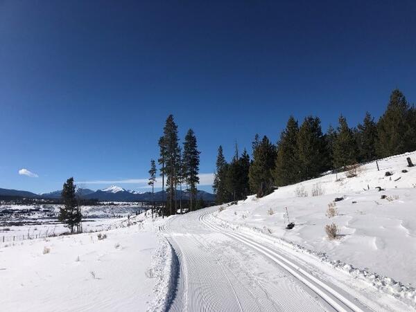
Granby Cross-Country Trail, by T. Dimascio (NDT Photo of the Month - March 2021)
Granby Cross-Country Trail, by T. Dimascio (NDT Photo of the Month - March 2021)A photograph taking while looking down the Granby Cross-Country Trail in Colorado. The sun shines bright on the snow-covered ground of a hill leading into tall pine trees. The trail itself is packed snow wide enough for a snow vehicle. Snow-capped mountains line the horizon against a blue sky with a few white clouds.
Science and Products
The National Hydrography Dataset (NHD)
The National Hydrography Dataset (NHD) represents surface waters of the United States including, rivers, streams, lakes, and coastal features. The Watershed Boundary Dataset (WBD) is comprised of hierarchical polygons called hydrologic units that represent surface area over which water drains to a point. Both datasets are updated by stewards and are available by subsets of the United States.
Data and tools website
USGS Trail Data Portal is a web application that will help streamline trail data submission and integration into the USGS nationwide trail dataset.
USGS Trail Data Portal is a web application that will help streamline trail data submission and integration into the USGS nationwide trail dataset.
Trails Mgmt Webinar.png
Partnership for National Trail System will be holding a live webinar called “A Comprehensive Approach to Inform User Management on Trails and Public Lands”.
Partnership for National Trail System will be holding a live webinar called “A Comprehensive Approach to Inform User Management on Trails and Public Lands”.
ParkServe mapping platform
Planners and community members can use the ParkServe mapping platform to influence decisions about parks.
Planners and community members can use the ParkServe mapping platform to influence decisions about parks.
Granby Cross-Country Trail, by T. Dimascio (NDT Photo of the Month - March 2021)
Granby Cross-Country Trail, by T. Dimascio (NDT Photo of the Month - March 2021)A photograph taking while looking down the Granby Cross-Country Trail in Colorado. The sun shines bright on the snow-covered ground of a hill leading into tall pine trees. The trail itself is packed snow wide enough for a snow vehicle. Snow-capped mountains line the horizon against a blue sky with a few white clouds.